Search Constraints
Search Results

601. Barron County, Wis.


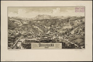
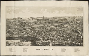
608. Barton, Vt

609. Base map of Illinois


611. Bataan

612. Bath, Penn

613. Baton Rouge


618. Battle of Zorndorf


630. Bay Bulls

631. Bay of Chaleurs

![[Bay of Seven Islands]](https://bpldcassets.blob.core.windows.net/derivatives/images/commonwealth:7h149v48t/image_thumbnail_300.jpg)


636. La Beauce


638. Becket

639. Becket, Mass


641. Bedford Co., Pa


647. Belgii veteris typus


649. Bellows Falls, Vt


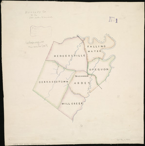
656. Berkley Co., W. Va
658. Bermudas
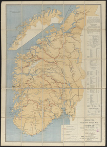
660. Bern