Toggle navigation
LMEC Home
Exhibitions
Georeferencing
Tools for Teachers
Collections
My Favorites
Sign Up / Log In
Search
Search the map portal
Map Collection
Map Collection
Map Sets
Search
Search
Search for
Search In
All Fields
Creator
Title
Subject
Place
Search All Digital Collections
Advanced Search
8174 Results
My Search
Start Over
More Like
commonwealth:9g54xk56c
Remove constraint More Like: commonwealth:9g54xk56c
Filter your Search
Place
North and Central America
4,923
United States
3,602
Suffolk (county)
1,026
Boston
999
Europe
963
Canada
427
France
269
Massachusetts
249
more
Place
»
Topic
Boston (Mass.)--Maps
574
United States--Maps
270
Real property--Massachusetts--Boston--Maps
174
Massachusetts--Maps
160
Landowners--Massachusetts--Boston--Maps
132
North America--Maps--Early works to 1800
103
New England--Maps
99
Europe--Maps
78
more
Topic
»
Date
Date range begin
–
Date range end
Current results range from
1482
to
2023
View distribution
Creator
United States. Hydrographic Office
357
O.H. Bailey & Co
148
Des Barres, Joseph F. W. (Joseph Frederick Wallet), 1722-1824
123
United States. Post Office Dept
120
Ptolemy, 2nd cent
100
Walling, Henry Francis, 1825-1888
94
Jefferys, Thomas, -1771
84
Geological Survey (U.S.)
82
more
Creator
»
Format
Maps/Atlases
8,115
Manuscripts
216
Prints
51
Books
36
Objects/Artifacts
10
Drawings/Illustrations
8
Posters
4
Georeferenced
Yes
869
No
7,305
Collection
Norman B. Leventhal Map Center Collection
8,169
Boston and New England Maps
2,189
Urban Maps
1,925
Maritime Charts and Atlases
754
American Revolutionary War-Era Maps
622
Boston Redevelopment Authority Collection
86
Mapping Boston Collection
7
Richard H. Brown Revolutionary War Map Collection at Mount Vernon
2
more
Collection
»
Available to use
No known restrictions
8,021
Creative Commons license
57
Search Constraints
Sort by relevance
relevance
title
date (asc)
date (desc)
Number of results to display per page
50 per page
10
per page
20
per page
50
per page
100
per page
View results as:
grid view
map view
Search Results
1.
Pas caerte van Nieu Nederlandt en de Engelsche Virginies van Cabo Cod tot Cabo Canrick
2.
The coast of New England
3.
Chart of the coast of New England
4.
The coast of New England
5.
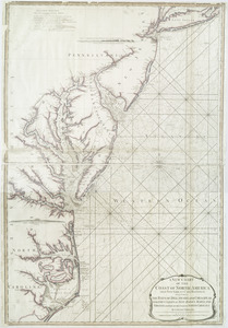
An actual survey of the sea coast from New York to the I. Cape Briton : with tables of the direct and thwart courses &...
6.
A chart of the sea coast of New Found Land, New Scotland, New England, New York, New Jersey, with Virginia and Maryland
7.
Chart from New York to Timber Island including Nantucket Shoals
8.
Chart from New York to Timber Island including Nantucket shoals
9.
Chart from New York to Timber Island including Nantucket Shoals
10.
Chart from New York to Timber Island including Nantucket shoals
11.
A new chart of the coast of North America : from New York to Cape Hatteras, including the bays of Delaware and Chesapeak, with...
12.
A chart of the coast of New England from the South Shoal to Cape Sable including Georges Bay from Holland & actual surveys
13.
A correct map of the coast of New England
14.
Pas caarte van Nieu Nederlandt
15.
The coast of a part of New England, New York, New Jersey, Pensilvania, Maryland, Virginia, and part of North Carolina &c. with...
16.
Costes et rivieres de Virginie, de Mariland, et de Nouvelle Angletere
17.
A new and correct chart of the sea coast of New-England from Cape Codd to Casco Bay
18.
De Noordelyckste Zee Kusten van America van Groenland door de Straet Davis ende Straet Hudson tot Terra Neuf =...
19.
Paskaert van de Noordelijckste kuste van America van Groenland door de Straet Davis en de Straet Hudson tot Terra Neuf
20.
Carta particolare della costa di Florida è di Virginia
21.
[Globe gore featuring North American coastline]
22.
Carta particolare della nuoua Belgia è parte della nuoua Anglia
23.
A chart of the coast of New England from the South Shoal to Cape Sable including Georges Bay from Holland & actual surveys
24.
[Coast of New England from Chatham Harbor to Naragansett Bay]
25.
[Coast of New England from Chatham Harbor to Naragansett Bay]
26.
Map of coast from southern Florida to central New Jersey
27.
A correct map of the coast of New England
28.
A correct map of the coast of New England
29.
New England : the most remarqueable parts thus named by the high and mighty Prince Charles, prince of great Britaine
30.
A new chart of the coast of New England, Nova Scotia, and the islands of St. John, Cape Breton, Sable, the banks of St. Peters,...
31.
The 100th anniversary map of Abraham Lincoln's visit to Massachusetts, September 11-23, 1848
32.
1630 shoreline
33.
1879. Progress map of the U.S. Geographical Surveys west of the 100th Meridian : prepared under the direction of 1st Lieut....
34.
1903 Map of Salem and surrounding places
35.
19th annual convention of the National Association of Real Estate Boards : at Tulsa, June 7 to June 11 in 1926
36.
2005 significant U.S. hurricane strikes
37.
The 2100 project : an atlas for the Green New Deal
38.
227 Harzgerode
39.
305 Glatz
40.
38,000,000 escaped -- 10,000,000 died
41.
4 Kinten
42.
660 Wakulah St., Roxbury
43.
[A chart of Boston Bay and vicinity]
44.
[A chart of New York Island & North River : East River, passage through Hell Gate, Flushing Bay, Hampstead Bay, Oyster,...
45.
The A.A.A. key road map of continental Europe
46.
Aaron Bohrod's America, its history
47.
ABC pathfinder railway guide map : eastern division
48.
Abolition of Slavery, 1863
49.
Aboriginal map of North America, denoting the boundaries and the locations of various Indian tribes
50.
Acapulco, México
‹ Prev
Next ›
1
2
3
4
5
…
163
164


![[Globe gore featuring North American coastline]](https://bpldcassets.blob.core.windows.net/derivatives/images/commonwealth:qb98n804g/image_thumbnail_300.jpg)


![[Coast of New England from Chatham Harbor to Naragansett Bay]](https://bpldcassets.blob.core.windows.net/derivatives/images/commonwealth:7h149x27g/image_thumbnail_300.jpg)
![[Coast of New England from Chatham Harbor to Naragansett Bay]](https://bpldcassets.blob.core.windows.net/derivatives/images/commonwealth:7h149z37x/image_thumbnail_300.jpg)


![[A chart of Boston Bay and vicinity]](https://bpldcassets.blob.core.windows.net/derivatives/images/commonwealth:cj82m2976/image_thumbnail_300.jpg)


