Toggle navigation
LMEC Home
Exhibitions
Georeferencing
Tools for Teachers
Collections
My Favorites
Sign Up / Log In
Search
Search the map portal
Map Collection
Map Collection
Map Sets
Search
Search
Search for
Search In
All Fields
Creator
Title
Subject
Place
Search All Digital Collections
Advanced Search
8166 Results
My Search
Start Over
More Like
commonwealth:9g54xk154
Remove constraint More Like: commonwealth:9g54xk154
Filter your Search
Place
North and Central America
4,915
United States
3,604
Suffolk (county)
1,026
Boston
999
Europe
963
Canada
427
France
269
Massachusetts
250
more
Place
»
Topic
Boston (Mass.)--Maps
575
United States--Maps
270
Real property--Massachusetts--Boston--Maps
174
Massachusetts--Maps
161
Landowners--Massachusetts--Boston--Maps
132
North America--Maps--Early works to 1800
103
New England--Maps
99
Europe--Maps
78
more
Topic
»
Date
Date range begin
–
Date range end
Current results range from
1482
to
2023
View distribution
Creator
United States. Hydrographic Office
357
O.H. Bailey & Co
148
Des Barres, Joseph F. W. (Joseph Frederick Wallet), 1722-1824
123
United States. Post Office Dept
120
Ptolemy, 2nd cent
100
Walling, Henry Francis, 1825-1888
94
Jefferys, Thomas, -1771
84
Geological Survey (U.S.)
83
more
Creator
»
Format
Maps/Atlases
8,107
Manuscripts
215
Prints
51
Books
36
Objects/Artifacts
10
Drawings/Illustrations
8
Posters
4
Georeferenced
Yes
868
No
7,298
Collection
Norman B. Leventhal Map Center Collection
8,162
Boston and New England Maps
2,183
Urban Maps
1,924
Maritime Charts and Atlases
750
American Revolutionary War-Era Maps
616
Boston Redevelopment Authority Collection
86
Massachusetts Real Estate Atlases
4
Available to use
No known restrictions
8,021
Creative Commons license
46
Search Constraints
Sort by relevance
relevance
title
date (asc)
date (desc)
Number of results to display per page
20 per page
10
per page
20
per page
50
per page
100
per page
View results as:
grid view
map view
Search Results
1.
1903 Map of Salem and surrounding places
2.
Atlas of Essex County, Massachusetts
3.
Atlas of the city of Salem, Massachusetts : based on plans in the office of the City Engineer
4.
Atlas of the city of Salem, Massachusetts : from actual survey and official records
5.
Chart of the harbours of Salem, Marblehead, Beverly and Manchester : from a survey taken in the years 1804, 5 & 6
6.
Chart of the harbours of Salem, Marblehead, Beverly, and Manchester : from a survey taken in the years 1804, 5 & 6
7.
City of Salem
8.
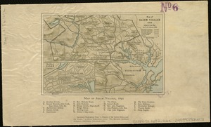
[Map of Salem, Mass.]
9.
Map of Salem Village 1692
10.
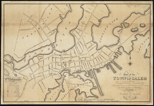
Plan of the town of Salem in the commonwealth of Massachusetts : from actual surveys, made in the years 1796 & 1804; with the...
11.
The port of Salem, Massachusetts
12.
Atlas of Massachusetts
13.
Atlas of the city of Salem, Massachusetts : including also the towns of Marblehead, Peabody, and Danvers
14.
Atlas of the city of Salem, Massachusetts
15.
Atlas of the city of Salem, Massachusetts
16.
The 100th anniversary map of Abraham Lincoln's visit to Massachusetts, September 11-23, 1848
17.
1630 shoreline
18.
1879. Progress map of the U.S. Geographical Surveys west of the 100th Meridian : prepared under the direction of 1st Lieut....
19.
19th annual convention of the National Association of Real Estate Boards : at Tulsa, June 7 to June 11 in 1926
20.
2005 significant U.S. hurricane strikes
‹ Prev
Next ›
1
2
3
4
5
…
408
409


![[Map of Salem, Mass.]](https://bpldcassets.blob.core.windows.net/derivatives/images/commonwealth:8336h3099/image_thumbnail_300.jpg)