Toggle navigation
LMEC Home
Exhibitions
Georeferencing
Tools for Teachers
Collections
My Favorites
Sign Up / Log In
Search
Search the map portal
Map Collection
Map Collection
Map Sets
Search
Search
Search for
Search In
All Fields
Creator
Title
Subject
Place
Search All Digital Collections
Advanced Search
8162 Results
My Search
Start Over
More Like
commonwealth:7h14b0760
Remove constraint More Like: commonwealth:7h14b0760
Filter your Search
Place
North and Central America
4,912
United States
3,602
Suffolk (county)
1,026
Boston
999
Europe
962
Canada
427
France
269
Massachusetts
249
more
Place
»
Topic
Boston (Mass.)--Maps
574
United States--Maps
270
Real property--Massachusetts--Boston--Maps
174
Massachusetts--Maps
160
Landowners--Massachusetts--Boston--Maps
132
North America--Maps--Early works to 1800
103
New England--Maps
99
Europe--Maps
78
more
Topic
»
Date
Date range begin
–
Date range end
Current results range from
1482
to
2023
View distribution
Creator
United States. Hydrographic Office
357
O.H. Bailey & Co
148
Des Barres, Joseph F. W. (Joseph Frederick Wallet), 1722-1824
123
United States. Post Office Dept
120
Ptolemy, 2nd cent
99
Walling, Henry Francis, 1825-1888
94
Jefferys, Thomas, -1771
84
Geological Survey (U.S.)
82
more
Creator
»
Format
Maps/Atlases
8,103
Manuscripts
215
Prints
51
Books
36
Objects/Artifacts
10
Drawings/Illustrations
8
Posters
4
Georeferenced
Yes
869
No
7,293
Collection
Norman B. Leventhal Map Center Collection
8,162
Boston and New England Maps
2,184
Urban Maps
1,925
Maritime Charts and Atlases
750
American Revolutionary War-Era Maps
616
Boston Redevelopment Authority Collection
86
Available to use
No known restrictions
8,021
Creative Commons license
46
Search Constraints
Sort by relevance
relevance
title
date (asc)
date (desc)
Number of results to display per page
50 per page
10
per page
20
per page
50
per page
100
per page
View results as:
grid view
map view
Search Results
1.
Tabula IX Europae
2.
Ta. moder. Bossinae, Serviae, Graeciae, et Sclavoniae
3.
Nona Europae tabula
4.
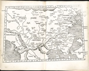
Tabu. moderna Hungariae, Poloniae, Russiae, Prussiae et Valachiae
5.
Octava Europae tabula
6.
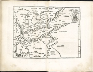
Octava Europe tabula continet Sarmatiam
7.
Tabula VIII Europae
8.
To His Most Serene and August Majesty Peter Alexovitz absolute lord of Russia &c. this map of Moscovy, Poland, Little Tartary,...
9.
Macedonia Alexandri M. Patria Illustris
10.
Macedonia, Epirus et Achaia
11.
A new generall map of the seat of war from Vpper Hungary to the Isle of Candia : with exact prospects of Napoli di Romania,...
12.
A new mapp of the Kingdom of Hungary and the states that have been subject to it, which are at present the northern parts of...
13.
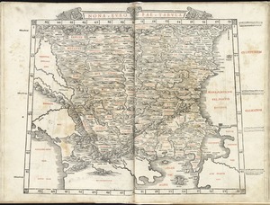
Regni Hungariae, et regionum, quae ei quondam fuêre unitae, ut Transilvaniae, Valachiae, Moldaviae, Serviae, Romaniae,...
14.
Regnum Hungaria in omnes suos comitatus accurate divisum et editum
15.
Le Royaume de Hongrie, divisé en Haute et Basse Hongrie, Transilvanie, Esclavonie et Croatie
16.
Decima et ultima Europae tabula
17.
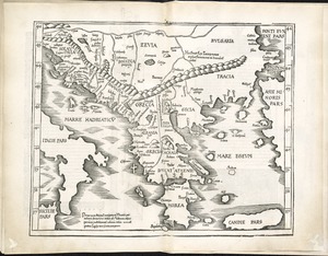
Decima Europe tabula continent Macedonia et Epirum et Achaiam & Peloponesum
18.
Graeciae antiquae
19.
Greece, Archipelago and part of Anadoli
20.
Greece with part of Anatolia = La Graecia con parte della Natolia
21.
Tabula X Europae
22.
The 100th anniversary map of Abraham Lincoln's visit to Massachusetts, September 11-23, 1848
23.
1630 shoreline
24.
1879. Progress map of the U.S. Geographical Surveys west of the 100th Meridian : prepared under the direction of 1st Lieut....
25.
1903 Map of Salem and surrounding places
26.
19th annual convention of the National Association of Real Estate Boards : at Tulsa, June 7 to June 11 in 1926
27.
2005 significant U.S. hurricane strikes
28.
The 2100 project : an atlas for the Green New Deal
29.
227 Harzgerode
30.
305 Glatz
31.
38,000,000 escaped -- 10,000,000 died
32.
4 Kinten
33.
660 Wakulah St., Roxbury
34.
[A chart of Boston Bay and vicinity]
35.
[A chart of New York Island & North River : East River, passage through Hell Gate, Flushing Bay, Hampstead Bay, Oyster,...
36.
The A.A.A. key road map of continental Europe
37.
Aaron Bohrod's America, its history
38.
ABC pathfinder railway guide map : eastern division
39.
Abolition of Slavery, 1863
40.
Aboriginal map of North America, denoting the boundaries and the locations of various Indian tribes
41.
Acapulco, México
42.
Accurata delineatio Castrorum Suecicorum, ut et Haffniae, Regni Daniae Metropolis
43.
Accurata delineatio oppugnatae a faederatis, Caesareis, Polonicis, Danicis, et Brandeburgicis copijs sub-ductu Seren: Electoris...
44.
Accurata delineatio regionis circa Nieburgum Fioniæ cum prælio ibi commisso inter Danorum et fæderatorum exercitum ab una et...
45.
Accurata Scaniae, Blekingiae et Hallandiae descriptio
46.
An accurate map of Cuba, and the adjacent islands
47.
An accurate map of Dorset Shire divided into hundreds
48.
An accurate map of Dorset Shire, divided into its hundreds
49.
An accurate map of England and Wales with the principal roads from the best authorities
50.
An accurate map of England and Wales with the principal roads from the best authorities
‹ Prev
Next ›
1
2
3
4
5
…
163
164


![Regni Hungariae, et regionum, quae ei quondam fuêre unitae, ut Transilvaniae, Valachiae, Moldaviae, Serviae, Romaniae, Bulgariae, Bessarabiae, Croatiae, Bosniae, Dalmatiae, Sclavoniae, Morlachiae, Ragusanae Reipublicae, maximaeq[ue] partis Danubii Fluminis, novissima delineatio](https://bpldcassets.blob.core.windows.net/derivatives/images/commonwealth:cj82ks70z/image_thumbnail_300.jpg)


![[A chart of Boston Bay and vicinity]](https://bpldcassets.blob.core.windows.net/derivatives/images/commonwealth:cj82m2976/image_thumbnail_300.jpg)


