Toggle navigation
LMEC Home
Exhibitions
Georeferencing
Tools for Teachers
Collections
My Favorites
Sign Up / Log In
Search
Search the map portal
Map Collection
Map Collection
Map Sets
Search
Search
Search for
Search In
All Fields
Creator
Title
Subject
Place
Search All Digital Collections
Advanced Search
8174 Results
My Search
Start Over
More Like
commonwealth:7h14b0379
Remove constraint More Like: commonwealth:7h14b0379
Filter your Search
Place
North and Central America
4,923
United States
3,612
Suffolk (county)
1,026
Boston
999
Europe
963
Canada
428
France
269
Massachusetts
249
more
Place
»
Topic
Boston (Mass.)--Maps
574
United States--Maps
270
Real property--Massachusetts--Boston--Maps
174
Massachusetts--Maps
160
Landowners--Massachusetts--Boston--Maps
132
North America--Maps--Early works to 1800
103
New England--Maps
99
Europe--Maps
78
more
Topic
»
Date
Date range begin
–
Date range end
Current results range from
1482
to
2023
View distribution
Creator
United States. Hydrographic Office
357
O.H. Bailey & Co
148
Des Barres, Joseph F. W. (Joseph Frederick Wallet), 1722-1824
123
United States. Post Office Dept
120
Ptolemy, 2nd cent
100
Walling, Henry Francis, 1825-1888
94
Jefferys, Thomas, -1771
84
Geological Survey (U.S.)
82
more
Creator
»
Format
Maps/Atlases
8,115
Manuscripts
215
Prints
51
Books
36
Objects/Artifacts
10
Drawings/Illustrations
8
Posters
4
Georeferenced
Yes
870
No
7,304
Collection
Norman B. Leventhal Map Center Collection
8,163
Boston and New England Maps
2,184
Urban Maps
1,925
Maritime Charts and Atlases
750
American Revolutionary War-Era Maps
627
Boston Redevelopment Authority Collection
86
William L. Clements Library Collection
11
Available to use
No known restrictions
8,022
Creative Commons license
46
Search Constraints
Sort by relevance
relevance
title
date (asc)
date (desc)
Number of results to display per page
20 per page
10
per page
20
per page
50
per page
100
per page
View results as:
grid view
map view
Search Results
1.
Map of the Yellowstone and Missouri Rivers and their tributaries : explored by Capt. W.F. Raynolds, Topl. Engrs., and 1st...
2.
District map of the lower Mississippi River
3.
The great overflow : inundated districts of the Mississippi Valey [sic]
4.
Lloyd's map of the Lower Mississippi River from St. Louis to the Gulf of Mexico : compiled from government surveys in the...
5.
Lloyd's map of the lower Mississippi River from St. Louis to the Gulf of Mexico
6.
Lloyd's new map of the Mississippi River from Cairo to its mouth
7.
A map of the River Mississippi and territory adjacent to N. Orleans illustrating the military position and camp at Terre au Boeuf
8.
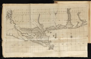
A new chart of the Mississippi River, the coast of west Florida, and part of Louisiana
9.
A survey of the Mississippi River
10.
Illinois River
11.
A draft of the Ohio from an Indian account
12.
A plan of the river Ohio from Fort Pitt to the Mississipi : by order of ye chief engineer
13.
An accurate map of the British empire in Nth. America as settled by the preliminaries in 1762
14.
Carte composée des differens ouvrages de messieurs les ingenieurs qui ont eté à Louisiane, avec les renvois alphabetiques de...
15.
The communication between the Iberville and the river Mississippe
16.
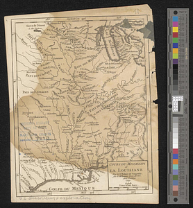
Cours du Mississipi et la Louisiane
17.
A draught of the river Missisippi. From the Balise to Fort Cavendish : taken in the months of June, July, August, September,...
18.
Map of the Lower Mississippi River
19.
A plan of Manchac 1774
20.
Plan of the river Mississippi from the Indian village of the Tonicas to the river Ibberville, shewing the lands surveyed...
‹ Prev
Next ›
1
2
3
4
5
…
408
409