Toggle navigation
LMEC Home
Exhibitions
Georeferencing
Tools for Teachers
Collections
My Favorites
Sign Up / Log In
Search
Search the map portal
Map Collection
Map Collection
Map Sets
Search
Search
Search for
Search In
All Fields
Creator
Title
Subject
Place
Search All Digital Collections
Advanced Search
8190 Results
My Search
Start Over
More Like
commonwealth:7h149z36n
Remove constraint More Like: commonwealth:7h149z36n
Filter your Search
Place
North and Central America
4,939
United States
3,610
Suffolk (county)
1,028
Boston
1,001
Europe
963
Canada
428
France
269
Massachusetts
260
more
Place
»
Topic
Boston (Mass.)--Maps
575
United States--Maps
270
Real property--Massachusetts--Boston--Maps
174
Massachusetts--Maps
160
Landowners--Massachusetts--Boston--Maps
132
North America--Maps--Early works to 1800
103
New England--Maps
99
Europe--Maps
78
more
Topic
»
Date
Date range begin
–
Date range end
Current results range from
1482
to
2023
View distribution
Creator
United States. Hydrographic Office
357
O.H. Bailey & Co
148
Des Barres, Joseph F. W. (Joseph Frederick Wallet), 1722-1824
123
United States. Post Office Dept
120
Ptolemy, 2nd cent
100
Walling, Henry Francis, 1825-1888
94
Jefferys, Thomas, -1771
84
Geological Survey (U.S.)
82
more
Creator
»
Format
Maps/Atlases
8,131
Manuscripts
219
Prints
51
Books
36
Objects/Artifacts
10
Drawings/Illustrations
8
Posters
4
Georeferenced
Yes
870
No
7,320
Collection
Norman B. Leventhal Map Center Collection
8,171
Boston and New England Maps
2,195
Urban Maps
1,925
Maritime Charts and Atlases
755
American Revolutionary War-Era Maps
635
Boston Redevelopment Authority Collection
86
Mapping Boston Collection
8
Sidney R. Knafel Map Collection at Phillips Academy
7
more
Collection
»
Available to use
No known restrictions
8,022
Creative Commons license
64
Search Constraints
Sort by relevance
relevance
title
date (asc)
date (desc)
Number of results to display per page
50 per page
10
per page
20
per page
50
per page
100
per page
View results as:
grid view
map view
Search Results
1.
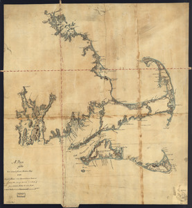
[Coast of New England from Chatham Harbor to Naragansett Bay]
2.
Coast of Massachusetts from Cape Ann to Manomet Point, including northern tip of Cape Cod
3.
Coast of Massachusetts from Cape Ann to Manomet Point, including northern tip of Cape Cod
4.
[Coast of Rhode Island and Long Island from Narragansett Bay to Peconic Bay]
5.
A correct map of the coast of New England
6.
An accurate map of Rhode Island, part of Connecticut and Massachusets, shewing Admiral Arbuthnot's station in blocking up...
7.
A map of the colony of Rhode Island : with the adjacent parts of Connecticut, Massachusetts Bay, &c
8.
A map of the country adjacent to the north boundary line of the colony of Rhode Island as the same was run by commissioners...
9.
A map of the province of Massachusets Bay and colony of Rhode Island, with part of Connecticut, New Hampshire, and Vermont
10.
A new and accurate map of the colony of Massachusets Bay, in North America, from a late survey
11.
A plan of the sea coast from Boston Bay to the light house near Rhode Island : reduced from the large survey
12.
The coast of a part of New England, New York, New Jersey, Pensilvania, Maryland, Virginia, and part of North Carolina &c. with...
13.
A new chart of the coast of New England, Nova Scotia, and the islands of St. John, Cape Breton, Sable, the banks of St. Peters,...
14.
An accurate map of Rhode Island, part of Connecticut and Massachusets, shewing Admiral Arbuthnot's station in blocking up...
15.
A map of the province of Massachusets Bay and colony of Rhode Island, with part of Connecticut, New Hampshire, and Vermont
16.
A new and accurate map of the colony of Massachusets Bay, in North America, from a late survey
17.
A chart of the coast of New England, from Beverly to Scituate harbour, including the ports of Boston and Salem
18.
The coast of New England
19.
An actual survey of the sea coast from New York to the I. Cape Briton : with tables of the direct and thwart courses &...
20.
Carta particolare della nuoua Belgia è parte della nuoua Anglia
21.
A chart of the coast of New England from the South Shoal to Cape Sable including Georges Bay from Holland & actual surveys
22.
A chart of the coast of New England from the South Shoal to Cape Sable including Georges Bay from Holland & actual surveys
23.
A chart of the sea coast of New Found Land, New Scotland, New England, New York, New Jersey, with Virginia and Maryland
24.
The coast of New England
25.
The coast of Nova Scotia, New England, New-York, Jersey, the Gulph and River of St. Lawrence : the islands of Newfoundland,...
26.
Pas caerte van Nieu Nederlandt en de Engelsche Virginies van Cabo Cod tot Cabo Canrick
27.
A map of the colonies of Connecticut and Rhode Island, divided into counties & townships, from the best authorities
28.
A new and accurate map of Connecticut and Rhode Island, from the best authorities
29.
An accurate map of the Commonwealth of Massachusetts exclusive of the district of Maine : compiled pursuant to an Act of the...
30.
An accurate map of the country round Boston in New England from the best authorities
31.
Carta rappresentante il porto di Boston
32.
Carte des environs de Boston, capitale de la Nlle. Angleterre en Amerique
33.
Die gegend um Boston
34.
[Map of eastern Massachusetts and vicinity]
35.
Massachusetts
36.
The state of Massachusetts from the best information
37.
Buzzards Bay and shoals of Nantucket
38.
A correct map of the coast of New England
39.
A correct map of the coast of New England
40.
A new and correct chart of the sea coast of New-England from Cape Codd to Casco Bay
41.
Pas-kaart vande zee kusten inde boght van Niew Engeland : tusschen de staaten Hoek en C. de Sable
42.
Chart of the coast of New England
43.
The coast of New England
44.
Costes et rivieres de Virginie, de Mariland, et de Nouvelle Angletere
45.
1. Prise de Newport par d'Estaing, 1778 : 2. Embossage de Ternay à Newport, 1780
46.
A new and accurate map of the present seat of war in North America : from a late survey
47.
[Plan de defense de New-Port] : [dans l'Isle Rhode (Amerique Septentrionalle) par l'escadre du Roy aux ordres de Monsieur le...
48.
An accurate map of the country round Boston in New England from the best authorities
49.
A Copy of the Plan returned by his Maj:tys Com:rs for setling the Boundarys between the Provinces of New Hampshire and the...
50.
A map of Massachusetts, from the best authorities
‹ Prev
Next ›
1
2
3
4
5
…
163
164
![[Coast of New England from Chatham Harbor to Naragansett Bay]](https://bpldcassets.blob.core.windows.net/derivatives/images/commonwealth:7h149x27g/image_thumbnail_300.jpg)


![[Coast of Rhode Island and Long Island from Narragansett Bay to Peconic Bay]](https://bpldcassets.blob.core.windows.net/derivatives/images/commonwealth:7h149z14m/image_thumbnail_300.jpg)


![[Map of eastern Massachusetts and vicinity]](https://bpldcassets.blob.core.windows.net/derivatives/images/commonwealth:9s161d29f/image_thumbnail_300.jpg)


![[Plan de defense de New-Port]](https://bpldcassets.blob.core.windows.net/derivatives/images/commonwealth:z603vn044/image_thumbnail_300.jpg)


