Toggle navigation
LMEC Home
Exhibitions
Georeferencing
Tools for Teachers
Collections
My Favorites
Sign Up / Log In
Search
Search the map portal
Map Collection
Map Collection
Map Sets
Search
Search
Search for
Search In
All Fields
Creator
Title
Subject
Place
Search All Digital Collections
Advanced Search
8190 Results
My Search
Start Over
More Like
commonwealth:7h149z36n
Remove constraint More Like: commonwealth:7h149z36n
Filter your Search
Place
North and Central America
4,939
United States
3,610
Suffolk (county)
1,028
Boston
1,001
Europe
963
Canada
428
France
269
Massachusetts
260
more
Place
»
Topic
Boston (Mass.)--Maps
575
United States--Maps
270
Real property--Massachusetts--Boston--Maps
174
Massachusetts--Maps
160
Landowners--Massachusetts--Boston--Maps
132
North America--Maps--Early works to 1800
103
New England--Maps
99
Europe--Maps
78
more
Topic
»
Date
Date range begin
–
Date range end
Current results range from
1482
to
2023
View distribution
Creator
United States. Hydrographic Office
357
O.H. Bailey & Co
148
Des Barres, Joseph F. W. (Joseph Frederick Wallet), 1722-1824
123
United States. Post Office Dept
120
Ptolemy, 2nd cent
100
Walling, Henry Francis, 1825-1888
94
Jefferys, Thomas, -1771
84
Geological Survey (U.S.)
82
more
Creator
»
Format
Maps/Atlases
8,131
Manuscripts
219
Prints
51
Books
36
Objects/Artifacts
10
Drawings/Illustrations
8
Posters
4
Georeferenced
Yes
870
No
7,320
Collection
Norman B. Leventhal Map Center Collection
8,171
Boston and New England Maps
2,195
Urban Maps
1,925
Maritime Charts and Atlases
755
American Revolutionary War-Era Maps
635
Boston Redevelopment Authority Collection
86
Mapping Boston Collection
8
Sidney R. Knafel Map Collection at Phillips Academy
7
more
Collection
»
Available to use
No known restrictions
8,022
Creative Commons license
64
Search Constraints
Sort by relevance
relevance
title
date (asc)
date (desc)
Number of results to display per page
100 per page
10
per page
20
per page
50
per page
100
per page
View results as:
grid view
map view
Search Results
1.
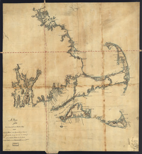
[Coast of New England from Chatham Harbor to Naragansett Bay]
2.
Coast of Massachusetts from Cape Ann to Manomet Point, including northern tip of Cape Cod
3.
Coast of Massachusetts from Cape Ann to Manomet Point, including northern tip of Cape Cod
4.
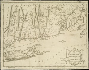
[Coast of Rhode Island and Long Island from Narragansett Bay to Peconic Bay]
5.
A correct map of the coast of New England
6.
An accurate map of Rhode Island, part of Connecticut and Massachusets, shewing Admiral Arbuthnot's station in blocking up...
7.
A map of the colony of Rhode Island : with the adjacent parts of Connecticut, Massachusetts Bay, &c
8.
A map of the country adjacent to the north boundary line of the colony of Rhode Island as the same was run by commissioners...
9.
A map of the province of Massachusets Bay and colony of Rhode Island, with part of Connecticut, New Hampshire, and Vermont
10.
A new and accurate map of the colony of Massachusets Bay, in North America, from a late survey
11.
A plan of the sea coast from Boston Bay to the light house near Rhode Island : reduced from the large survey
12.
The coast of a part of New England, New York, New Jersey, Pensilvania, Maryland, Virginia, and part of North Carolina &c. with...
13.
A new chart of the coast of New England, Nova Scotia, and the islands of St. John, Cape Breton, Sable, the banks of St. Peters,...
14.
An accurate map of Rhode Island, part of Connecticut and Massachusets, shewing Admiral Arbuthnot's station in blocking up...
15.
A map of the province of Massachusets Bay and colony of Rhode Island, with part of Connecticut, New Hampshire, and Vermont
16.
A new and accurate map of the colony of Massachusets Bay, in North America, from a late survey
17.
A chart of the coast of New England, from Beverly to Scituate harbour, including the ports of Boston and Salem
18.
The coast of New England
19.
An actual survey of the sea coast from New York to the I. Cape Briton : with tables of the direct and thwart courses &...
20.
Carta particolare della nuoua Belgia è parte della nuoua Anglia
21.
A chart of the coast of New England from the South Shoal to Cape Sable including Georges Bay from Holland & actual surveys
22.
A chart of the coast of New England from the South Shoal to Cape Sable including Georges Bay from Holland & actual surveys
23.
A chart of the sea coast of New Found Land, New Scotland, New England, New York, New Jersey, with Virginia and Maryland
24.
The coast of New England
25.
The coast of Nova Scotia, New England, New-York, Jersey, the Gulph and River of St. Lawrence : the islands of Newfoundland,...
26.
Pas caerte van Nieu Nederlandt en de Engelsche Virginies van Cabo Cod tot Cabo Canrick
27.
A map of the colonies of Connecticut and Rhode Island, divided into counties & townships, from the best authorities
28.
A new and accurate map of Connecticut and Rhode Island, from the best authorities
29.
An accurate map of the Commonwealth of Massachusetts exclusive of the district of Maine : compiled pursuant to an Act of the...
30.
An accurate map of the country round Boston in New England from the best authorities
31.
Carta rappresentante il porto di Boston
32.
Carte des environs de Boston, capitale de la Nlle. Angleterre en Amerique
33.
Die gegend um Boston
34.
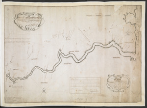
[Map of eastern Massachusetts and vicinity]
35.
Massachusetts
36.
The state of Massachusetts from the best information
37.
Buzzards Bay and shoals of Nantucket
38.
A correct map of the coast of New England
39.
A correct map of the coast of New England
40.
A new and correct chart of the sea coast of New-England from Cape Codd to Casco Bay
41.
Pas-kaart vande zee kusten inde boght van Niew Engeland : tusschen de staaten Hoek en C. de Sable
42.
Chart of the coast of New England
43.
The coast of New England
44.
Costes et rivieres de Virginie, de Mariland, et de Nouvelle Angletere
45.
1. Prise de Newport par d'Estaing, 1778 : 2. Embossage de Ternay à Newport, 1780
46.
A new and accurate map of the present seat of war in North America : from a late survey
47.
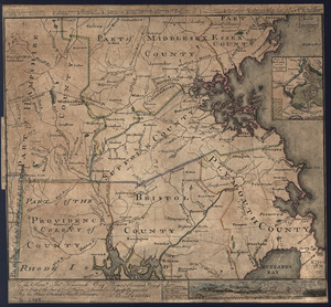
[Plan de defense de New-Port] : [dans l'Isle Rhode (Amerique Septentrionalle) par l'escadre du Roy aux ordres de Monsieur le...
48.
An accurate map of the country round Boston in New England from the best authorities
49.
A Copy of the Plan returned by his Maj:tys Com:rs for setling the Boundarys between the Provinces of New Hampshire and the...
50.
A map of Massachusetts, from the best authorities
51.
A Map Of the River MERRIMACK from the Atlantick Ocean to Pantuckett Falls describing bounds between His Maj:tys Province of New...
52.
A PLAN of the Rivers and Boundary Lines referr'd to in ye Proceedings & Judgment of ye Commissioners for adjusting the Bounds...
53.
The south part of New England as it planted this yeare, 1634
54.
The south part of New England, as it planted this yeare, 1639
55.
The state of Massachusetts
56.
The state of Massachusetts from the best information
57.
To the Hone. Jno. Hancock, Esqre. president of ye Continental Congress, this map of the seat of civil war in America, is...
58.
To the Hone. Jno. Hancock, Esqre. president of ye Continental Congress, this map of the seat of civil war in America, is...
59.
The 100th anniversary map of Abraham Lincoln's visit to Massachusetts, September 11-23, 1848
60.
1630 shoreline
61.
1879. Progress map of the U.S. Geographical Surveys west of the 100th Meridian : prepared under the direction of 1st Lieut....
62.
1903 Map of Salem and surrounding places
63.
19th annual convention of the National Association of Real Estate Boards : at Tulsa, June 7 to June 11 in 1926
64.
2005 significant U.S. hurricane strikes
65.
The 2100 project : an atlas for the Green New Deal
66.
227 Harzgerode
67.
305 Glatz
68.
38,000,000 escaped -- 10,000,000 died
69.
4 Kinten
70.
660 Wakulah St., Roxbury
71.
[A chart of Boston Bay and vicinity]
72.
[A chart of New York Island & North River : East River, passage through Hell Gate, Flushing Bay, Hampstead Bay, Oyster,...
73.
The A.A.A. key road map of continental Europe
74.
Aaron Bohrod's America, its history
75.
ABC pathfinder railway guide map : eastern division
76.
Abolition of Slavery, 1863
77.
Aboriginal map of North America, denoting the boundaries and the locations of various Indian tribes
78.
Acapulco, México
79.
Accurata delineatio Castrorum Suecicorum, ut et Haffniae, Regni Daniae Metropolis
80.
Accurata delineatio oppugnatae a faederatis, Caesareis, Polonicis, Danicis, et Brandeburgicis copijs sub-ductu Seren: Electoris...
81.
Accurata delineatio regionis circa Nieburgum Fioniæ cum prælio ibi commisso inter Danorum et fæderatorum exercitum ab una et...
82.
Accurata Scaniae, Blekingiae et Hallandiae descriptio
83.
An accurate map of Cuba, and the adjacent islands
84.
An accurate map of Dorset Shire divided into hundreds
85.
An accurate map of Dorset Shire, divided into its hundreds
86.
An accurate map of England and Wales with the principal roads from the best authorities
87.
An accurate map of England and Wales with the principal roads from the best authorities
88.
An accurate map of Europe from the best authorities
89.
An accurate map of Hindostan or India, from the best authorities
90.
An accurate map of His Majesty's province of New-Hampshire in New England : taken from actual surveys of all the inhabited...
91.
An Accurate map of New Hampshire in New England, from a late survey
92.
An Accurate map of New York in North America, from a late survey
93.
An accurate map of North America : describing and distinguishing the British and Spanish dominions on this great continent :...
94.
An accurate map of North America : describing and distinguishing the British and Spanish dominions of this great continent;...
95.
An accurate map of North America : describing and distinguishing the British, Spanish and French dominions on this great...
96.
An accurate map of North and South Carolina with their Indian frontiers, shewing in a distinct manner all the mountains,...
97.
An accurate map of the coast of Cape de Verde
98.
An accurate map of the county of Essex, divided into its hundreds
99.
An accurate map of the district of Maine being part of the Commonwealth of Massachusetts : compiled pursuant to an act of the...
100.
An accurate map of the United States of America, with part of the surrounding provinces agreeable to the Treaty of Peace of 1783
‹ Prev
Next ›
1
2
3
4
5
…
81
82
![[Coast of New England from Chatham Harbor to Naragansett Bay]](https://bpldcassets.blob.core.windows.net/derivatives/images/commonwealth:7h149x27g/image_thumbnail_300.jpg)


![[Coast of Rhode Island and Long Island from Narragansett Bay to Peconic Bay]](https://bpldcassets.blob.core.windows.net/derivatives/images/commonwealth:7h149z14m/image_thumbnail_300.jpg)


![[Map of eastern Massachusetts and vicinity]](https://bpldcassets.blob.core.windows.net/derivatives/images/commonwealth:9s161d29f/image_thumbnail_300.jpg)


![[Plan de defense de New-Port]](https://bpldcassets.blob.core.windows.net/derivatives/images/commonwealth:z603vn044/image_thumbnail_300.jpg)


![[A chart of Boston Bay and vicinity]](https://bpldcassets.blob.core.windows.net/derivatives/images/commonwealth:cj82m2976/image_thumbnail_300.jpg)


