Toggle navigation
LMEC Home
Exhibitions
Georeferencing
Tools for Teachers
Collections
My Favorites
Sign Up / Log In
Search
Search the map portal
Map Collection
Map Collection
Map Sets
Search
Search
Search for
Search In
All Fields
Creator
Title
Subject
Place
Search All Digital Collections
Advanced Search
8203 Results
My Search
Start Over
More Like
commonwealth:6h446z16x
Remove constraint More Like: commonwealth:6h446z16x
Filter your Search
Place
North and Central America
4,952
United States
3,641
Suffolk (county)
1,065
Boston
1,038
Europe
963
Canada
427
France
269
Massachusetts
251
more
Place
»
Topic
Boston (Mass.)--Maps
575
United States--Maps
270
Real property--Massachusetts--Boston--Maps
191
Massachusetts--Maps
161
Landowners--Massachusetts--Boston--Maps
149
North America--Maps--Early works to 1800
103
New England--Maps
99
City planning--Massachusetts--Boston--Maps
82
more
Topic
»
Date
Date range begin
–
Date range end
Current results range from
1482
to
2023
View distribution
Creator
United States. Hydrographic Office
357
O.H. Bailey & Co
148
Des Barres, Joseph F. W. (Joseph Frederick Wallet), 1722-1824
123
United States. Post Office Dept
120
Ptolemy, 2nd cent
100
Walling, Henry Francis, 1825-1888
94
Jefferys, Thomas, -1771
84
Geological Survey (U.S.)
83
more
Creator
»
Format
Maps/Atlases
8,144
Manuscripts
215
Prints
51
Books
36
Objects/Artifacts
10
Drawings/Illustrations
8
Posters
4
Georeferenced
Yes
870
No
7,333
Collection
Norman B. Leventhal Map Center Collection
8,163
Boston and New England Maps
2,206
Urban Maps
1,947
Maritime Charts and Atlases
750
American Revolutionary War-Era Maps
616
Boston Redevelopment Authority Collection
108
Massachusetts Real Estate Atlases
18
Available to use
No known restrictions
8,044
Creative Commons license
46
Search Constraints
Sort by relevance
relevance
title
date (asc)
date (desc)
Number of results to display per page
50 per page
10
per page
20
per page
50
per page
100
per page
View results as:
grid view
map view
Search Results
1.
Atlas of Dorchester, West Roxbury and Brighton, city of Boston
2.
Atlas of the city of Boston : volume 6 : West Roxbury : from actual surveys and official plans
3.
Atlas of the city of Boston : volume 6 : West Roxbury : from actual surveys and official plans
4.
Atlas of the city of Boston : West Roxbury : from actual surveys and official plans
5.
Atlas of the city of Boston : West Roxbury : from actual surveys and official plans
6.
Atlas of the city of Boston : West Roxbury : volume five : from actual surveys and official records
7.
Atlas of the city of Boston, West Roxbury, Mass., volume six : from actual surveys and official plans
8.
Atlas of the county of Suffolk, Massachusetts : vol. 5th, West Roxbury, now ward 17, Boston : from actual survey & official...
9.
Atlas of Dorchester, West Roxbury, and Brighton, City of Boston
10.
Allston-Brighton open space plan site inventory
11.
Atlas of Suffolk, county, vol. 7th, late town of Brighton, now ward 19 of Boston, Massachusetts : from actual survey & official...
12.
Atlas of the city of Boston : Brighton : from actual surveys and official plans
13.
Atlas of the city of Boston : volume 7: Brighton : from actual surveys and official plans
14.
Atlas of the city of Boston : ward 25, Brighton : from actual surveys and official plans
15.
Atlas of the city of Boston : wards 25 & 26, Brighton : from actual surveys and official plans
16.
Atlas of the city of Boston, volume seven, Brighton, Mass. : from actual surveys and official plans
17.
Brighton and Allston urban design strategy
18.
Topographic map of Brighton and Allston
19.
Atlas of the city of Boston : Dorchester : from actual surveys and official plans
20.
Atlas of the city of Boston : Dorchester : from actual surveys and official plans
21.
Atlas of the city of Boston : Dorchester : from actual surveys and official plans
22.
Atlas of the city of Boston : Dorchester : volume three : from actual surveys and official records
23.
Atlas of the city of Boston : Dorchester, Mass., vol. 5 : from actual surveys and official plans
24.
Atlas of the city of Boston : Dorchester, Mass., vol. 5 : from actual surveys and official plans
25.
Atlas of the city of Boston : Dorchester, Mass., vol. 5 : from actual surveys and official plans
26.
Atlas of the city of Boston, volume five, Dorchester Mass. : from actual surveys and official plans
27.
Map of Dorchester, Roxbury, and West Roxbury
28.
Plan of Mount Hope Cemetery : including the City Cemetery belonging to the City of Boston and situated in West Roxbury &...
29.
North Harvard project area : location map
30.
Plan of Mount Hope Cemetery belonging to the City of Boston
31.
Plan of Bradford Estate, Roslindale, Ward 23, Boston
32.
Atlas of the city of Boston : Charlestown and Brighton, volume six : from actual surveys and official records
33.
Brighton park : Brighton district
34.
Map of Brookline and vicinity
35.
Plan of 82 building lots, in the town of Brighton, comprising 48 acres of the Parkman Farm next the estate of Saml. Bigelow...
36.
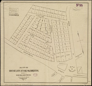
Plan of house lots at Oak Sq. Brighton : belonging to Oak Sq. Land Trust
37.
Plan of house lots in the village of Brighton : upon a part of the well known Winship Estate ... to be sold by public auction...
38.
Plan of the town of Brighton
39.
Allston Park, Boston, Mass
40.
Map of the town of Roxbury : surveyed by order of the town authorities
41.
Map of West Roxbury
42.
Plan no. 1 of building lots near Spring St. Station West Roxbury belonging to the West Roxbury Land Co
43.
Plan of dwelling houses & house lots, in West Roxbury
44.
Plan of house lots, Mt. Vernon St., West Roxbury : owned by the Mt. Vernon Land Company, 257 Washington St., Room 3
45.
Plan of lands in West-Roxbury, belonging to the estate of Chas. M. Taft : to be sold by public auction on Wednesday June 9th...
46.
Plan of lands in West-Roxbury, belonging to the estate of Chas. M. Taft : to be sold by public auction in Wednesday June 9th at...
47.
Plan of the town of West Roxbury : compiled from various plans and surveys, by order of the selectmen
48.
Trustees' sale : beautiful building lots on Walnut St. and Walnut Avenue, in West Roxbury, containing about 3,126,519 square feet
49.
West Roxbury Park : West Roxbury district
50.
Atlas of the city of Boston : Roxbury : from actual surveys and official plans
‹ Prev
Next ›
1
2
3
4
5
…
164
165