Toggle navigation
LMEC Home
Collections
My Favorites
Exhibitions
Georeferencing
Tools for Teachers
Sign Up / Log In
Search
Search the map portal
Search
Search
Search for
Search in
All Fields
Title
Subject
Place
Creator
Search All Digital Collections
Advanced Search
115 Results
Search Constraints
My Search
Start Over
More like
commonwealth:6395x781b
Remove constraint More like: commonwealth:6395x781b
Filter your Search
Show filters
Hide filters
Place
North and Central America
100
United States
95
New York
42
Maine
19
Europe
6
Lower Bay
6
Upper Bay
6
Erie (county)
5
more
Place
»
Topic
United States--History--Revolution, 1775-1783
35
Maps--Early works to 1800
23
Maine--Maps
21
Campaigns & battles
8
Harbors
5
Navigation
5
War
5
Civil wars
4
more
Topic
»
Creator
Des Barres, Joseph F. W. (Joseph Frederick Wallet), 1729-1824
25
Cram, George Franklin, 1841-1928
11
Rand McNally and Company
7
Matthews-Northrup Company
5
Smith, Benjamin E. (Benjamin Eli), 1857-1913
5
Faden, William, 1749-1836
4
Mitchell, S. Augustus (Samuel Augustus), 1792-1868
4
Bache, A. D. (Alexander Dallas), 1806-1867
3
more
Creator
»
Format
Maps/Atlases
112
Prints
3
Books
1
Manuscripts
1
Georeferenced
Yes
6
No
109
Collection
Robert E. Diefenbach Map Collection at Phillips Academy
75
American Revolutionary War-Era Maps
31
Osher Map Library Collection
26
Ralph Finos Map Collection at Phillips Academy
8
Boston and New England Maps
1
George Washington Presidential Library at Mount Vernon Collection
1
Harvard Map Collection
1
Mapping Boston Collection
1
more
Collection
»
Available to use
No known restrictions
80
Creative Commons license
6
Sort
by date (asc)
relevance
title
date (asc)
date (desc)
recently added
Number of results to display per page
20
per page
per page
10
per page
20
per page
50
per page
100
per page
Search Results
21.
Coast of Maine- From Spurwink River to Moose Point or, from Musketo Island to Cape Elizabeth, inclulding Kennebec River
22.
Coast of Maine-Moose Harbor to Watering Cove, including Mechiass Bay, Naragnagus Bay, and Gouldsborough, Dated April 24, 1776
23.
Gouldsborough to Moose Harbor, Maine
24.
Gouldsborough to Moose Harbor, Maine
25.
Gouldsborough to Moose Harbor, Maine
26.
Coast of ME, NH, MA- Cape Elizabeth to Newbury Harbor
27.
Coast of Maine - From Seal Harbor to Penmaquid Point
28.
Coast of Maine - From Seal Harbor to Penmaquid Point
29.
Coast of Maine- From Seal Harbor to Penmaquid Point, Dated June 24, 1776
30.
Coast of Maine from Cape Elizabeth to Merrymeeting Bay
31.
Coast of Maine- From Roger's Bay to Portland Sound including Falmouth Harbor, Dated July, 1776
32.
Coast of Maine- Mount Desart Island, Frenchman's Bay, Long Island, Dated July 15, 1776
33.
Coast of Maine- Detail of Penobscot Bay with Isle Haut and Southern Fox Island, Dated Aug. 17, 1776
34.
Coast of Maine- Detail of Penobscot Bay with Isle Haut and Southern Fox Island, Dated Aug. 17, 1776
35.
Coast of Maine- Detail of Inner Penobscot Bay with Deer Island, Long Island and Winslow or Long Island, Dated Sept. 3, 1776
36.
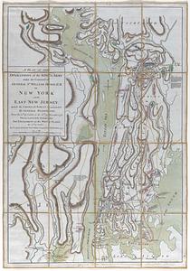
A plan of the operations of the king's army under the command of General Sr. William Howe, K.B. in New York and East New...
37.
Plan of Valley Forge
38.
A Chart of Delawar Bay, with Soundings and Nautical Observations
39.
Chart of the Coast and Harbors of New England
40.
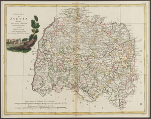
Circolo di Svevia diviso ne suoi stati di nuova projezione
« Previous
Next »
1
2
3
4
5
6