Toggle navigation
LMEC Home
Exhibitions
Georeferencing
Tools for Teachers
Collections
My Favorites
Sign Up / Log In
Search
Search the map portal
Map Collection
Map Collection
Map Sets
Search
Search
Search for
Search In
All Fields
Creator
Title
Subject
Place
Search All Digital Collections
Advanced Search
376 Results
My Search
Start Over
More Like
commonwealth:6108vv723
Remove constraint More Like: commonwealth:6108vv723
Filter your Search
Place
North and Central America
336
United States
210
Canada
103
Essex (county)
24
Louisbourg
21
Saint Lawrence River
19
Fort Edward
16
Suffolk (county)
16
more
Place
»
Topic
United States--History--French and Indian War, 1754-1763--Maps, Manuscript--Early works to 1800
58
Louisbourg (N.S.)--Maps, Manuscript--Early works to 1800
18
Fort Edward (N.Y.)--Maps, Manuscript--Early works to 1800
16
Fort Ticonderoga (N.Y.)--Maps, Manuscript--Early works to 1800
15
Saint Lawrence River--Maps, Manuscript--Early works to 1800
15
Louisbourg (N.S.)--History--Siege, 1745--Maps, Manuscript--Early works to 1800
14
Fortification--New York (State)--Fort Edward--Maps, Manuscript--Early works to 1800
13
Fortification--New York (State)--Maps, Manuscript--Early works to 1800
13
more
Topic
»
Date
Date range begin
–
Date range end
Current results range from
1664
to
1816
View distribution
Creator
Royal United Services Institute for Defence and Security Studies
160
George, III, King of Great Britain, 1738-1820
151
George, IV, King of Great Britain, 1762-1830
150
Amherst, Jeffery Amherst, Baron, 1717-1797
128
Skinner, Monier
28
Skinner, William, 1700-1780
28
Brasier, William
16
Bastide, John Henry, approximately 1700-1770
15
more
Creator
»
Format
Maps/Atlases
360
Manuscripts
149
Drawings/Illustrations
14
Georeferenced
Yes
7
No
369
Collection
British Library Collection
376
American Revolutionary War-Era Maps
352
Boston and New England Maps
21
Urban Maps
5
Maritime Charts and Atlases
2
Available to use
Creative Commons license
376
Search Constraints
Sort by title
relevance
title
date (asc)
date (desc)
Number of results to display per page
50 per page
10
per page
20
per page
50
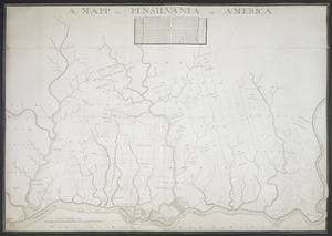
per page
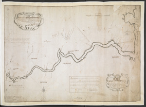
100
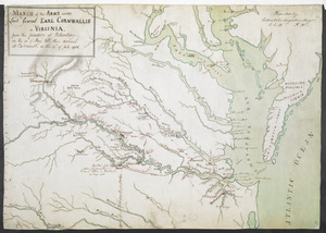
per page
View results as:
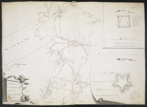
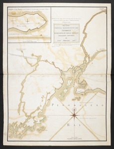
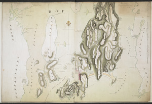
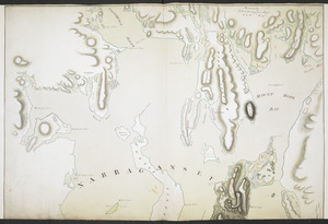
grid view
map view
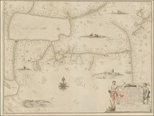
Search Results
101.
[Map of Fort Pitt]
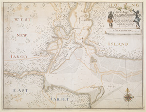
102.
[Map of Narragansett Bay]
103.
[Map of New England]
104.
A MAP of NEW YORK, & STATEN ISLDS; And part of LONG ISLAND : Surveyed by Order of His Excellency General Sir Henry Clinton K.B....
105.
A Map of Niagara River or ye Straights between the Lakes Erie and Ontario with the Islands, Falls, and Rapids, as also the...
106.
[Map of Quebec and environs showing the position of the English and French troops]
107.
[Map of Saint Simons and Jekyll Islands]
108.
[Map of Saint Simons and Jekyll Islands with fortifications]
109.
A MAP of the BRITISH COLONIES in North America : WITH THE Roads, Distances, Limits, and Extent of the SETTLEMENTS, Humbly...
110.
[Map of the coast of Florida from Fort William to Musketae River] [north sheet]
111.
[Map of the coast of Florida from Fort William to Musketae River] [south sheet]
112.
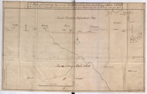
A Map of the Country Adjacent to the North Boundary Line of of the Colony of Rhode Island as the same was Run by Commissioners...
113.
[Map of the environs of Quebec showing the position of the English and French troops]
114.
[Map of the proposed fort and adjacent redoubt on Saint Simons Island]
115.
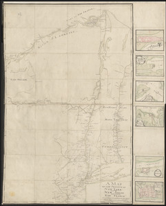
A MAP of the PROVINCE of NEW YORK & Part of NEW ENGLAND & NEW JERSEY with Part of NEW FRANCE the whole Compsed from Actual...
116.
A MAP OF THE PROVINCE OF NEW-YORK, & PART OF NEW ENGLAND WITH A PART OF NEW FRANCE the whole Composed from Actual Surveys
117.
A MAP OF THE PROVINCE OF NEW-YORK, PART OF NEW JERSEY with a Part of NEW FRANCE Composed from Actual Surveys
118.
A Map Of the River MERRIMACK from the Atlantick Ocean to Pantuckett Falls describing bounds between His Maj:tys Province of New...
119.
A Map of the Sea Coasts of NEW ENGLAND According to the actual Survey made thereof BY CAP.T CYPRIAN SOUTHACK As also the...
120.
A MAP OF THE SURVEYED PARTS OF NOVA SCOTIA MDCCLVI
121.
MAP of the Western parts of the COLONY of VIRGINIA, as far as the Mississipi
122.
[Map of the Wilderness Road]
123.
[Map of West Florida and the Mississippi River] : John Campbell
124.
[Map showing Fort Pitt, Fort Duquesne and Fort Mercer]
125.
[Map showing Fort William Henry, Fort Carillon, Fort St Frederic, and the upper reaches of the Connecticut River]
126.
[Map showing Jonathan Carver's travels west of the Great Lakes.]
127.
[Map showing Jonathan Carver's travels west of the Great Lakes.]
128.
[Map showing military locations from Fort Cumberland on the River Potomac to Fort Presqu'Isle on Lake Erie]
129.
[Map showing military locations from Fort Cumberland on the River Potomac to Fort Presqu'Isle on Lake Erie]
130.
[Map showing neck of land between 'Baye francaise' and 'Baye verte']
131.
[Map showing operations against Philadelphia by the British in November 1777]
132.
[Map showing rivers and forts in North America]
133.
[Map showing Saint John's Harbour and a proposed fort]
134.
[Map showing Saint John's Harbour with Fort William and Fort Townshend]
135.
[Map showing the attack of the French upon York in Virginia, June 1782]
136.
[Map showing the boundary line between the provinces of Massachusetts Bay and Connecticut by Woodward and Saffery in 1642 and...
137.
[Map showing the disposition of General Amhert's boats and rafts]
138.
[Map showing the location of Fort de la Presentation]
139.
A MAPP OF PENSYLVANIA IN AMERICA
140.
A Mappe of Colonel Römers Voyage to ye: 5 Indian nations going from New Yorck to Albany thence west to ye 3 Macquas Castle and...
141.
MARCH of the ARMY under Lieut:t General EARL CORNWALLIS in VIRGINIA, from the JUNCTION at Petersburg on the 20.th of May, til...
142.
MAY 23. 1759. PROVINCE MASSACHUSETTS BAY PENOBSCOT DOMINIONS OF GREAT BRITAIN POSSESSION CONFIRM'D BY THOS. POWNALL GOVR
143.
NARRAGANSETT BAY containing Rhode Island &c
144.
NARRAGANSETT BAY containing Rhode Island &c
145.
A new Mappe of a part of Hutsons or the North River, Rareton River which have there aiet lett in to the Sea by Sandy hoocke,...
146.
A New Plan of ye Great Town of BOSTON in New England in AMERICA with the many Additionall Buildings & New Streets to the Year,...
147.
A new plan of ye great town of Boston in New England in America with the many additionall buildings & new streets to the year 1743
148.
[New York Island and the Narrows. 1781]
149.
Nouveau plan du Lac ontario depuis Le fort frontenac jusquà Chouayguin, avec les isles Et Bancs qui y Sont
150.
PART OF HUDSON'S RIVER
‹ Prev
Next ›
1
2
3
4
5
6
7
8
![[Map of Fort Pitt]](https://bpldcassets.blob.core.windows.net/derivatives/images/commonwealth:hx11z224f/image_thumbnail_300.jpg)
![[Map of Narragansett Bay]](https://bpldcassets.blob.core.windows.net/derivatives/images/commonwealth:hx11z2791/image_thumbnail_300.jpg)
![[Map of New England]](https://bpldcassets.blob.core.windows.net/derivatives/images/commonwealth:hx11z5705/image_thumbnail_300.jpg)
![[Map of Quebec and environs showing the position of the English and French troops]](https://bpldcassets.blob.core.windows.net/derivatives/images/commonwealth:hx11xz61s/image_thumbnail_300.jpg)
![[Map of Saint Simons and Jekyll Islands]](https://bpldcassets.blob.core.windows.net/derivatives/images/commonwealth:hx11z454k/image_thumbnail_300.jpg)
![[Map of Saint Simons and Jekyll Islands with fortifications]](https://bpldcassets.blob.core.windows.net/derivatives/images/commonwealth:hx11z4564/image_thumbnail_300.jpg)

![[Map of the coast of Florida from Fort William to Musketae River] [north sheet]](https://bpldcassets.blob.core.windows.net/derivatives/images/commonwealth:hx11z4742/image_thumbnail_300.jpg)
![[Map of the coast of Florida from Fort William to Musketae River] [south sheet]](https://bpldcassets.blob.core.windows.net/derivatives/images/commonwealth:hx11z476m/image_thumbnail_300.jpg)
![[Map of the environs of Quebec showing the position of the English and French troops]](https://bpldcassets.blob.core.windows.net/derivatives/images/commonwealth:hx11xz690/image_thumbnail_300.jpg)
![[Map of the proposed fort and adjacent redoubt on Saint Simons Island]](https://bpldcassets.blob.core.windows.net/derivatives/images/commonwealth:hx11z468x/image_thumbnail_300.jpg)


![[Map of the Wilderness Road]](https://bpldcassets.blob.core.windows.net/derivatives/images/commonwealth:hx11z2855/image_thumbnail_300.jpg)
![[Map of West Florida and the Mississippi River]](https://bpldcassets.blob.core.windows.net/derivatives/images/commonwealth:hx11z2898/image_thumbnail_300.jpg)
![[Map showing Fort Pitt, Fort Duquesne and Fort Mercer]](https://bpldcassets.blob.core.windows.net/derivatives/images/commonwealth:hx11z222w/image_thumbnail_300.jpg)
![[Map showing Fort William Henry, Fort Carillon, Fort St Frederic, and the upper reaches of the Connecticut River]](https://bpldcassets.blob.core.windows.net/derivatives/images/commonwealth:hx11z1735/image_thumbnail_300.jpg)
![[Map showing Jonathan Carver's travels west of the Great Lakes.]](https://bpldcassets.blob.core.windows.net/derivatives/images/commonwealth:6108vw266/image_thumbnail_300.jpg)
![[Map showing Jonathan Carver's travels west of the Great Lakes.]](https://bpldcassets.blob.core.windows.net/derivatives/images/commonwealth:hx11z299h/image_thumbnail_300.jpg)
![[Map showing military locations from Fort Cumberland on the River Potomac to Fort Presqu'Isle on Lake Erie]](https://bpldcassets.blob.core.windows.net/derivatives/images/commonwealth:hx11z2367/image_thumbnail_300.jpg)
![[Map showing military locations from Fort Cumberland on the River Potomac to Fort Presqu'Isle on Lake Erie]](https://bpldcassets.blob.core.windows.net/derivatives/images/commonwealth:hx11z2324/image_thumbnail_300.jpg)
![[Map showing neck of land between 'Baye francaise' and 'Baye verte']](https://bpldcassets.blob.core.windows.net/derivatives/images/commonwealth:hx11z035j/image_thumbnail_300.jpg)
![[Map showing operations against Philadelphia by the British in November 1777]](https://bpldcassets.blob.core.windows.net/derivatives/images/commonwealth:6108vv61k/image_thumbnail_300.jpg)
![[Map showing rivers and forts in North America]](https://bpldcassets.blob.core.windows.net/derivatives/images/commonwealth:hx11z163x/image_thumbnail_300.jpg)
![[Map showing Saint John's Harbour and a proposed fort]](https://bpldcassets.blob.core.windows.net/derivatives/images/commonwealth:6108vw12v/image_thumbnail_300.jpg)
![[Map showing Saint John's Harbour with Fort William and Fort Townshend]](https://bpldcassets.blob.core.windows.net/derivatives/images/commonwealth:6108vv278/image_thumbnail_300.jpg)
![[Map showing the attack of the French upon York in Virginia, June 1782]](https://bpldcassets.blob.core.windows.net/derivatives/images/commonwealth:hx11xz51j/image_thumbnail_300.jpg)
![[Map showing the boundary line between the provinces of Massachusetts Bay and Connecticut by Woodward and Saffery in 1642 and as run in 1713]](https://bpldcassets.blob.core.windows.net/derivatives/images/commonwealth:hx11z5641/image_thumbnail_300.jpg)
![[Map showing the disposition of General Amhert's boats and rafts]](https://bpldcassets.blob.core.windows.net/derivatives/images/commonwealth:hx11xz67f/image_thumbnail_300.jpg)
![[Map showing the location of Fort de la Presentation]](https://bpldcassets.blob.core.windows.net/derivatives/images/commonwealth:hx11z0993/image_thumbnail_300.jpg)


![[New York Island and the Narrows. 1781]](https://bpldcassets.blob.core.windows.net/derivatives/images/commonwealth:hx11z295d/image_thumbnail_300.jpg)