Toggle navigation
LMEC Home
Exhibitions
Georeferencing
Tools for Teachers
Collections
My Favorites
Sign Up / Log In
Search
Search the map portal
Map Collection
Map Collection
Map Sets
Search
Search
Search for
Search In
All Fields
Creator
Title
Subject
Place
Search All Digital Collections
Advanced Search
8166 Results
My Search
Start Over
More Like
commonwealth:4m90fk33m
Remove constraint More Like: commonwealth:4m90fk33m
Filter your Search
Place
North and Central America
4,915
United States
3,602
Suffolk (county)
1,026
Boston
999
Europe
963
Canada
427
France
269
Massachusetts
249
more
Place
»
Topic
Boston (Mass.)--Maps
574
United States--Maps
270
Real property--Massachusetts--Boston--Maps
174
Massachusetts--Maps
160
Landowners--Massachusetts--Boston--Maps
132
North America--Maps--Early works to 1800
103
New England--Maps
99
Europe--Maps
78
more
Topic
»
Date
Date range begin
–
Date range end
Current results range from
1482
to
2023
View distribution
Creator
United States. Hydrographic Office
360
O.H. Bailey & Co
148
Des Barres, Joseph F. W. (Joseph Frederick Wallet), 1722-1824
123
United States. Post Office Dept
120
Ptolemy, 2nd cent
100
Walling, Henry Francis, 1825-1888
94
Jefferys, Thomas, -1771
84
Geological Survey (U.S.)
82
more
Creator
»
Format
Maps/Atlases
8,107
Manuscripts
215
Prints
51
Books
36
Objects/Artifacts
10
Drawings/Illustrations
8
Posters
4
Georeferenced
Yes
868
No
7,298
Collection
Norman B. Leventhal Map Center Collection
8,166
Boston and New England Maps
2,184
Urban Maps
1,925
Maritime Charts and Atlases
754
American Revolutionary War-Era Maps
616
Boston Redevelopment Authority Collection
86
Available to use
No known restrictions
8,025
Creative Commons license
46
Search Constraints
Sort by relevance
relevance
title
date (asc)
date (desc)
Number of results to display per page
20 per page
10
per page
20
per page
50
per page
100
per page
View results as:
grid view
map view
Search Results
1.
Dagbladets kart over krigsskuepladsen
2.
The Evening Post map of the West Indies
3.
Map of Havana and Havana Harbor showing the fortifications and public buildings
4.
A map of the island of Puerto Rico
5.
Map of the seat of war : showing the only practical method by which the movements of the warships of both nations can be...
6.
Military map, island of Puerto Rico
7.
Outline map of Puerto Rico
8.
Porto Rico and Virgin Isles : Haiti, Hispaniola or St. Domingo
9.
Porto-Rico showing road work, light houses, rail roads, towns and coast line
10.
Post route map of Porto-Rico showing post offices in operation on the 1st of December, 1903
11.
Where the fight will be centered, if there is one
12.
Carte de l'ile de Cuba
13.
Carte de l'Isle de Cuba et des Isles Lucayes
14.
Coast of North America from Point Judith to St. Antonio, (island of Cuba) including the Bahama Banks
15.
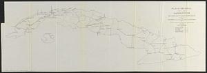
Plano general de las carreteras que merecen atencion preferente
16.
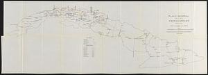
Plano general de los ferrocarriles de la Isla de Cuba
17.
Tactical pilotage chart, TPC
18.
West Indies, ports and anchorages at the eastern end of Cuba : from Spanish government surveys in 1860-74
19.
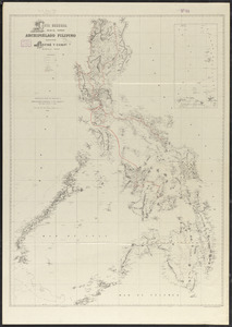
Carta general del Archipiélago Filipino
20.
Chart of the Philippine Islands, from the Spanish chart 1808 : the adjacent islands are added from the latest surveys
‹ Prev
Next ›
1
2
3
4
5
…
408
409