Toggle navigation
LMEC Home
Exhibitions
Georeferencing
Tools for Teachers
Collections
My Favorites
Sign Up / Log In
Search
Search the map portal
Map Collection
Map Collection
Map Sets
Search
Search
Search for
Search In
All Fields
Creator
Title
Subject
Place
Search All Digital Collections
Advanced Search
8166 Results
My Search
Start Over
More Like
commonwealth:4m90fk33m
Remove constraint More Like: commonwealth:4m90fk33m
Filter your Search
Place
North and Central America
4,915
United States
3,602
Suffolk (county)
1,026
Boston
999
Europe
963
Canada
427
France
269
Massachusetts
249
more
Place
»
Topic
Boston (Mass.)--Maps
574
United States--Maps
270
Real property--Massachusetts--Boston--Maps
174
Massachusetts--Maps
160
Landowners--Massachusetts--Boston--Maps
132
North America--Maps--Early works to 1800
103
New England--Maps
99
Europe--Maps
78
more
Topic
»
Date
Date range begin
–
Date range end
Current results range from
1482
to
2023
View distribution
Creator
United States. Hydrographic Office
360
O.H. Bailey & Co
148
Des Barres, Joseph F. W. (Joseph Frederick Wallet), 1722-1824
123
United States. Post Office Dept
120
Ptolemy, 2nd cent
100
Walling, Henry Francis, 1825-1888
94
Jefferys, Thomas, -1771
84
Geological Survey (U.S.)
82
more
Creator
»
Format
Maps/Atlases
8,107
Manuscripts
215
Prints
51
Books
36
Objects/Artifacts
10
Drawings/Illustrations
8
Posters
4
Georeferenced
Yes
868
No
7,298
Collection
Norman B. Leventhal Map Center Collection
8,166
Boston and New England Maps
2,184
Urban Maps
1,925
Maritime Charts and Atlases
754
American Revolutionary War-Era Maps
616
Boston Redevelopment Authority Collection
86
Available to use
No known restrictions
8,025
Creative Commons license
46
Search Constraints
Sort by relevance
relevance
title
date (asc)
date (desc)
Number of results to display per page
100 per page
10
per page
20
per page
50
per page
100
per page
View results as:
grid view
map view
Search Results
1.
Dagbladets kart over krigsskuepladsen
2.
The Evening Post map of the West Indies
3.
Map of Havana and Havana Harbor showing the fortifications and public buildings
4.
A map of the island of Puerto Rico
5.
Map of the seat of war : showing the only practical method by which the movements of the warships of both nations can be...
6.
Military map, island of Puerto Rico
7.
Outline map of Puerto Rico
8.
Porto Rico and Virgin Isles : Haiti, Hispaniola or St. Domingo
9.
Porto-Rico showing road work, light houses, rail roads, towns and coast line
10.
Post route map of Porto-Rico showing post offices in operation on the 1st of December, 1903
11.
Where the fight will be centered, if there is one
12.
Carte de l'ile de Cuba
13.
Carte de l'Isle de Cuba et des Isles Lucayes
14.
Coast of North America from Point Judith to St. Antonio, (island of Cuba) including the Bahama Banks
15.
Plano general de las carreteras que merecen atencion preferente
16.
Plano general de los ferrocarriles de la Isla de Cuba
17.
Tactical pilotage chart, TPC
18.
West Indies, ports and anchorages at the eastern end of Cuba : from Spanish government surveys in 1860-74
19.
Carta general del Archipiélago Filipino
20.
Chart of the Philippine Islands, from the Spanish chart 1808 : the adjacent islands are added from the latest surveys
21.
Eastern passages to China
22.
Geologic reconnaissance map of Mindanao
23.
Karte der Philippinen : in zwei sectionen : nördliches und südliches blatt
24.
Map of Philippine Islands and adjacent seas : from material of the English and Batavian governments
25.
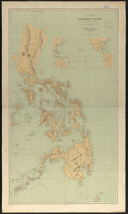
Map of the Philippine Islands and Sulu Archipelago
26.
Northern Philippines land utilization
27.
Philippine Islands : [outline map]
28.
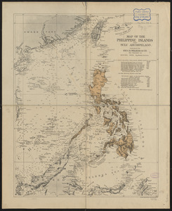
The Philippine Islands
29.
Philippine Islands radio stations and cables
30.
Progress map of Signal Corps telegraph lines & cables in the military division of the Philippines : based on map of Montero y...
31.
Progress map of Signal Corps telegraph lines & cables in the military division of the Philippines : based on map of Montero y...
32.
West Indies, eastern part of Bahama Islands with part of Cuba and north coast of Santo Domingo : compiled from the latest...
33.
West Indies, eastern part of Bahama Islands with part of Cuba and north coast of Santo Domingo : compiled from the latest...
34.
West Indies, sheet no. Jamaica with Pedro and Rosalind Banks and with parts of Cuba and San Domingo : from British, Spanish and...
35.
Ports in the Philippine Islands
36.
The 100th anniversary map of Abraham Lincoln's visit to Massachusetts, September 11-23, 1848
37.
1630 shoreline
38.
1879. Progress map of the U.S. Geographical Surveys west of the 100th Meridian : prepared under the direction of 1st Lieut....
39.
1903 Map of Salem and surrounding places
40.
19th annual convention of the National Association of Real Estate Boards : at Tulsa, June 7 to June 11 in 1926
41.
2005 significant U.S. hurricane strikes
42.
The 2100 project : an atlas for the Green New Deal
43.
227 Harzgerode
44.
305 Glatz
45.
38,000,000 escaped -- 10,000,000 died
46.
4 Kinten
47.
660 Wakulah St., Roxbury
48.
[A chart of Boston Bay and vicinity]
49.
[A chart of New York Island & North River : East River, passage through Hell Gate, Flushing Bay, Hampstead Bay, Oyster,...
50.
The A.A.A. key road map of continental Europe
51.
Aaron Bohrod's America, its history
52.
ABC pathfinder railway guide map : eastern division
53.
Abolition of Slavery, 1863
54.
Aboriginal map of North America, denoting the boundaries and the locations of various Indian tribes
55.
Acapulco, México
56.
Accurata delineatio Castrorum Suecicorum, ut et Haffniae, Regni Daniae Metropolis
57.
Accurata delineatio oppugnatae a faederatis, Caesareis, Polonicis, Danicis, et Brandeburgicis copijs sub-ductu Seren: Electoris...
58.
Accurata delineatio regionis circa Nieburgum Fioniæ cum prælio ibi commisso inter Danorum et fæderatorum exercitum ab una et...
59.
Accurata Scaniae, Blekingiae et Hallandiae descriptio
60.
An accurate map of Cuba, and the adjacent islands
61.
An accurate map of Dorset Shire divided into hundreds
62.
An accurate map of Dorset Shire, divided into its hundreds
63.
An accurate map of England and Wales with the principal roads from the best authorities
64.
An accurate map of England and Wales with the principal roads from the best authorities
65.
An accurate map of Europe from the best authorities
66.
An accurate map of Hindostan or India, from the best authorities
67.
An accurate map of His Majesty's province of New-Hampshire in New England : taken from actual surveys of all the inhabited...
68.
An Accurate map of New Hampshire in New England, from a late survey
69.
An Accurate map of New York in North America, from a late survey
70.
An accurate map of North America : describing and distinguishing the British and Spanish dominions on this great continent :...
71.
An accurate map of North America : describing and distinguishing the British and Spanish dominions of this great continent;...
72.
An accurate map of North America : describing and distinguishing the British, Spanish and French dominions on this great...
73.
An accurate map of North and South Carolina with their Indian frontiers, shewing in a distinct manner all the mountains,...
74.
An accurate map of Rhode Island, part of Connecticut and Massachusets, shewing Admiral Arbuthnot's station in blocking up...
75.
An accurate map of the coast of Cape de Verde
76.
An accurate map of the Commonwealth of Massachusetts exclusive of the district of Maine : compiled pursuant to an Act of the...
77.
An accurate map of the country round Boston in New England from the best authorities
78.
An accurate map of the county of Essex, divided into its hundreds
79.
An accurate map of the district of Maine being part of the Commonwealth of Massachusetts : compiled pursuant to an act of the...
80.
An accurate map of the United States of America, with part of the surrounding provinces agreeable to the Treaty of Peace of 1783
81.
Accuratissima Brasiliae tabula
82.
Accuratissima Circuli Saxoniae tabula quae est pars septentrionalis Germaniae
83.
Accuratissima Dominii Veneti in Italia, Ducatus Parmae, Placentiae, Modenae Regii Et Mantuae, Episcopatus Tridentini Tabula...
84.
Accuratissima et maxima totius Turcici Imperii tabula cum omnibus suis regionibus novissima delineatio
85.
Accuratissima principatus Cataloniae, et comitatuum Ruscinonis, et Cerretaniae descriptio
86.
An actual survey of the sea coast from New York to the I. Cape Briton : with tables of the direct and thwart courses &...
87.
Adams, Mass : 1882
88.
Adriatic
89.
The adventures of Mark Twain
90.
Aegyptus Antiqua
91.
Aerial photograph of South Boston
92.
Aerial photograph of South Boston
93.
An aerial view of New York City showing how easily the weary traveler may reach the Herald Square Hotel wherein he will find...
94.
Aero view of Canton, Mass. 1918
95.
Aero view of Lynn, Mass, 1916 : looking north
96.
Aeronautical view of the Panama Canal
97.
Aethiopia inferior, vel exterior : partes magis septentrionales, quae hic desiderantur, vide in tabula Ethiopiae superioris
98.
Aethiopia superior vel interior : vulgo Abissinorum, sive Presbiteri Ioannis imperium
99.
Ævi veteris usque ad annum salutis nonagesimum supra milles quadringentos cogniti tantum, typus geographica
100.
Affrice Tabule Quatuor : Prima Libie tabula continet ambas Mauritanias
‹ Prev
Next ›
1
2
3
4
5
…
81
82


![[A chart of Boston Bay and vicinity]](https://bpldcassets.blob.core.windows.net/derivatives/images/commonwealth:cj82m2976/image_thumbnail_300.jpg)


