Toggle navigation
LMEC Home
Exhibitions
Georeferencing
Tools for Teachers
Collections
My Favorites
Sign Up / Log In
Search
Search the map portal
Map Collection
Map Collection
Map Sets
Search
Search
Search for
Search In
All Fields
Creator
Title
Subject
Place
Search All Digital Collections
Advanced Search
8172 Results
My Search
Start Over
More Like
commonwealth:4m90f867k
Remove constraint More Like: commonwealth:4m90f867k
Filter your Search
Place
North and Central America
4,921
United States
3,611
Suffolk (county)
1,026
Boston
999
Europe
963
Canada
427
France
269
Massachusetts
249
more
Place
»
Topic
Boston (Mass.)--Maps
574
United States--Maps
270
Real property--Massachusetts--Boston--Maps
174
Massachusetts--Maps
160
Landowners--Massachusetts--Boston--Maps
132
North America--Maps--Early works to 1800
103
New England--Maps
99
Europe--Maps
78
more
Topic
»
Date
Date range begin
–
Date range end
Current results range from
1482
to
2023
View distribution
Creator
United States. Hydrographic Office
357
O.H. Bailey & Co
148
Des Barres, Joseph F. W. (Joseph Frederick Wallet), 1722-1824
123
United States. Post Office Dept
120
Ptolemy, 2nd cent
100
Walling, Henry Francis, 1825-1888
94
Jefferys, Thomas, -1771
84
Geological Survey (U.S.)
82
more
Creator
»
Format
Maps/Atlases
8,113
Manuscripts
215
Prints
51
Books
36
Objects/Artifacts
10
Drawings/Illustrations
8
Posters
4
Georeferenced
Yes
869
No
7,303
Collection
Norman B. Leventhal Map Center Collection
8,163
Boston and New England Maps
2,184
Urban Maps
1,925
Maritime Charts and Atlases
750
American Revolutionary War-Era Maps
625
Boston Redevelopment Authority Collection
86
William L. Clements Library Collection
9
Available to use
No known restrictions
8,022
Creative Commons license
46
Search Constraints
Sort by relevance
relevance
title
date (asc)
date (desc)
Number of results to display per page
50 per page
10
per page
20
per page
50
per page
100
per page
View results as:
grid view
map view
Search Results
1.
A geological map of Ohio
2.
Being a cartograph of Ohio : the oldest state west of the thirteen original colonies; now the fourth state in the Union in...
3.
Colton's map of the oil district of West Virginia and Ohio
4.
A map of part of the N:W: Territory of the United States : compiled from actual surveys, and the best information
5.
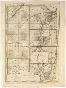
Map of the district of Delaware in Ohio
6.
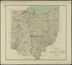
Map of the state of Ohio
7.
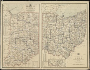
Map of the states of Ohio, Indiana and Illinois with the settled parts of Michigan & Wisconsin
8.
Map of Virginia, West Virginia and Ohio : showing Norfolk and Western Railway : main line branches and connections
9.
Plat of the seven ranges of townships being part of the territory of the United States n.w. of the Ohio River which by a late...
10.
Post route map of the State of Ohio showing post offices with the intermediate distances and mail routes in operation on the...
11.
Post route map of the state of Ohio showing post offices with the intermediate distances on mail routes in operation on the...
12.
Post route map of the state of Ohio showing post offices with the intermediate distances on mail routes in operation on the 1st...
13.
Post route map of the states of Ohio and Indiana with adjacent parts of Pennsylvania, Michigan, Illinois, Kentucky and West...
14.
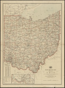
State of Ohio
15.
State of Ohio coal fields and producing districts
16.
The tourist's pocket map of the state of Ohio : exhibiting its internal improvements, roads, distances &c
17.
The two routes surveyed for the National Road from Springfield to Richmond, 1835 : reduced from the original survey of Captain...
18.
Action between Genl. St Clairs army & that of the American Indians Novr. 4th 1791 : collected from his public letter
19.
Campaign of Major General Anthony Wayne, 1793-94
20.
A draft of the Ohio from an Indian account
21.
A map of the state of Ohio : from actual survey
22.
Mr. Mathew's draft of the Scioto & Ohio Companies purchase
23.
Plan of St. Clairs battle ground
24.
Plan of the Indian countrys through which the troops marchd in 1764 under the command of Col. Henry Bouquet
25.
A plan of the river Ohio from Fort Pitt to the Mississipi : by order of ye chief engineer
26.
A sketch of the several Indian roads leading from Fort Pitt to Sioto, Lake Erie &c. : takn. from a draft (made on a tour thro'...
27.
A topographical plan of that part of the Indian-country through which the army under the command of Colonel Bouquet marched in...
28.
The 100th anniversary map of Abraham Lincoln's visit to Massachusetts, September 11-23, 1848
29.
1630 shoreline
30.
1879. Progress map of the U.S. Geographical Surveys west of the 100th Meridian : prepared under the direction of 1st Lieut....
31.
1903 Map of Salem and surrounding places
32.
19th annual convention of the National Association of Real Estate Boards : at Tulsa, June 7 to June 11 in 1926
33.
2005 significant U.S. hurricane strikes
34.
The 2100 project : an atlas for the Green New Deal
35.
227 Harzgerode
36.
305 Glatz
37.
38,000,000 escaped -- 10,000,000 died
38.
4 Kinten
39.
660 Wakulah St., Roxbury
40.
[A chart of Boston Bay and vicinity]
41.
[A chart of New York Island & North River : East River, passage through Hell Gate, Flushing Bay, Hampstead Bay, Oyster,...
42.
The A.A.A. key road map of continental Europe
43.
Aaron Bohrod's America, its history
44.
ABC pathfinder railway guide map : eastern division
45.
Abolition of Slavery, 1863
46.
Aboriginal map of North America, denoting the boundaries and the locations of various Indian tribes
47.
Acapulco, México
48.
Accurata delineatio Castrorum Suecicorum, ut et Haffniae, Regni Daniae Metropolis
49.
Accurata delineatio oppugnatae a faederatis, Caesareis, Polonicis, Danicis, et Brandeburgicis copijs sub-ductu Seren: Electoris...
50.
Accurata delineatio regionis circa Nieburgum Fioniæ cum prælio ibi commisso inter Danorum et fæderatorum exercitum ab una et...
‹ Prev
Next ›
1
2
3
4
5
…
163
164


![[A chart of Boston Bay and vicinity]](https://bpldcassets.blob.core.windows.net/derivatives/images/commonwealth:cj82m2976/image_thumbnail_300.jpg)


