Toggle navigation
LMEC Home
Exhibitions
Georeferencing
Tools for Teachers
Collections
My Favorites
Sign Up / Log In
Search
Search the map portal
Map Collection
Map Collection
Map Sets
Search
Search
Search for
Search In
All Fields
Creator
Title
Subject
Place
Search All Digital Collections
Advanced Search
8357 Results
My Search
Start Over
More Like
commonwealth:3f463689d
Remove constraint More Like: commonwealth:3f463689d
Filter your Search
Place
North and Central America
5,106
United States
3,794
Suffolk (county)
1,216
Boston
1,189
Europe
963
Canada
427
Massachusetts
275
France
269
more
Place
»
Topic
Boston (Mass.)--Maps
740
United States--Maps
270
Real property--Massachusetts--Boston--Maps
222
Landowners--Massachusetts--Boston--Maps
168
Massachusetts--Maps
163
City planning--Massachusetts--Boston--Maps
156
North America--Maps--Early works to 1800
103
New England--Maps
101
more
Topic
»
Date
Date range begin
–
Date range end
Current results range from
1482
to
2023
View distribution
Creator
United States. Hydrographic Office
357
Boston Redevelopment Authority
161
O.H. Bailey & Co
148
Des Barres, Joseph F. W. (Joseph Frederick Wallet), 1722-1824
124
United States. Post Office Dept
120
Ptolemy, 2nd cent
100
Walling, Henry Francis, 1825-1888
94
Bromley, George Washington
86
more
Creator
»
Format
Maps/Atlases
8,298
Manuscripts
215
Prints
51
Books
36
Objects/Artifacts
10
Drawings/Illustrations
8
Posters
4
Georeferenced
Yes
885
No
7,472
Collection
Norman B. Leventhal Map Center Collection
8,191
Boston and New England Maps
2,310
Urban Maps
2,045
Maritime Charts and Atlases
750
American Revolutionary War-Era Maps
638
Boston Redevelopment Authority Collection
192
Massachusetts Real Estate Atlases
38
Mapping Boston Collection
20
more
Collection
»
Available to use
No known restrictions
8,135
Creative Commons license
69
Search Constraints
Sort by date (asc)
relevance
title
date (asc)
date (desc)
Number of results to display per page
20 per page
10
per page
20
per page
50
per page
100
per page
View results as:
grid view
map view
Search Results
7641.
Pictorial map of Kansas
7642.
The port of Salem, Massachusetts
7643.
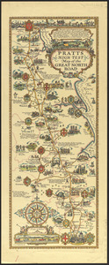
Pratts high test map of the Great North Road
7644.
Rose garden in Fens-Back Bay
7645.
Town of Brookline, Mass. assessors' plans 1930
7646.
Umatilla National Forest, Oregon and Washington
7647.
Winthrop - anciently Pullin Point : our peninsula in 1624
7648.
Atlas of the city of Boston : Roxbury : from actual surveys and official plans
7649.
Being a map of the United States in the year 1831 when the Country Gentleman first made its appearance as the Genesee Farmer
7650.
Bus routes Boston Elevated Railway 1931 July 18
7651.
A chart of the history of printing in Europe
7652.
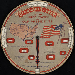
Geographic chart of the United States and our presidents
7653.
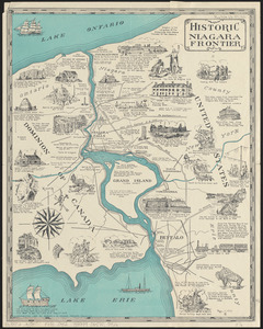
Historic Niagara Frontier
7654.
An historical and literary map of the Old Line State of Maryland : showing forth divers curious and notable facts relating to...
7655.
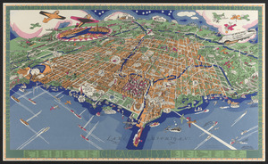
An illustrated map of Chicago : youthful city of the big shoulders, restless, ingenious, wilful, violent, proud to be alive!
7656.
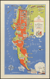
A map of the Cape Peninsula
7657.
A map of the Seneca villages and the Jesuit and French contacts 1615-1708
7658.
Mercator map of the world
7659.
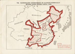
Nationalist government of Nanking - nominally ruling over entire China, 1930
7660.
Ye olde towne of Rumford : (Concord, N.H.)
‹ Prev
Next ›
1
2
…
379
380
381
382
383
384
385
386
387
…
417
418