Toggle navigation
LMEC Home
Exhibitions
Georeferencing
Tools for Teachers
Collections
My Favorites
Sign Up / Log In
Search
Search the map portal
Map Collection
Map Collection
Map Sets
Search
Search
Search for
Search In
All Fields
Creator
Title
Subject
Place
Search All Digital Collections
Advanced Search
8734 Results
My Search
Start Over
More Like
commonwealth:3f462w042
Remove constraint More Like: commonwealth:3f462w042
Filter your Search
Place
North and Central America
5,965
United States
4,883
Massachusetts
2,098
Europe
1,396
Suffolk (county)
1,068
Boston
1,041
Canada
449
Asia
438
more
Place
»
Topic
Boston (Mass.)--Maps
586
United States--Maps
282
Real property--Massachusetts--Boston--Maps
175
Massachusetts--Maps
162
Landowners--Massachusetts--Boston--Maps
133
North America--Maps--Early works to 1800
103
New England--Maps
102
Europe--Maps
79
more
Topic
»
Date
Date range begin
–
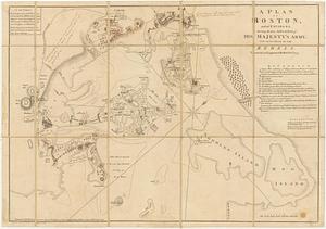
Date range end
Current results range from
1482
to
2023
View distribution
Creator
United States. Hydrographic Office
595
O.H. Bailey & Co
148
Des Barres, Joseph F. W. (Joseph Frederick Wallet), 1722-1824
124
United States. Post Office Dept
120
Ptolemy, 2nd cent
100
Walling, Henry Francis, 1825-1888
94
Geological Survey (U.S.)
86
Jefferys, Thomas, -1771
85
more
Creator
»
Format
Maps/Atlases
8,674
Manuscripts
221
Prints
56
Books
36
Objects/Artifacts
10
Drawings/Illustrations
8
Posters
5
Georeferenced
Yes
873
No
7,861
Collection
Norman B. Leventhal Map & Education Center Collection
8,712
Boston and New England Maps
2,249
Urban Maps
2,029
Maritime Charts and Atlases
1,091
American Revolutionary War-Era Maps
648
Boston Redevelopment Authority Collection
87
Mapping Boston Collection
18
Library of Congress Collection
10
more
Collection
»
Available to use
No known restrictions
8,554
Creative Commons license
83
Search Constraints
Sort by relevance
relevance
title
date (asc)
date (desc)
Number of results to display per page
20 per page
10
per page
20
per page
50
per page
100
per page
View results as:
grid view
map view
Search Results
61.
A large draught of New England, New York and Long Island
62.
A new and accurate chart of the harbour of Boston in New England in North America
63.
A plan of the town and harbour of Boston : and the country adjacent with the road from Boston to Concord, shewing the place of...
64.
Boston
65.
Grundriss von der Stadt Boston und ihren Gegenden
66.
A Map of forty miles north, thirty miles west, and twentyfive miles south of Boston : including an accurate draft of the...
67.
Map of the environs of Boston
68.
A new and correct plan of the town of Boston
69.
A New Plan of ye Great Town of BOSTON in New England in AMERICA with the many Additionall Buildings & New Streets to the Year,...
70.
Plan de Boston
71.
Plan de la ville de Boston
72.
Plan de la ville et du port de Boston : capitale de la Nouvelle Angleterre
73.
Plan de la ville et du port de Boston : capitale de la Nouvelle Angleterre
74.
A plan of Boston, and its environs : shewing the true situation of His Majesty's army, and also those of the rebels
75.
A plan of Boston, from actual survey
76.
A Plan of the Battle of Bunker Hill
77.
The 100th anniversary map of Abraham Lincoln's visit to Massachusetts, September 11-23, 1848
78.
1630 shoreline
79.
1879. Progress map of the U.S. Geographical Surveys west of the 100th Meridian : prepared under the direction of 1st Lieut....
80.
1903 Map of Salem and surrounding places
‹ Prev
Next ›
1
2
3
4
5
6
7
8
…
436
437