Toggle navigation
LMEC Home
Exhibitions
Georeferencing
Tools for Teachers
Collections
My Favorites
Sign Up / Log In
Search
Search the map portal
Map Collection
Map Collection
Map Sets
Search
Search
Search for
Search In
All Fields
Creator
Title
Subject
Place
Search All Digital Collections
Advanced Search
109 Results
My Search
Start Over
More Like
commonwealth:3f462s808
Remove constraint More Like: commonwealth:3f462s808
Filter your Search
Place
North and Central America
102
New England
88
United States
36
Middle Atlantic
20
Canada
13
Northeastern United States
10
New York
9
Massachusetts
8
more
Place
»
Topic
New England--Maps--Early works to 1800
91
Middle Atlantic States--Maps--Early works to 1800
20
Northeastern States--Maps--Early works to 1800
10
New York (State)--Maps--Early works to 1800
8
Maritime Provinces--Maps--Early works to 1800
6
Massachusetts--Maps--Early works to 1800
6
Boston (Mass.)--Maps--Early works to 1800
5
Boston Harbor (Mass.)--Maps--Early works to 1800
5
more
Topic
»
Date
Date range begin
–
Date range end
Current results range from
1483
to
1999
View distribution
Creator
Jefferys, Thomas, d. 1771
8
Bachelder, John B. (John Badger), 1825-1894
4
Bellin, Jacques Nicolas, 1703-1772
4
Green, John, d. 1757
4
Jefferys, Thomas, -1771
4
Bien, Julius, 1826-1909
3
Bowles, Carington, 1724-1793
3
Brady, Mathew B., approximately 1823-1896
3
more
Creator
»
Format
Maps/Atlases
104
Manuscripts
4
Photographs
3
Books
1
Documents
1
Georeferenced
Yes
8
No
101
Collection
Norman B. Leventhal Map Center Collection
79
American Revolutionary War-Era Maps
49
Boston and New England Maps
31
Mapping Boston Collection
23
Sidney R. Knafel Map Collection at Phillips Academy
15
Maritime Charts and Atlases
10
Richard H. Brown Revolutionary War Map Collection at Mount Vernon
6
New York Public Library Collection
3
more
Collection
»
Available to use
No known restrictions
56
Creative Commons license
35
Search Constraints
Sort by date (desc)
relevance
title
date (asc)
date (desc)
Number of results to display per page
20 per page
10
per page
20
per page
50
per page
100
per page
View results as:
grid view
map view
Search Results
1.
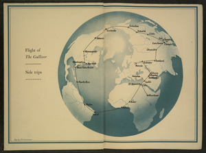
Flight of "The Gulliver"
2.
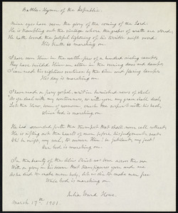
Battle hymn of the republic
3.
A mapp of New England
4.
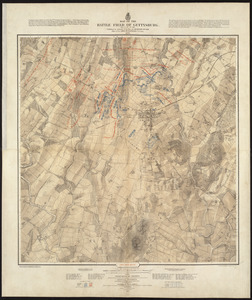
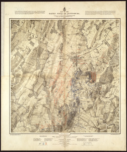
Map of the battle field of Gettysburg, July 1st, 2nd, 3rd, 1863 : Second day's battle
5.
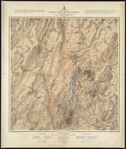
Map of the battle field of Gettysburg, July 1st, 2nd, 3rd, 1863 : First day's battle
6.
Map of the battle field of Gettysburg, July 1st, 2nd, 3rd, 1863 : Third day's battle
7.
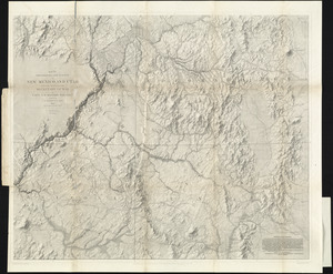
Map of explorations and surveys in New Mexico and Utah made under the direction of the Secretary of War by Capt. J. N. Macomb...
8.
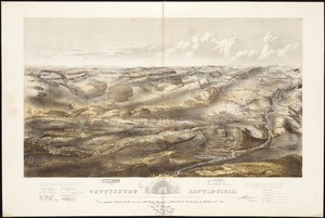
Gettysburg battle-field : Battle fought at Gettysburg, Pa., July 1st, 2d & 3d, 1863 by the Federal and Confederate armies,...
9.
Little Round Top, Gettysburg, July 1863
10.
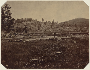
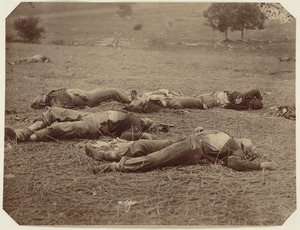
Union dead at Gettysburg
11.
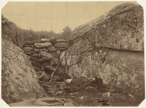
Dead rebel sharpshooter at Gettysburg
12.
Carte réduite du nord des Etat-Unis avec l'intérieur du pays : pour servir à l'intelligence de cette histoire ; copieé par...
13.
A chart of the coast of New England from the South Shoal to Cape Sable including Georges Bay from Holland & actual surveys
14.
A chart of the coast of New England from the South Shoal to Cape Sable including Georges Bay from Holland & actual surveys
15.
Map of the northern, or, New England states of America, comprehending Vermont, New Hampshire, District of Main, Massachusetts,...
16.
Map of the northern, or, New England states of America, comprehending Vermont, New Hampshire, District of Main, Massachusetts,...
17.
Chart for the journal of Mr. le Mquis. de Chastellux
18.
Carte de la Nouvelle Angleterre, Nouvelle York, Nouvelle Jersey et Pensilvanie
19.
An accurate map of the four New England states : shewing in a distinct manner all the mountains, forts, rivers, swamps,...
20.
Carte de la Nouvelle Angleterre, comprenant les etats de Massachusets Bay, N. Hamp Shire, Connecticut et Rhode Island
‹ Prev
Next ›
1
2
3
4
5
6