Toggle navigation
LMEC Home
Exhibitions
Georeferencing
Tools for Teachers
Collections
My Favorites
Sign Up / Log In
Search
Search the map portal
Map Collection
Map Collection
Map Sets
Search
Search
Search for
Search In
All Fields
Creator
Title
Subject
Place
Search All Digital Collections
Advanced Search
232 Results
My Search
Start Over
More Like
commonwealth:3f462s719
Remove constraint More Like: commonwealth:3f462s719
Filter your Search
Place
North and Central America
198
United States
108
New England
100
Boston
53
Suffolk (county)
52
Boston Harbor
35
Massachusetts
33
Middle Atlantic
24
more
Place
»
Topic
New England--Maps--Early works to 1800
91
Massachusetts--Maps--Early works to 1800
30
Boston (Mass.)--Maps
21
Middle Atlantic States--Maps--Early works to 1800
21
Boston Harbor (Mass.)--Maps--Early works to 1800
20
World maps--Early works to 1800
19
Boston (Mass.)--History--Revolution, 1775-1783--Maps--Early works to 1800
18
Boston (Mass.)--Maps--Early works to 1800
14
more
Topic
»
Date
Date range begin
–
Date range end
Current results range from
1493
to
1999
View distribution
Creator
Des Barres, Joseph F. W. (Joseph Frederick Wallet), 1722-1824
9
Bellin, Jacques Nicolas, 1703-1772
8
Jefferys, Thomas, d. 1771
8
Page, Thomas Hyde, Sir, 1746-1821
7
Southack, Cyprian, 1662-1745
6
United States Coast Survey
6
Bache, A. D. (Alexander Dallas), 1806-1867
4
Green, John, d. 1757
4
more
Creator
»
Format
Maps/Atlases
231
Manuscripts
2
Prints
1
Georeferenced
Yes
34
No
198
Collection
Norman B. Leventhal Map Center Collection
192
Mapping Boston Collection
139
Boston and New England Maps
109
American Revolutionary War-Era Maps
98
Maritime Charts and Atlases
39
Urban Maps
24
Sidney R. Knafel Map Collection at Phillips Academy
19
Richard H. Brown Revolutionary War Map Collection at Mount Vernon
8
more
Collection
»
Available to use
Creative Commons license
155
No known restrictions
56
Search Constraints
Sort by relevance
relevance
title
date (asc)
date (desc)
Number of results to display per page
100 per page
10
per page
20
per page
50
per page
100
per page
View results as:
grid view
map view
Search Results
1.
An accurate map of Rhode Island, part of Connecticut and Massachusets, shewing Admiral Arbuthnot's station in blocking up...
2.
An accurate map of Rhode Island, part of Connecticut and Massachusets, shewing Admiral Arbuthnot's station in blocking up...
3.
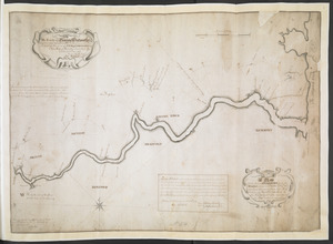
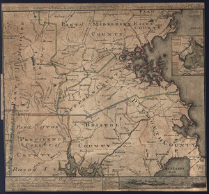
[Map of eastern Massachusetts and vicinity]
4.
A map of the colony of Rhode Island : with the adjacent parts of Connecticut, Massachusetts Bay, &c
5.
The south part of New England as it planted this yeare, 1634
6.
The state of Massachusetts
7.
An accurate map of the four New England states : shewing in a distinct manner all the mountains, forts, rivers, swamps,...
8.
An actual survey of the sea coast from New York to the I. Cape Brition : with tables of the direct and thwart courses &...
9.
Belgii Novi, Angliae Novae, et partis Virginiae : novissima delineatio
10.
Bowles's new pocket map of the most inhabited part of New England : comprehending the provinces of Massachusets Bay and New...
11.
Carte réduite du nord des Etat-Unis avec l'intérieur du pays : pour servir à l'intelligence de cette histoire ; copieé par...
12.
A chart of the coast of America from New found Land to Cape Cod
13.
A map of New England and New York
14.
A map of New-England, being the first that ever was here cut, and done by the best pattern that could be had, which being in...
15.
A map of the coast of New England, from Staten Island to the island of Breton
16.
A map of the most inhabited part of New England : containing the provinces of Massachusets Bay and New Hampshire, with the...
17.
A mapp of New England
18.
New England : the most remarqueable parts thus named by the high and mighty Prince Charles, prince of great Britaine
19.
New England : the most remarqueable parts thus named by the high and mighty Prince Charles, nowe King of great Britaine
20.
New France, New Englande, New Scotlande, and New Foundlande
21.
A new map of New England, New York, New Iarsey, Pensilvania, Maryland and Virginia
22.
A new mapp of New England and Annapolis and the countrys adjacent
23.
Noua Anglia, Nouum Belgium, et Virginia
24.
Nouvelle Hollande (à présent Nouvelle-York), Nouvelle-Angleterre, et une partie de la Virginie
25.
Nova Belgica et Anglia Nova
26.
Novi Belgii, Novaeque Angliae nec non partis Virginiae tabula
27.
Partie septentrionale des possessions Angloise en Amerique : pour servire d'intelligence à la guerre présente entre les...
28.
Pas-kaart vande zee kusten inde boght van Niew Engeland : tusschen de staaten Hoek en C. de Sable
29.
An accurate map of the Commonwealth of Massachusetts exclusive of the district of Maine : compiled pursuant to an Act of the...
30.
An accurate map of the country round Boston in New England from the best authorities
31.
An accurate map of the country round Boston in New England from the best authorities
32.
Carta rappresentante il porto di Boston
33.
Carte des environs de Boston, capitale de la Nlle. Angleterre en Amerique
34.
Coast of Massachusetts from Cape Ann to Manomet Point, including northern tip of Cape Cod
35.
Coast of Massachusetts from Cape Ann to Manomet Point, including northern tip of Cape Cod
36.
[Coast of New England from Chatham Harbor to Naragansett Bay]
37.
[Coast of New England from Chatham Harbor to Naragansett Bay]
38.
A Copy of the Plan returned by his Maj:tys Com:rs for setling the Boundarys between the Provinces of New Hampshire and the...
39.
Die gegend um Boston
40.
A map of Massachusetts, from the best authorities
41.
A map of the country adjacent to the north boundary line of the colony of Rhode Island as the same was run by commissioners...
42.
A map of the province of Massachusets Bay and colony of Rhode Island, with part of Connecticut, New Hampshire, and Vermont
43.
A map of the province of Massachusets Bay and colony of Rhode Island, with part of Connecticut, New Hampshire, and Vermont
44.
A Map Of the River MERRIMACK from the Atlantick Ocean to Pantuckett Falls describing bounds between His Maj:tys Province of New...
45.
Massachusetts
46.
A new and accurate map of the colony of Massachusets Bay, in North America, from a late survey
47.
A new and accurate map of the colony of Massachusets Bay, in North America, from a late survey
48.
A PLAN of the Rivers and Boundary Lines referr'd to in ye Proceedings & Judgment of ye Commissioners for adjusting the Bounds...
49.
The state of Massachusetts from the best information
50.
The state of Massachusetts from the best information
51.
To the Hone. Jno. Hancock, Esqre. president of ye Continental Congress, this map of the seat of civil war in America, is...
52.
To the Hone. Jno. Hancock, Esqre. president of ye Continental Congress, this map of the seat of civil war in America, is...
53.
An Accurate map of New Hampshire in New England, from a late survey
54.
Bowles's map of the seat of war in New England, comprehending the provinces of Massachusets Bay, and New Hampshire : with the...
55.
Bowles's new pocket map of the most inhabited part of New England : comprehending the provinces of Massachusets Bay and New...
56.
Carta particolare della nuoua Belgia è parte della nuoua Anglia
57.
Carte de la Nouvelle Angleterre, comprenant les etats de Massachusets Bay, N. Hamp Shire, Connecticut et Rhode Island
58.
Carte de la Nouvelle Angleterre, New York, Pensilvanie et Nouveau Jersay suivant les cartes angloises
59.
Carte de la Nouvelle Angleterre, Nouvelle Yorck, et Pensilvanie : pour servir à l'Histoire générale des voyages
60.
Carte de la Nouvelle Angleterre, Nouvelle York, Nouvelle Jersey et Pensilvanie
61.
Carte d'une partie de l'Amérique Septentrionale : pour servir à l'intellegence du mémoire sur les prétentions des Anglois...
62.
Carte generale du Canada ou Nouvelle France
63.
Chart for the journal of Mr. le Mquis. de Chastellux
64.
A chart of the coast of New England from the South Shoal to Cape Sable including Georges Bay from Holland & actual surveys
65.
A chart of the coast of New England from the South Shoal to Cape Sable including Georges Bay from Holland & actual surveys
66.
A chart of the province of New England, with the soundings on the coast; drawn about 1670, on a scale of 1 2/3 English league...
67.
The coast of New England
68.
A correct map of the coast of New England
69.
An exact map of New England, New York, Pensylvania & New Jersey, from the latest surveys
70.
Karte von dem Ostlichen-Stucke von Neu Franckreich oder Canada in America : besonders aber Acadia und Neu Schottland
71.
Karte von Neu England, Neu Yorck und Pensilvanien
72.
A map of 100 miles round Boston
73.
A map of New England, New York, New Jersey and Pensilvania
74.
A map of New-England, being the first that ever was here cut, and done by the best pattern that could be had, which being in...
75.
A map of New-England, being the first that ever was here cut, and done by the best pattern that could be had, which being in...
76.
A map of the most inhabited part of New England : containing the provinces of Massachusets Bay and New Hampshire, with the...
77.
A map of the most inhabited part of New England : containing the provinces of Massachusets Bay and New Hampshire, with the...
78.
A map of the most inhabited part of New England : containing the provinces of Massachusets Bay and New Hampshire, with the...
79.
A map of the most inhabited part of New England : containing the provinces of Massachusets Bay and New Hampshire, with the...
80.
A map of the most inhabited part of New England : containing the provinces of Massachusets Bay and New Hampshire, with the...
81.
A map of the most inhabited part of New England : containing the provinces of Massachusets Bay and New Hampshire, with the...
82.
A map of the most inhabited part of New England : containing the provinces of Massachusets Bay and New Hampshire, with the...
83.
A map of the most inhabited part of New England containing the provinces of Massachusets Bay and New Hampshire with the...
84.
A map of the most inhabited part of New England, containing the provinces of Massachusets Bay and New Hampshire, with the...
85.
Map of the northern, or, New England states of America, comprehending Vermont, New Hampshire, District of Main, Massachusetts,...
86.
Map of the northern, or, New England states of America, comprehending Vermont, New Hampshire, District of Main, Massachusetts,...
87.
A map of the Province of New York, with part of Pensilvania, and New England : from an actual survey by Captain Montresor,...
88.
A map of the Province of New York, with part of Pensilvania, and New England : from an actual survey by Captain Montresor,...
89.
A mapp of New England
90.
A new and accurate map of the present seat of war in North America : from a late survey
91.
A new chart of the coast of New England, Nova Scotia, New France or Canada, with the islands of Newfoundld. Cape Breton St....
92.
New Engelland, New York, New Yersey und Pensilvania
93.
New England : die mercklichsten dheile, also genennet durch den durchl: und mechtigen Prinzen und h.h. Carolus, Prinzen von...
94.
New England and New York
95.
New England and New York
96.
A new map of Nova Scotia and Cape Breton Island : with the adjacent parts of New England and Canada composed from a great...
97.
A new map of Nova Scotia, and Cape Britain : with the adjacent parts of New England and Canada, composed from a great number of...
98.
A new map of Nova Scotia, and Cape Britain : with the adjacent parts of New England and Canada, composed from a great number of...
99.
A new map of the most considerable plantations of the English in America
100.
Noui Belgii Nouaeque Angliae nec non partis Virginiae tabula
‹ Prev
Next ›
1
2
3


![[Map of eastern Massachusetts and vicinity]](https://bpldcassets.blob.core.windows.net/derivatives/images/commonwealth:9s161d29f/image_thumbnail_300.jpg)


![[Coast of New England from Chatham Harbor to Naragansett Bay]](https://bpldcassets.blob.core.windows.net/derivatives/images/commonwealth:7h149x27g/image_thumbnail_300.jpg)
![[Coast of New England from Chatham Harbor to Naragansett Bay]](https://bpldcassets.blob.core.windows.net/derivatives/images/commonwealth:7h149z37x/image_thumbnail_300.jpg)


![A map of the most inhabited part of New England containing the provinces of Massachusets Bay and New Hampshire with the colonies of Connecticut and Rhode Island divided into counties and townships the w[h]ole composed from actual surveys and its situation adjusted by astronomical observations](https://bpldcassets.blob.core.windows.net/derivatives/images/commonwealth:6t053p316/image_thumbnail_300.jpg)


