Toggle navigation
LMEC Home
Exhibitions
Georeferencing
Tools for Teachers
Collections
My Favorites
Sign Up / Log In
Search
Search the map portal
Map Collection
Map Collection
Map Sets
Search
Search
Search for
Search In
All Fields
Creator
Title
Subject
Place
Search All Digital Collections
Advanced Search
8176 Results
My Search
Start Over
More Like
commonwealth:3f462s42v
Remove constraint More Like: commonwealth:3f462s42v
Filter your Search
Place
North and Central America
4,925
United States
3,606
Suffolk (county)
1,026
Boston
999
Europe
963
Canada
428
France
269
Massachusetts
249
more
Place
»
Topic
Boston (Mass.)--Maps
574
United States--Maps
270
Real property--Massachusetts--Boston--Maps
174
Massachusetts--Maps
160
Landowners--Massachusetts--Boston--Maps
132
North America--Maps--Early works to 1800
105
New England--Maps
99
Europe--Maps
78
more
Topic
»
Date
Date range begin
–
Date range end
Current results range from
1482
to
2023
View distribution
Creator
United States. Hydrographic Office
357
O.H. Bailey & Co
148
Des Barres, Joseph F. W. (Joseph Frederick Wallet), 1722-1824
123
United States. Post Office Dept
120
Ptolemy, 2nd cent
100
Walling, Henry Francis, 1825-1888
94
Jefferys, Thomas, -1771
88
Geological Survey (U.S.)
82
more
Creator
»
Format
Maps/Atlases
8,117
Manuscripts
215
Prints
51
Books
36
Objects/Artifacts
10
Drawings/Illustrations
8
Posters
4
Georeferenced
Yes
871
No
7,305
Collection
Norman B. Leventhal Map Center Collection
8,163
Boston and New England Maps
2,184
Urban Maps
1,925
Maritime Charts and Atlases
750
American Revolutionary War-Era Maps
628
Boston Redevelopment Authority Collection
86
Richard H. Brown Revolutionary War Map Collection at Mount Vernon
5
New York Public Library Collection
3
more
Collection
»
Available to use
No known restrictions
8,023
Creative Commons license
57
Search Constraints
Sort by relevance
relevance
title
date (asc)
date (desc)
Number of results to display per page
50 per page
10
per page
20
per page
50
per page
100
per page
View results as:
grid view
map view
Search Results
1.
Virginia Marylandia et Carolina in America septentrionali Brittannorum industria excultæ
2.
Virginiae item et Floridae Americae provincarum, nova descriptio
3.
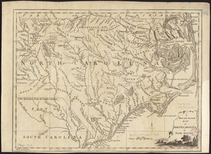
Virginiae partis australis et Floridae partis orientalis, interjacentium[que] regionum nova descriptio
4.
Virginiae partis australis, et Floridae partis orientalis, interjacentiumq[ue] regionum nova descriptio
5.
A map of the seat of war in the southern part of Virginia, North Carolina, and the northern part of South Carolina
6.
An accurate map of North and South Carolina with their Indian frontiers, shewing in a distinct manner all the mountains,...
7.
Carolina
8.
Carte des deux Carolines et de la Géorgie
9.
Chart of the coast of America from Cape Hateras to Cape Roman
10.
Chart of the coast of America from Cape Hateras to Cape Roman
11.
Chart of the coast of America from Cape Hateras to Cape Roman
12.
Chart of the coast of America from Cape Hateras to Cape Roman
13.
A new and accurate map of North Carolina in North America
14.
A New description of Carolina
15.
A new map of Carolina
16.
A new mapp of Carolina
17.
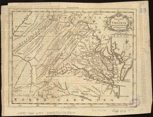
Carte de la Virginie, du Maryland et de l'etat de Delaware
18.
Carte de la Virginie et du Maryland
19.
A draught of Virginia from the Capes to York in York River and to Kuiquotan or Hamton in James River
20.
A map of the country between Will's Creek & Monongahela River shewing the rout and encampments of the English army in 1755
21.
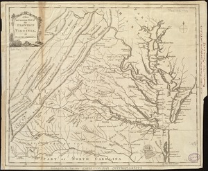
A map of the most inhabited part of Virginia containing the whole province of Maryland with part of Pensilvania, New Jersey and...
22.
A map of Virginia and Maryland
23.
A new and accurate map of the province of Virginia in North America
24.
A new map of Virginia from the best authorities
25.
A new map of Virginia, Mary-land and the improved parts of Penn-sylvania & New Jersey
26.
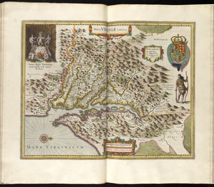
Nova Virginiae tabula
27.
Nova Virginiae tabula
28.
Virginia
29.
Virginia and Maryland
30.
Virginia, Maryland, Pennsilvania, east & west New Jarsey
31.
Virginiae item et Floridae Americae provinciarum, nova descriptio
32.
A compleat map of North-Carolina from an actual survey
33.
Carte des environs du Fort Pitt et de la nouvelle province Indiana : dediée a M. Franklin
34.
A map of the country between Will's Creek & Monongahela River shewing the rout and encampments of the English army in 1755
35.
A map of the most inhabited part of Virginia containing the whole province of Maryland : with part of Pensilvania, New Jersey...
36.
A map of the most inhabited part of Virginia containing the whole province of Maryland with part of Pensilvania, New Jersey and...
37.
Map of the western parts of the colony of Virginia
38.
Map of the western parts of the colony of Virginia, as far as the Mississipi
39.
MAP of the Western parts of the COLONY of VIRGINIA, as far as the Mississipi
40.
A New and accurate map of Virginia : and part of Maryland and Pennsylvania
41.
Noua Anglia, Nouum Belgium, et Virginia
42.
A plan of the entrance of Chesapeak Bay, with James and York Rivers : wherein are shown the respective positions (in the...
43.
To His Excellency Genl. Washington, Commander in Chief of the armies of the United States of America : this plan of the...
44.
Virginia et Nova Francia
45.
The 100th anniversary map of Abraham Lincoln's visit to Massachusetts, September 11-23, 1848
46.
1630 shoreline
47.
1879. Progress map of the U.S. Geographical Surveys west of the 100th Meridian : prepared under the direction of 1st Lieut....
48.
1903 Map of Salem and surrounding places
49.
19th annual convention of the National Association of Real Estate Boards : at Tulsa, June 7 to June 11 in 1926
50.
2005 significant U.S. hurricane strikes
‹ Prev
Next ›
1
2
3
4
5
…
163
164


![Virginiae partis australis et Floridae partis orientalis, interjacentium[que] regionum nova descriptio](https://bpldcassets.blob.core.windows.net/derivatives/images/commonwealth:6t053p120/image_thumbnail_300.jpg)
![Virginiae partis australis, et Floridae partis orientalis, interjacentiumq[ue] regionum nova descriptio](https://bpldcassets.blob.core.windows.net/derivatives/images/commonwealth:st74cw930/image_thumbnail_300.jpg)