Toggle navigation
LMEC Home
Exhibitions
Georeferencing
Tools for Teachers
Collections
My Favorites
Sign Up / Log In
Search
Search the map portal
Map Collection
Map Collection
Map Sets
Search
Search
Search for
Search In
All Fields
Creator
Title
Subject
Place
Search All Digital Collections
Advanced Search
197 Results
My Search
Start Over
More Like
commonwealth:3f462s302
Remove constraint More Like: commonwealth:3f462s302
Filter your Search
Place
North and Central America
107
United States
79
World
63
Boston
44
Suffolk (county)
43
New England
30
Boston Harbor
28
Massachusetts
10
more
Place
»
Topic
World maps--Early works to 1800
76
New England--Maps--Early works to 1800
23
Boston (Mass.)--Maps
20
Boston (Mass.)--History--Revolution, 1775-1783--Maps--Early works to 1800
16
Boston Harbor (Mass.)--Maps--Early works to 1800
13
Boston Harbor (Mass.)--Maps
10
Fortification--Massachusetts--Boston--Maps--Early works to 1800
10
North America--Maps--Early works to 1800
9
more
Topic
»
Date
Date range begin
–
Date range end
Current results range from
1488
to
1927
View distribution
Creator
Page, Thomas Hyde, Sir, 1746-1821
7
United States Coast Survey
6
Southack, Cyprian, 1662-1745
5
Bache, A. D. (Alexander Dallas), 1806-1867
4
Bellin, Jacques Nicolas, 1703-1772
4
Des Barres, Joseph F. W. (Joseph Frederick Wallet), 1722-1824
4
Faden, William, 1749-1836
4
Moll, Herman, d. 1732
4
more
Creator
»
Format
Maps/Atlases
196
Manuscripts
2
Prints
1
Georeferenced
Yes
29
No
168
Collection
Norman B. Leventhal Map Center Collection
184
Mapping Boston Collection
139
Boston and New England Maps
73
American Revolutionary War-Era Maps
38
Maritime Charts and Atlases
28
Urban Maps
23
Sidney R. Knafel Map Collection at Phillips Academy
13
Available to use
Creative Commons license
137
No known restrictions
47
Search Constraints
Sort by date (desc)
relevance
title
date (asc)
date (desc)
Number of results to display per page
20 per page
10
per page
20
per page
50
per page
100
per page
View results as:
grid view
map view
Search Results
81.
Plan of the battle, on Bunker's Hill : fought on the 17th of June 1775
82.
A plan of the town and chart of the harbour of Boston exhibiting a view of the islands, castle forts, and entrances into the...
83.
A sketch of the action between the British forces and the American provincials, on the heights of the peninsula of Charlestown,...
84.
The able doctor; or America swallowing the bitter draught
85.
A map of the most inhabited part of New England : containing the provinces of Massachusets Bay and New Hampshire, with the...
86.
An accurate map of North America : describing and distinguishing the British and Spanish dominions on this great continent :...
87.
A new and correct chart of the sea coast of New-England from Cape Codd to Casco Bay
88.
Carte de la Baye de Baston : située dans la Nouvelle Angleterre
89.
Plan de la ville de Boston
90.
Plan de la ville et du port de Boston : capitale de la Nouvelle Angleterre : erigée prémierement en 1630, et en 1735 elle fut...
91.
Plan de la ville et du port de Boston : capitale de la Nouvelle Angleterre
92.
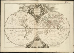
The world, according to the latest discoveries
93.
A correct map of the coast of New England
94.
Carte reduite des costes orientales de l'Amerique septentrionale : 1re. feuille contenant L'Isle Royale, L'Accadie, La Baye...
95.
Baye et port de Boston
96.
Mappemonde ou Description du globe terrestre
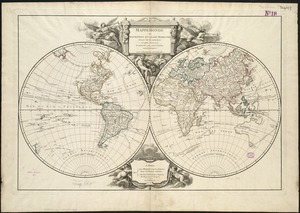
97.
Orbis vetus in utrâque continente juxtà mentem Sansonianam distinctus, nec non observationibus astronomicis
98.
A chart of the sea coast of New Foundland, New Scotland, New York, New Jersey, with Virginia and Maryland and New England
99.
A large draught of New England, New York and Long Island
100.
A new suruey of the harbour of Boston in New England
‹ Prev
Next ›
1
2
3
4
5
6
7
8
9
10