Toggle navigation
LMEC Home
Exhibitions
Georeferencing
Tools for Teachers
Collections
My Favorites
Sign Up / Log In
Search
Search the map portal
Map Collection
Map Collection
Map Sets
Search
Search
Search for
Search In
All Fields
Creator
Title
Subject
Place
Search All Digital Collections
Advanced Search
197 Results
My Search
Start Over
More Like
commonwealth:3f462s302
Remove constraint More Like: commonwealth:3f462s302
Filter your Search
Place
North and Central America
107
United States
79
World
63
Boston
44
Suffolk (county)
43
New England
30
Boston Harbor
28
Massachusetts
10
more
Place
»
Topic
World maps--Early works to 1800
76
New England--Maps--Early works to 1800
23
Boston (Mass.)--Maps
20
Boston (Mass.)--History--Revolution, 1775-1783--Maps--Early works to 1800
16
Boston Harbor (Mass.)--Maps--Early works to 1800
13
Boston Harbor (Mass.)--Maps
10
Fortification--Massachusetts--Boston--Maps--Early works to 1800
10
North America--Maps--Early works to 1800
9
more
Topic
»
Date
Date range begin
–
Date range end
Current results range from
1488
to
1927
View distribution
Creator
Page, Thomas Hyde, Sir, 1746-1821
7
United States Coast Survey
6
Southack, Cyprian, 1662-1745
5
Bache, A. D. (Alexander Dallas), 1806-1867
4
Bellin, Jacques Nicolas, 1703-1772
4
Des Barres, Joseph F. W. (Joseph Frederick Wallet), 1722-1824
4
Faden, William, 1749-1836
4
Moll, Herman, d. 1732
4
more
Creator
»
Format
Maps/Atlases
196
Manuscripts
2
Prints
1
Georeferenced
Yes
29
No
168
Collection
Norman B. Leventhal Map Center Collection
184
Mapping Boston Collection
139
Boston and New England Maps
73
American Revolutionary War-Era Maps
38
Maritime Charts and Atlases
28
Urban Maps
23
Sidney R. Knafel Map Collection at Phillips Academy
13
Available to use
Creative Commons license
137
No known restrictions
47
Search Constraints
Sort by date (desc)
relevance
title
date (asc)
date (desc)
Number of results to display per page
20 per page
10
per page
20
per page
50
per page
100
per page
View results as:
grid view
map view
Search Results
41.
A variation chart
42.
Chart of the world according to Mercators projection, shewing the tracks & discoveries of Captn. Cook
43.
A new chart of America with the harbors of New York, Boston, &c
44.
A map of the world from the best authorities
45.
The state of Massachusetts
46.
A map of the world on a globular projection : exhibiting particularly the nautical researches of Captain James Cook, F.R.S. :...
47.
A new and correct chart of the coast of New England and New York with the adjacent parts of Nova Scotia and New Brunswick from...
48.
A plan of the action at Bunkers Hill on the 17th of June 1775 between His Majesty's troops, under the command of Major General...
49.
A Mercators chart
50.
Chart of the coast of New England
51.
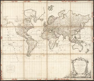
Mappe Monde ou carte générale du globe terrestre dessinée suivant les regles de la projection des cartes réduites
52.
An accurate map of the four New England states : shewing in a distinct manner all the mountains, forts, rivers, swamps,...
53.
Carte de la partie nord, des Etats Unis, de l'Amérique Septentrionale
54.
A chart of the harbour of Boston
55.
The coast of New England
56.
Boston
57.
Boston et ses environs
58.
Carte particuliere du havre de Boston : avec les sondes les bancs de Sable, les rochers les Amaies et les autres directions...
59.
Carte particuliere du havre de Boston : avec les sondes les bancs de Sable, les rochers les Amaies et les autres directions...
60.
Hafen von Boston
‹ Prev
Next ›
1
2
3
4
5
6
7
…
9
10