Toggle navigation
LMEC Home
Exhibitions
Georeferencing
Tools for Teachers
Collections
My Favorites
Sign Up / Log In
Search
Search the map portal
Map Collection
Map Collection
Map Sets
Search
Search
Search for
Search In
All Fields
Creator
Title
Subject
Place
Search All Digital Collections
Advanced Search
8166 Results
My Search
Start Over
More Like
commonwealth:1257bc115
Remove constraint More Like: commonwealth:1257bc115
Filter your Search
Place
North and Central America
4,915
United States
3,605
Suffolk (county)
1,026
Boston
999
Europe
963
Canada
427
France
269
Massachusetts
249
more
Place
»
Topic
Boston (Mass.)--Maps
574
United States--Maps
270
Real property--Massachusetts--Boston--Maps
174
Massachusetts--Maps
160
Landowners--Massachusetts--Boston--Maps
132
North America--Maps--Early works to 1800
103
New England--Maps
99
Europe--Maps
78
more
Topic
»
Date
Date range begin
–
Date range end
Current results range from
1482
to
2023
View distribution
Creator
United States. Hydrographic Office
357
O.H. Bailey & Co
148
Des Barres, Joseph F. W. (Joseph Frederick Wallet), 1722-1824
123
United States. Post Office Dept
120
Ptolemy, 2nd cent
100
Walling, Henry Francis, 1825-1888
94
Jefferys, Thomas, -1771
84
Geological Survey (U.S.)
82
more
Creator
»
Format
Maps/Atlases
8,107
Manuscripts
215
Prints
51
Books
36
Objects/Artifacts
10
Drawings/Illustrations
8
Posters
4
Georeferenced
Yes
869
No
7,297
Collection
Norman B. Leventhal Map Center Collection
8,162
Boston and New England Maps
2,183
Urban Maps
1,924
Maritime Charts and Atlases
750
American Revolutionary War-Era Maps
616
Boston Redevelopment Authority Collection
86
Massachusetts Real Estate Atlases
4
Available to use
No known restrictions
8,021
Creative Commons license
46
Search Constraints
Sort by relevance
relevance
title
date (asc)
date (desc)
Number of results to display per page
50 per page
10
per page
20
per page
50
per page
100
per page
View results as:
grid view
map view
Search Results
1.
Atlas of the town of Brookline 1969
2.
Atlas of the town of Brookline 1972
3.
Atlas of the town of Brookline, Massachusetts : from actual surveys & official records
4.
Atlas of the town of Brookline, Massachusetts : from official records, private plans and actual surveys
5.
Atlas of the town of Brookline, Norfolk County, Massachusetts : from actual surveys and official plans
6.
Atlas of the town of Brookline, Norfolk County, Massachusetts : from actual surveys and official plans
7.
Atlas of the town of Brookline, Norfolk County, Massachusetts : from actual surveys and official plans
8.
Atlas of the town of Brookline, Norfolk County, Massachusetts : from actual surveys and official plans
9.
Atlas of the town of Brookline, Norfolk County, Massachusetts : from actual surveys and official plans
10.
Atlas of the town of Brookline, Norfolk County, Massachusetts : from actual surveys and official plans
11.
Atlas of the town of Brookline, Norfolk County, Massachusetts : from actual surveys and official plans
12.
Copies of plans of various parts of Brookline and Roxbury
13.
The estate of the Brookline Land Company : June 20, 1860
14.
Map of the estate of the Brookline Land Company and vicinity : showing especially the relation of this property to the park...
15.
Map of the town of Brookline, Mass. : made by order of the town authorities from actual survey
16.
Plan of lands owned by The Aspinwall Land Company in Brookline : July 1886
17.
Plan of the Sumner Estate in Brookline : to be sold at public auction, on the premises on Saturday June 1st, 1850, at 3 o'clock...
18.
Town of Brookline, Mass. assessors' plans 1930
19.
Town of Brookline Mass. Assessors' plans 1943
20.
Town of Brookline, Mass. assessors' plans 1944
21.
Atlas of the town of Brookline, Norfolk County, Massachusetts
22.
Atlas of the town of Brookline, Norfolk County, Massachusetts
23.
Atlas of the town of Brookline, Norfolk County, Massachusetts
24.
Atlas of the town of Brookline, Norfolk County, Massachusetts
25.
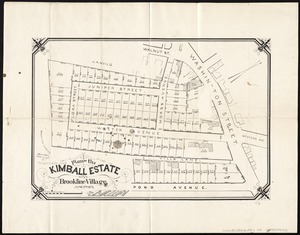
Plan of the Kimball Estate in Brookline Village : June 2nd 1873
26.
Brookline Water Works : profile of main pipe from engine house to reservoir
27.
Brookline Water Works : source, line of supply and distribution
28.
Corey Hill Terraces, Brookline
29.
Map of Brookline and vicinity
30.
Map of the cities of Boston, Cambridge, Somerville and Chelsea, and the town of Brookline with parts of Newton, Malden and...
31.
Map of the town of Brookline : 1894
32.
Map of the town of Brookline : 1893
33.
Map of the town of Brookline, Mass : surveyed in 1844 by order of the Town Authorities
34.
Preliminary plan for the extension of Commonwealth Avenue along Beacon Street Brookline : showing connection with Chestnut Hill...
35.
Preliminary plan for widening Beacon Street from the Back Bay district of Boston to the public pleasure ground at Chestnut Hill...
36.
Preliminary plan for widening Chestnut Hill Avenue
37.
The town of Brookline : 1896
38.
Trees in Brookline, Massachusetts
39.
The 100th anniversary map of Abraham Lincoln's visit to Massachusetts, September 11-23, 1848
40.
1630 shoreline
41.
1879. Progress map of the U.S. Geographical Surveys west of the 100th Meridian : prepared under the direction of 1st Lieut....
42.
1903 Map of Salem and surrounding places
43.
19th annual convention of the National Association of Real Estate Boards : at Tulsa, June 7 to June 11 in 1926
44.
2005 significant U.S. hurricane strikes
45.
The 2100 project : an atlas for the Green New Deal
46.
227 Harzgerode
47.
305 Glatz
48.
38,000,000 escaped -- 10,000,000 died
49.
4 Kinten
50.
660 Wakulah St., Roxbury
‹ Prev
Next ›
1
2
3
4
5
…
163
164