Toggle navigation
LMEC Home
Exhibitions
Georeferencing
Tools for Teachers
Collections
My Favorites
Sign Up / Log In
Search
Search the map portal
Map Collection
Map Collection
Map Sets
Search
Search
Search for
Search In
All Fields
Creator
Title
Subject
Place
Search All Digital Collections
Advanced Search
8189 Results
My Search
Start Over
More Like
commonwealth:1257bb10p
Remove constraint More Like: commonwealth:1257bb10p
Filter your Search
Place
North and Central America
4,938
United States
3,628
Suffolk (county)
1,040
Boston
1,013
Europe
963
Canada
427
France
269
Massachusetts
261
more
Place
»
Topic
Boston (Mass.)--Maps
585
United States--Maps
270
Real property--Massachusetts--Boston--Maps
174
Massachusetts--Maps
160
Landowners--Massachusetts--Boston--Maps
132
North America--Maps--Early works to 1800
103
New England--Maps
99
Europe--Maps
78
more
Topic
»
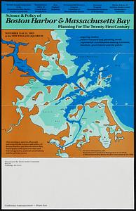
Date
Date range begin
–
Date range end
Current results range from
1482
to
2023
View distribution
Creator
United States. Hydrographic Office
357
O.H. Bailey & Co
148
Des Barres, Joseph F. W. (Joseph Frederick Wallet), 1722-1824
123
United States. Post Office Dept
120
Ptolemy, 2nd cent
100
Walling, Henry Francis, 1825-1888
94
Jefferys, Thomas, -1771
84
Geological Survey (U.S.)
82
more
Creator
»
Format
Maps/Atlases
8,130
Manuscripts
215
Prints
51
Books
36
Objects/Artifacts
10
Drawings/Illustrations
8
Posters
5
Georeferenced
Yes
872
No
7,317
Collection
Norman B. Leventhal Map Center Collection
8,174
Boston and New England Maps
2,198
Urban Maps
1,931
Maritime Charts and Atlases
754
American Revolutionary War-Era Maps
628
Boston Redevelopment Authority Collection
89
Mapping Boston Collection
11
William L. Clements Library Collection
10
more
Collection
»
Available to use
No known restrictions
8,025
Creative Commons license
58
Search Constraints
Sort by relevance
relevance
title
date (asc)
date (desc)
Number of results to display per page
100 per page
10
per page
20
per page
50
per page
100
per page
View results as:
grid view
map view
Search Results
1.
Boston Bay and Harbor
2.
Boston Harbor & vicinity
3.
Boston Harbor, Massachusetts
4.
Eldridge's new chart of Boston Harbor : compiled from the latest surveys
5.
Extract from the plan of the coast survey of Boston Harbor, 1847
6.
Map of Boston Harbor : showing commissioners' lines, wharves &c
7.
Map of Boston inner harbor to accompany report under chapter 93, resolves of 1907, December 1, 1907
8.
Map showing the terminal facilities of Boston
9.
Plan for the occupation of flats owned by the Commonwealth in Boston Harbor
10.
Plan of main ship channel in Boston Harbor showing the work of removing certain obstructions to navigation
11.
Plan of South Bay showing the Harbor Commissioners lines
12.
Plan of the harbour of Boston, from surveys made under the direction of commissioners appointed by a resolve of the...
13.
Plan showing encroachments upon the inner basins of Boston Harbor : accompanying annual report of Harbor and Land...
14.
Sketch of Boston Harbor and Bay
15.
Port facilities at Boston, MA
16.
Plan for the occupation of flats owned by the Commonwealth in Boston Harbor
17.
Plan of Mystic River showing the Harbor Commissioners lines : Dec. 1854
18.
Plan of Neponset River and part of Dorchester Bay showing the harbor lines proposed by the Commissioners 1854
19.
Plan of the proposed docks at South Boston
20.
Boston Harbor Mass : Charles River from Brookline Street bridge to Market Street bridge
21.
Boston Harbor, Mass : map of Charles River from Brookline Street bridge to its mouth
22.
Boston Harbor, Massachusetts
23.
Boston Harbor, Massachusetts
24.
Boston Harbour : from the survey of A.S. Wadsworth Esq. U.S.N. and the chart of Des Barres
25.
Boston Inner Harbor Massachusetts
26.
Changes in the bed of Boston Harbor from a comparison of the surveys of 1835-61
27.
A chart exhibiting the normal course & velocity of the tidal current at ebb in Boston Harbor
28.
Chart of Boston Harbor : from the best authorities, 1873
29.
Chart of Boston Harbor and Massachusetts Bay : with map of the adjacent country
30.
Chart of Boston Harbour : surveyed in 1817
31.
Copy of a plan of South Bay
32.
Copy of part of plan of inner harbor of Boston, showing commissioners' lines
33.
Eldridge's new chart no. 4 Boston Harbor : compiled from the latest surveys
34.
J. Schedler's relief map of Boston and environs
35.
Map of Boston Harbor
36.
Map of Boston inner harbor
37.
Map of Boston proper, Charlestown, South Boston and East Boston : showing original territory of old Boston, the areas filled...
38.
Map of the eastern junc. Broad Sound Pier, & Pt. Shirley railroad : steamboat lines and connections : established for the...
39.
Map showing the routes of The Winthrop Steamboat Co
40.
New chart of Boston Harbor
41.
Plan of Boston and its vicinity
42.
Plan of Boston and its vicinity
43.
[Plan of channels and flats as they were before the 200 feet outside of the Mill Dam was filled up]
44.
Plan of location of projected ship canal from Taunton River to Boston Harbor, through Weymouth Fore River ... Frank W. Hodgdon,...
45.
Plano de la bahia y puerto de Boston
46.
Sections of soundings made by order of the Harbor Committee of 1852
47.
Sketch of the narrows in Boston Harbor
48.
Boston Harbor : challenges and opportunities for the 1980's
49.
Plan for the occupation of flats owned by the Commonwealth in Boston Harbor
50.
Various plans and draughts of cities, towns, harbours &c
51.
Boston Harbor
52.
Boston Harbor, 1778
53.
Boston Harbor, Massachusetts
54.
Boston Harbour : from the survey of A.S. Wadsworth, Esq., U.S.N. and the chart of Des Barres
55.
Boston Harbour
56.
[Chart of Boston Harbor and the surrounding areas]
57.
A chart of the Harbour of Boston, with the soundings, sailing-marks and other directions
58.
A draught of the towns of Boston & Charles Town & the circumjacent country, shewing the works thrown up by the kings troops, &...
59.
The Harbor Park system
60.
Map of parts of Boston Harbor and its tributaries
61.
A map of the environs of Boston
62.
Map to accompany report of State Board on Docks and Terminal Facilities : showing existing conditions and proposed changes at...
63.
A new and accurate chart of the harbour of Boston, in New England, in North America
64.
A new survey of the harbour of Boston in New England : done by order of the principall officers and comissioners of Her Maties....
65.
Plan of Boston
66.
Plan of Boston
67.
A plan of Boston in New England with its environs, including Milton, Dorchester, Roxbury, Brooklin, Cambridge, Medford,...
68.
Plan of the Inner Harbor of Boston
69.
A plan of the town and chart of the harbour of Boston exhibiting a view of the islands castle forts and entrances into the said...
70.
A plan of the town and harbour of Boston and the country adjacent with the road from Boston to Concord shewing the place of the...
71.
Science & policy of Boston Harbor symposium poster
72.
Thirty-miles round Boston
73.
The town & harbour of Boston &c.
74.
The 100th anniversary map of Abraham Lincoln's visit to Massachusetts, September 11-23, 1848
75.
1630 shoreline
76.
1879. Progress map of the U.S. Geographical Surveys west of the 100th Meridian : prepared under the direction of 1st Lieut....
77.
1903 Map of Salem and surrounding places
78.
19th annual convention of the National Association of Real Estate Boards : at Tulsa, June 7 to June 11 in 1926
79.
2005 significant U.S. hurricane strikes
80.
The 2100 project : an atlas for the Green New Deal
81.
227 Harzgerode
82.
305 Glatz
83.
38,000,000 escaped -- 10,000,000 died
84.
4 Kinten
85.
660 Wakulah St., Roxbury
86.
[A chart of Boston Bay and vicinity]
87.
[A chart of New York Island & North River : East River, passage through Hell Gate, Flushing Bay, Hampstead Bay, Oyster,...
88.
The A.A.A. key road map of continental Europe
89.
Aaron Bohrod's America, its history
90.
ABC pathfinder railway guide map : eastern division
91.
Abolition of Slavery, 1863
92.
Aboriginal map of North America, denoting the boundaries and the locations of various Indian tribes
93.
Acapulco, México
94.
Accurata delineatio Castrorum Suecicorum, ut et Haffniae, Regni Daniae Metropolis
95.
Accurata delineatio oppugnatae a faederatis, Caesareis, Polonicis, Danicis, et Brandeburgicis copijs sub-ductu Seren: Electoris...
96.
Accurata delineatio regionis circa Nieburgum Fioniæ cum prælio ibi commisso inter Danorum et fæderatorum exercitum ab una et...
97.
Accurata Scaniae, Blekingiae et Hallandiae descriptio
98.
An accurate map of Cuba, and the adjacent islands
99.
An accurate map of Dorset Shire divided into hundreds
100.
An accurate map of Dorset Shire, divided into its hundreds
‹ Prev
Next ›
1
2
3
4
5
…
81
82


![[Plan of channels and flats as they were before the 200 feet outside of the Mill Dam was filled up]](https://bpldcassets.blob.core.windows.net/derivatives/images/commonwealth:b8516207x/image_thumbnail_300.jpg)


![[Chart of Boston Harbor and the surrounding areas]](https://bpldcassets.blob.core.windows.net/derivatives/images/commonwealth:6108vs71d/image_thumbnail_300.jpg)


![[A chart of Boston Bay and vicinity]](https://bpldcassets.blob.core.windows.net/derivatives/images/commonwealth:cj82m2976/image_thumbnail_300.jpg)


