Toggle navigation
LMEC Home
Exhibitions
Georeferencing
Tools for Teachers
Collections
My Favorites
Sign Up / Log In
Search
Search the map portal
Map Collection
Map Collection
Map Sets
Search
Search
Search for
Search In
All Fields
Creator
Title
Subject
Place
Search All Digital Collections
Advanced Search
13385 Results
Filter your Search
Place
North and Central America
9,353
United States
7,078
Suffolk (county)
1,664
Boston
1,621
Europe
1,035
Canada
949
Massachusetts
794
New York
532
more
Place
»
Topic
Boston (Mass.)--Maps
741
City planning--Massachusetts--Boston--Maps
418
United States--History--Revolution, 1775-1783--Maps
329
United States--Maps
315
Urban renewal--Massachusetts--Boston--Maps
254
Real property--Massachusetts--Boston--Maps
252
Massachusetts--Maps
219
Insurance surveys
197
more
Topic
»
Date
Date range begin
–
Date range end
Current results range from
1482
to
2023
View distribution
Creator
United States. Hydrographic Office
595
Boston Redevelopment Authority
403
Des Barres, Joseph F. W. (Joseph Frederick Wallet), 1722-1824
247
Royal United Services Institute for Defence and Security Studies
160
Jefferys, Thomas, -1771
154
George, III, King of Great Britain, 1738-1820
152
George, IV, King of Great Britain, 1762-1830
151
O.H. Bailey & Co
148
more
Creator
»
Format
Maps/Atlases
13,205
Manuscripts
985
Prints
102
Books
49
Drawings/Illustrations
44
Photographs
15
Objects/Artifacts
13
Documents
7
more
Format
»
Georeferenced
Yes
979
No
12,406
Collection
Norman B. Leventhal Map Center Collection
8,891
American Revolutionary War-Era Maps
3,305
Boston and New England Maps
2,804
Urban Maps
2,397
Maritime Charts and Atlases
1,150
William L. Clements Library Collection
910
Library of Congress Collection
618
Boston Redevelopment Authority Collection
475
more
Collection
»
Available to use
No known restrictions
9,952
Creative Commons license
1,677
Search Constraints
Sort by relevance
relevance
title
date (asc)
date (desc)
Number of results to display per page
50 per page
10
per page
20
per page
50
per page
100
per page
View results as:
grid view
map view
Search Results
1051.
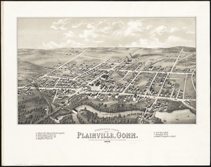
Bird's eye view of Plainville, Conn : 1878
1052.
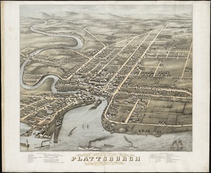
Bird's eye view of Plattsburgh, Clinton Co., New York 1877
1053.
Bird's eye view of Port Townsend, Puget Sound, Washington Territory : from the north-east, 1878
1054.
Bird's eye view of Portsmouth, Rockingham Co., New Hampshire
1055.
Bird's eye view of Rochester, Strafford County, New Hampshire, 1877 : from a position, east of town
1056.
Birds eye view of Syracuse, New York : 1874
1057.
Bird's eye view of the city of Brockton, Plymouth County, Mass : looking southwest, 1882
1058.
Bird's eye view of the city of Holyoke, and village of South Hadley Falls, Mass. looking north
1059.
Bird's eye view of the city of Olympia, East Olympia and Tumwater, Puget Sound, Washington Territory, 1879
1060.
Bird's eye view of the city of Portland, Maine, 1876
1061.
Birds eye view of the Mississippi Valley from Cairo to the Gulf of Mexico
1062.
Birds eye view of the seat of War in Europe
1063.
Birds eye view of the Soudan
1064.
A birds eye view of the Suez Canal
1065.
Bird's eye view of the town of Holbrook : Norfolk County, Mass., looking east, 1882
1066.
Bird's eye view of the town of Nantucket in the State of Massachusetts : looking southwest : 1881
1067.
Bird's eye view of the town of Provincetown, Barnstable County, Mass : 1882
1068.
Birds eye view of the town of Rockland, Plymouth County, Mass : looking northeast
1069.
Bird's eye view of the town of South Abington, Plymouth Co., Mass : looking southeast, 1882
1070.
Bird's eye view of the village of Campello : in the town of Brockton, Plymouth County, Mass., 1880
1071.
Bird's eye view of the village of Hyannis, Barnstable County, Mass
1072.
Birds eye view of the village of Wiscasset, Lincoln Co., Maine, 1878
1073.
Birds eye view of the White Mountains
1074.
Birds eye view of Virginia, Maryland, Delaware and the District of Columbia
1075.
Bird's eye view of Waterloo : Seneca County, N.Y., 1873
1076.
Birds eye view of Waterville, Kennebec Co. Maine : looking northwest
1077.
Bird's eye view of Waukesha, Waukesha County, Wisconsin 1874 : looking south west
1078.
Bird's eye view of Wilkes-Barre, Pa : 1872
1079.
Birds eye view showing Portland R.R. Co. system and connecting lines
1080.
Birdsboro, Pa. : settled 1740
1081.
Bird's-eye map of the White Mountains reached by Boston & Maine R.R.
1082.
Birds-eye view from summit of Mt. Washington; White Mountains, New Hampshire
1083.
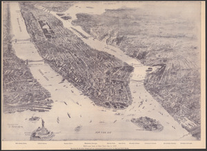
[Bird's-eye view of Boston]
1084.
Bird's-eye view of Boston and its environs
1085.
Birds-eye view of Boston and vicinity : showing the outlying towns and villages and railroad communications
1086.
Bird's-eye view of Boston, showing the burned district
1087.
Bird's-eye view of Boston, showing the burned district
1088.
Bird's-eye view of Boston, United States
1089.
Bird's-eye view of Branford, Connecticut
1090.
Bird's-eye view of New York City
1091.
Bird's-eye view of New York City in 1897
1092.
A bird's-eye view of Providence : showing the new railroad station and State House
1093.
Bird's-eye view of the city of Philadelphia : its streets, avenues, and public buildings--and of the Centennial buildings in...
1094.
Bird's-eye view of the Conemaugh Valley, from Nineveh to the Lake : Johnstown, Pa., from personal sketches and surveys of the...
1095.
Bird's-eye view of the Panama Canal
1096.
Bird's-eye view of the White Mountains, New Hampshire
1097.
Birmingham, Conn : 1876
1098.
Birthplace of Washington
1099.
Biscaia, Alava, et Guipuscoa Cantabriae veteris partes
1100.
Black in New England 1840
‹ Prev
Next ›
1
2
…
18
19
20
21
22
23
24
25
26
…
267
268


![[Bird's-eye view of Boston]](https://bpldcassets.blob.core.windows.net/derivatives/images/commonwealth:9s161d217/image_thumbnail_300.jpg)