Search Constraints
Search Results


![[Charlestown Promontory, the ruins of the town after the Battle of Bunker Hill and General Howe's encampment]](https://bpldcassets.blob.core.windows.net/derivatives/images/commonwealth:dz010v65g/image_thumbnail_300.jpg)


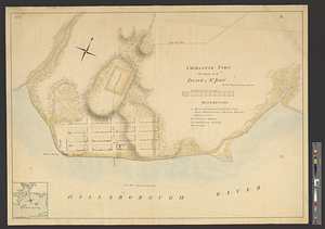
2029. Charlotte Bay

2030. Charlotte Bay

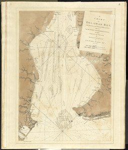
2032. Charlton

![Charlton Mills (Cotton Mill), Fall River, Mass. [insurance map]](https://bpldcassets.blob.core.windows.net/derivatives/images/commonwealth:4j03df53f/image_thumbnail_300.jpg)


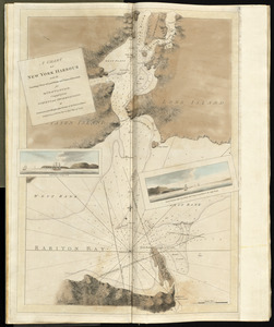
![[Chart of Boston Harbor and the surrounding areas]](https://bpldcassets.blob.core.windows.net/derivatives/images/commonwealth:6108vs71d/image_thumbnail_300.jpg)


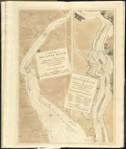


2065. Chart of Detroit River


![[Chart of Maldonado and the Island of Gorriti]](https://bpldcassets.blob.core.windows.net/derivatives/images/commonwealth:w9505s53p/image_thumbnail_300.jpg)


![[Chart of Nantucket Island and the eastern half of Martha's Vineyard]](https://bpldcassets.blob.core.windows.net/derivatives/images/commonwealth:7h149z54k/image_thumbnail_300.jpg)


2082. A chart of Nova Scotia

2083. A chart of Nova Scotia

2084. A chart of Nova Scotia


2086. Chart of Phœnix Group

2087. Chart of Plymouth Bay

2088. Chart of Plymouth Bay

2089. Chart of Plymouth Bay


2093. Chart of Sandusky Bay


