Toggle navigation
LMEC Home
Exhibitions
Georeferencing
Tools for Teachers
Collections
My Favorites
Sign Up / Log In
Search
Search the map portal
Map Collection
Map Collection
Map Sets
Search
Search
Search for
Search In
All Fields
Creator
Title
Subject
Place
Search All Digital Collections
Advanced Search
13385 Results
Filter your Search
Place
North and Central America
9,353
United States
7,078
Suffolk (county)
1,664
Boston
1,621
Europe
1,035
Canada
949
Massachusetts
794
New York
532
more
Place
»
Topic
Boston (Mass.)--Maps
741
City planning--Massachusetts--Boston--Maps
418
United States--History--Revolution, 1775-1783--Maps
329
United States--Maps
315
Urban renewal--Massachusetts--Boston--Maps
254
Real property--Massachusetts--Boston--Maps
252
Massachusetts--Maps
219
Insurance surveys
197
more
Topic
»
Date
Date range begin
–
Date range end
Current results range from
1482
to
2023
View distribution
Creator
United States. Hydrographic Office
595
Boston Redevelopment Authority
403
Des Barres, Joseph F. W. (Joseph Frederick Wallet), 1722-1824
247
Royal United Services Institute for Defence and Security Studies
160
Jefferys, Thomas, -1771
154
George, III, King of Great Britain, 1738-1820
152
George, IV, King of Great Britain, 1762-1830
151
O.H. Bailey & Co
148
more
Creator
»
Format
Maps/Atlases
13,205
Manuscripts
985
Prints
102
Books
49
Drawings/Illustrations
44
Photographs
15
Objects/Artifacts
13
Documents
7
more
Format
»
Georeferenced
Yes
979
No
12,406
Collection
Norman B. Leventhal Map Center Collection
8,891
American Revolutionary War-Era Maps
3,305
Boston and New England Maps
2,804
Urban Maps
2,397
Maritime Charts and Atlases
1,150
William L. Clements Library Collection
910
Library of Congress Collection
618
Boston Redevelopment Authority Collection
475
more
Collection
»
Available to use
No known restrictions
9,952
Creative Commons license
1,677
Search Constraints
Sort by relevance
relevance
title
date (asc)
date (desc)
Number of results to display per page
20 per page
10
per page
20
per page
50
per page
100
per page
View results as:
grid view
map view
Search Results
1961.
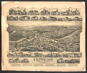
Centreville and Artic Centre, Rhode Island
1962.
Cereal map of Alberta : showing acreage under crop in each township in wheat, oats, barley and flax
1963.
Cestria comitatus Palatinus = the Countye Palatine of Chester
1964.
C.H. Guild & Co.'s newspaper map of New England
1965.
Champion-International Co., Lawrence, Mass. [insurance map]
1966.
Chancellorville
1967.
Change in median housing value, 2010 to 2018
1968.
Change in white population (non-Hispanic), 2010 to 2018
1969.
Changes in the bed of Boston Harbor from a comparison of the surveys of 1835-61
1970.
Channel on the north side of Vanua Levu from Aramula Passage to Muthuata Island, Feejee Islands
1971.
Channel on the north side of Vanua Levu from Aramula Passage to Muthuata Island, Feejee Islands
1972.
Channels around the Island of Orleans
1973.
Chapinville, Mass : 1887
1974.
Chapman's new sectional map of Wisconsin
1975.
Chapmans' Quarries : Pennsylvania, 1885
1976.
[Character conversion print errors on] Draft working map Neponset River estuary
1977.
Charles River : carries shown by red lines
1978.
Charles River
1979.
Charles River Basin contour map of lower basin from surveys and soundings made in Aug. and Sept. 1902 for Committee on Charles...
1980.
Charles River Basin contour map of upper basin from surveys and soundings
‹ Prev
Next ›
1
2
…
95
96
97
98
99
100
101
102
103
…
669
670


![Champion-International Co., Lawrence, Mass. [insurance map]](https://bpldcassets.blob.core.windows.net/derivatives/images/commonwealth:4j03dd758/image_thumbnail_300.jpg)


![[Character conversion print errors on] Draft working map Neponset River estuary](https://bpldcassets.blob.core.windows.net/derivatives/images/commonwealth:mc87v2589/image_thumbnail_300.jpg)


