Toggle navigation
LMEC Home
Exhibitions
Georeferencing
Tools for Teachers
Collections
My Favorites
Sign Up / Log In
Search
Search the map portal
Map Collection
Map Collection
Map Sets
Search
Search
Search for
Search In
All Fields
Creator
Title
Subject
Place
Search All Digital Collections
Advanced Search
4011 Results
My Search
Start Over
Date Range
before 1800
Remove constraint Date Range: before 1800
All Fields
americas
Remove constraint All Fields: americas
Filter your Search
Place
North and Central America
3,489
United States
2,236
Canada
629
Massachusetts
367
New York
355
North America
307
Suffolk (county)
201
Maine
190
more
Place
»
Topic
United States--History--Revolution, 1775-1783--Maps
321
North America--Maps--Early works to 1800
179
United States--History--French and Indian War, 1754-1763--Maps
161
Manuscript maps--Early works to 1800
121
New England--Maps--Early works to 1800
89
America--Maps--Early works to 1800
73
Western Hemisphere--Maps--Early works to 1800
59
Saint Lawrence River--Maps
57
more
Topic
»
Date
Date range begin
–
Date range end
Current results range from
1507
to
1899
View distribution
Creator
Des Barres, Joseph F. W. (Joseph Frederick Wallet), 1722-1824
188
Jefferys, Thomas, -1771
149
George, III, King of Great Britain, 1738-1820
146
George, IV, King of Great Britain, 1762-1830
145
Royal United Services Institute for Defence and Security Studies
137
Amherst, Jeffery Amherst, Baron, 1717-1797
110
Sayer, Robert, 1725-1794
99
Faden, William, 1749-1836
91
more
Creator
»
Format
Maps/Atlases
3,929
Manuscripts
738
Drawings/Illustrations
36
Prints
34
Books
8
Objects/Artifacts
3
Documents
1
Ephemera
1
Georeferenced
Yes
107
No
3,904
Collection
American Revolutionary War-Era Maps
3,057
Norman B. Leventhal Map Center Collection
1,049
William L. Clements Library Collection
887
Library of Congress Collection
552
Town plans, 1794
401
British Library Collection
346
Maritime Charts and Atlases
289
Richard H. Brown Revolutionary War Map Collection at Mount Vernon
274
more
Collection
»
Available to use
Creative Commons license
1,430
No known restrictions
1,408
Search Constraints
Sort by relevance
relevance
title
date (asc)
date (desc)
Number of results to display per page
20 per page
10
per page
20
per page
50
per page
100
per page
View results as:
grid view
map view
Search Results
3241.
[Chart of Boston Harbor and the surrounding areas]
3242.
Chart of Plymouth Bay
3243.
Chart of the entrance of Hudson's River, from Sandy Hook to New York, with the banks, depths of water, sailing-marks, & ca
3244.
A chart of the harbour of Boston
3245.
[Coast of Rhode Island and Long Island from Narragansett Bay to Peconic Bay]
3246.
A compleat plan of part of the province of Pennsylvania East and West Jersey shewing the transactions of the royal army under...
3247.
Copy of a sketch of the Monongahela, with the field of battle
3248.
A correct view of the late battle at Charlestown : June 17th, 1775
3249.
Costes et rivieres de Virginie, de Mariland, et de Nouvelle Angletere
3250.
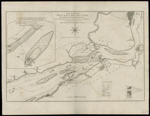
The course of Delaware River from Philadelphia to Chester, with the several forts and stackadoes raised by the rebels, and the...
3251.
The Course of the Wood Creek from the Mowhock River at the Onoida or Great Carrying Place to The Onoida Lake. Representing the...
3252.
Cross Roads to East Chester, and above : no 19
3253.
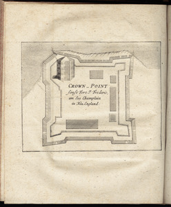
Crown Point : sonst Fort St. Frederic, am See Champlain in Neu England
3254.
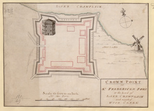
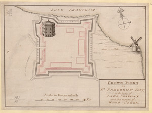
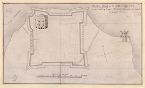
CROWN POINT or ST. FREDERICK'S FORT at the head of LAKE CHAMPLAIN and the Mouth of WOOD CREEK
3255.
CROWN POINT or ST. FREDERICK'S FORT at the head of LAKE CHAMPLAIN and the Mouth of WOOD CREEK
3256.
Crown Point or S.t Frederick's Fort at the Head of Lake Champlain and the Mouth of Wood Creek
3257.
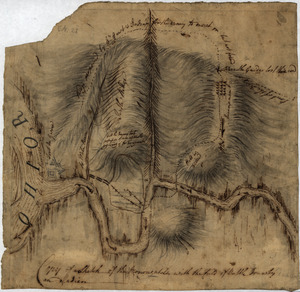
Crown Point to Fort Edward, New York
3258.
A Draught of the Fortress building at Crown Point 22.d Oct.t 1759
3259.
Fort Independence to Slaughter's Landing
3260.
French Draught of Lake Champlain & Lake George
‹ Prev
Next ›
1
2
…
159
160
161
162
163
164
165
166
167
…
200
201
![[Chart of Boston Harbor and the surrounding areas]](https://bpldcassets.blob.core.windows.net/derivatives/images/commonwealth:6108vs71d/image_thumbnail_300.jpg)


![[Coast of Rhode Island and Long Island from Narragansett Bay to Peconic Bay]](https://bpldcassets.blob.core.windows.net/derivatives/images/commonwealth:7h149z14m/image_thumbnail_300.jpg)