Toggle navigation
LMEC Home
Exhibitions
Georeferencing
Tools for Teachers
Collections
My Favorites
Sign Up / Log In
Search
Search the map portal
Map Collection
Map Collection
Map Sets
Search
Search
Search for
Search In
All Fields
Creator
Title
Subject
Place
Search All Digital Collections
Advanced Search
9 Results
My Search
Start Over
Guatemala
Remove constraint Guatemala
Filter your Search
Place
Guatemala
7
North and Central America
5
El Salvador
3
Mexico
3
Honduras
2
Bahía La Graciosa
1
Belize
1
Cortés
1
more
Place
»
Topic
Guatemala--Maps
7
El Salvador--Maps
3
Honduras--Maps
2
Mexico--Maps
2
Agriculture--Guatemala--Maps
1
Belize--Maps
1
Central America--Maps
1
Central America--Maps--Early works to 1800
1
more
Topic
»
Date
Date range begin
–
Date range end
Current results range from
1656
to
1917
View distribution
Creator
Hendges, M.
2
United States. Hydrographic Office
2
Bellin, Jacques Nicolas, 1703-1772
1
Christopher, John
1
Dougal, William H., 1822-1895
1
Franke, M. (Max)
1
Klakring, C. T. (Charles T.)
1
Ratzer, Bernard
1
more
Creator
»
Format
Maps/Atlases
9
Georeferenced
Yes
2
No
7
Collection
Norman B. Leventhal Map Center Collection
6
American Revolutionary War-Era Maps
3
William L. Clements Library Collection
3
Maritime Charts and Atlases
2
Available to use
No known restrictions
6
Search Constraints
Sort by relevance
relevance
title
date (asc)
date (desc)
Number of results to display per page
20 per page
10
per page
20
per page
50
per page
100
per page
View results as:
grid view
map view
Search Results
1.
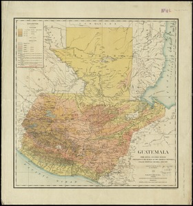
Guatemala, from official and other sources
2.
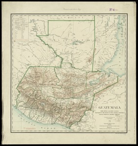
Guatemala, from official and other sources
3.
Guatemala and Salvador from a drawing by International Railways of Central America
4.
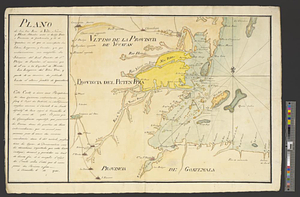
Map of the coast of Hunduras [sic] from the bay of Truxillo to the river Dulcee also the interieur part of that country, from...
5.
Plano de los Tres Rios de Valiz, Nuevo, y Hondo, situados entre et Golfo Dulce o provincia de Goatemala y de la Yucatan en et...
6.
North America, west coast of Central America, Ocos River to San Juan del Sur
7.
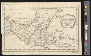
Carte des provinces de Tabasco, Chiapa, Verapaz, Guatimala, Honduras et Yucatan situées dans l'Amérique Meridionale : pour...
8.
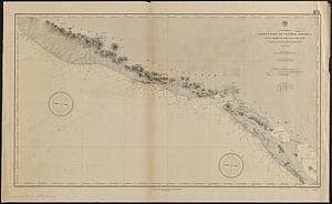
South western shore of the Caribbean Sea, anchorages on the coast of Honduras : from British surveys
9.
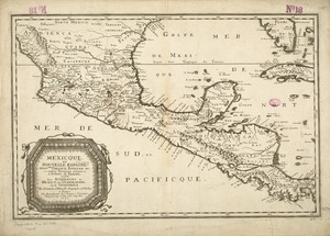
Mexicque, ou Nouvelle Espagne, Nouvlle. Gallice, Iucatan &c : et autres provinces jusques a l'Isthme de Panama, ou sont les...

![Map of the coast of Hunduras [sic] from the bay of Truxillo to the river Dulcee also the interieur part of that country, from the mouth of the river Roman to the city of Comayagua and their principle mines](https://bpldcassets.blob.core.windows.net/derivatives/metadata/commonwealth-oai:rj434386k/image_thumbnail_300.jpg)