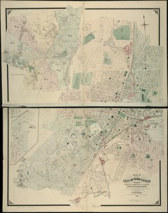
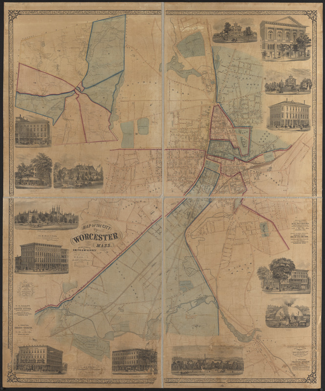
Map of the city of Worcester, Mass.
Item Information
- Title:
- Map of the city of Worcester, Mass.
- Cartographer:
- Ball, Phinehas, 1824-1894
- Publisher:
- Smith & McKinney (Firm)
- Name on Item:
-
from actual surveys under the direction of P. Ball, C.E.
- Date:
-
[ca. 1850–1860]
- Format:
-
Maps/Atlases
- Location:
-
Boston Public Library
Norman B. Leventhal Map Center - Collection (local):
-
Norman B. Leventhal Map Center Collection
- Subjects:
-
Real property--Massachusetts--Worcester--Maps
Worcester (Mass.)--Maps
- Places:
-
Worcester (county)Worcester
- Extent:
- 1 map : hand colored ; 166 x 136 cm
- Terms of Use:
-
No known copyright restrictions.
No known restrictions on use.
- Publisher:
-
[Worcester, Mass.?] :
Smith & McKinney
- Scale:
-
Scale 1:3,600
- Language:
-
English
- Notes:
-
Inset: [Town of Worcester].
Includes advertisements for local business and 14 illustrations.
- Identifier:
-
06_01_015166
- Call #:
-
G3764.W9 1850 .B35
- Barcode:
-
39999085932885