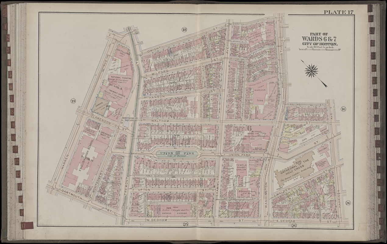
Atlas of the city of Boston, Boston proper and Back Bay : from actual surveys and official plans. plate 17
Item Information
- Title:
- Atlas of the city of Boston, Boston proper and Back Bay : from actual surveys and official plans. plate 17
- Title (alt.):
-
Part of wards 6 & 7, city of Boston
- Cartographer:
- Bromley, George Washington
- Cartographer:
- Bromley, Walter Scott
- Publisher:
- G.W. Bromley & Co.
- Date:
-
1922
- Format:
-
Maps/Atlases
- Location:
-
Boston Public Library
Norman B. Leventhal Map Center - Collection (local):
-
Norman B. Leventhal Map Center Collection
- Subjects:
-
Real property--Massachusetts--Boston--Maps
Landowners--Massachusetts--Boston--Maps
South End (Boston, Mass.)--Maps
- Places:
-
MassachusettsSuffolk (county)BostonSouth End
- Extent:
- 1 map : color ; on sheet 57 x 83 cm
- Terms of Use:
-
No known copyright restrictions.
No known restrictions on use.
- Publisher:
-
Philadelphia :
G.W. Bromley and Co.
- Scale:
-
Scale 1:960
- Language:
-
English
- Notes:
-
Digitization made possible with support from the Council on Library and Information Resources.
- Identifier:
-
G1234_B6_B7_1922x_0020
- Call #:
-
G1234.B6 B7 1922x
- Barcode:
-
39999059011526


![[Plan of boundary lines in Roxbury and the City of Boston]](https://bpldcassets.blob.core.windows.net/derivatives/images/commonwealth:1257bb127/image_thumbnail_300.jpg)
