City atlas of Boston, Massachusetts : complete in one volume : from official records, private plans and actual surveys : plate 8
Item Information
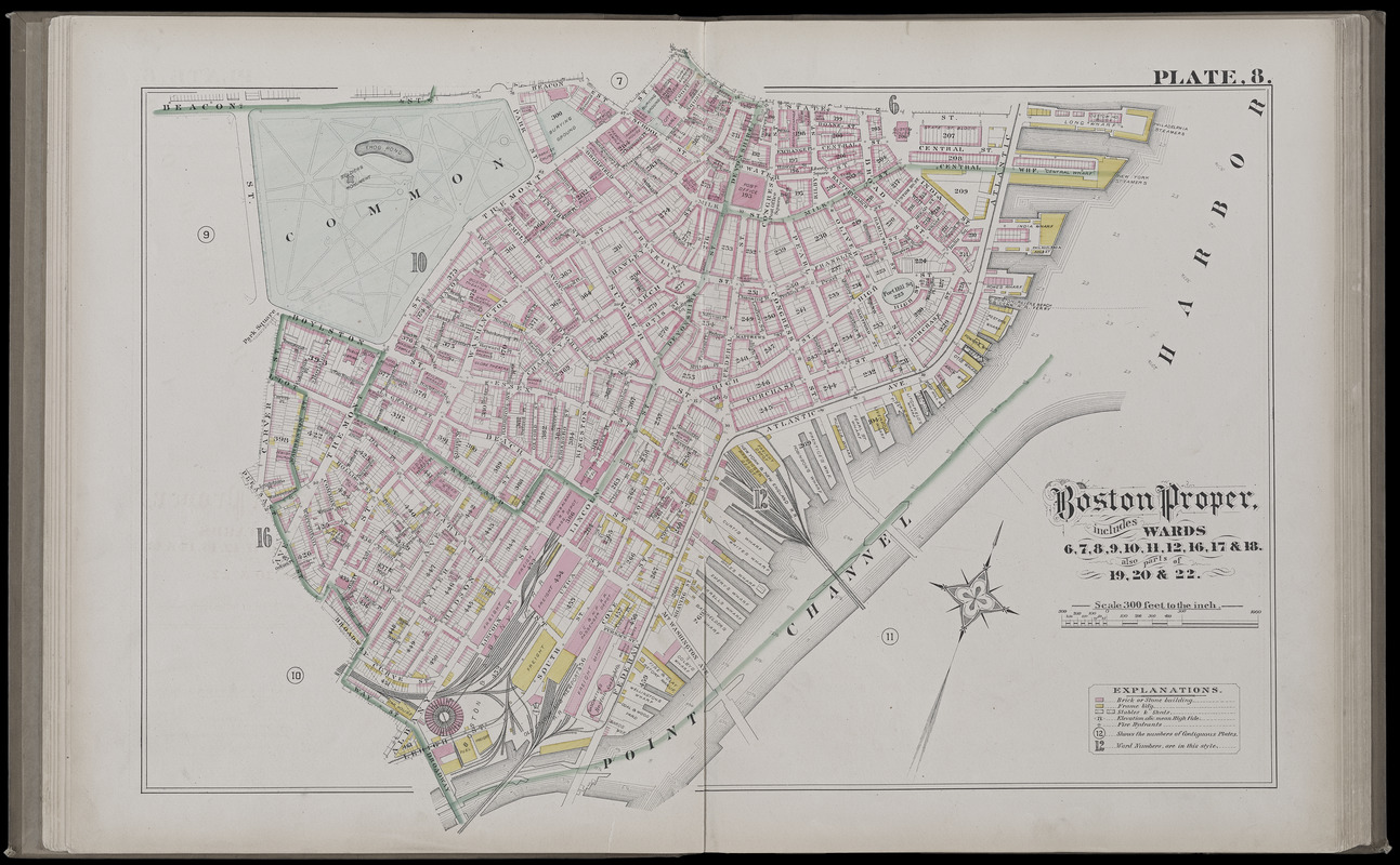
- Title:
- City atlas of Boston, Massachusetts : complete in one volume : from official records, private plans and actual surveys : plate 8
- Title (alt.):
-
Boston proper, includes wards 6, 7, 8, 9, 10, 11, 12, 16, 17 & 18, also parts of 19, 20 & 22
- Publisher:
- Hopkins, Griffith Morgan, Jr.
- Date:
-
1882
- Format:
-
Maps/Atlases
- Location:
-
Boston Public Library
Norman B. Leventhal Map Center - Collection (local):
-
Norman B. Leventhal Map Center Collection
- Subjects:
-
Real property--Massachusetts--Boston--Maps
Landowners--Massachusetts--Boston--Maps
Boston (Mass.)--Maps
- Places:
-
MassachusettsSuffolk (county)Boston
- Extent:
- 1 map : color ; sheet 48 x 72 cm
- Terms of Use:
-
No known copyright restrictions.
No known restrictions on use.
- Publisher:
-
Philadelphia :
G.M. Hopkins, c.e.
- Scale:
-
Scale 1:3,600
- Language:
-
English
- Notes:
-
Digitization made possible with support from the Council on Library and Information Resources.
- Identifier:
-
G1234_B6_H6_1882_0010
- Call #:
-
G1234.B6 H6 1882
- Barcode:
-
39999059010825


