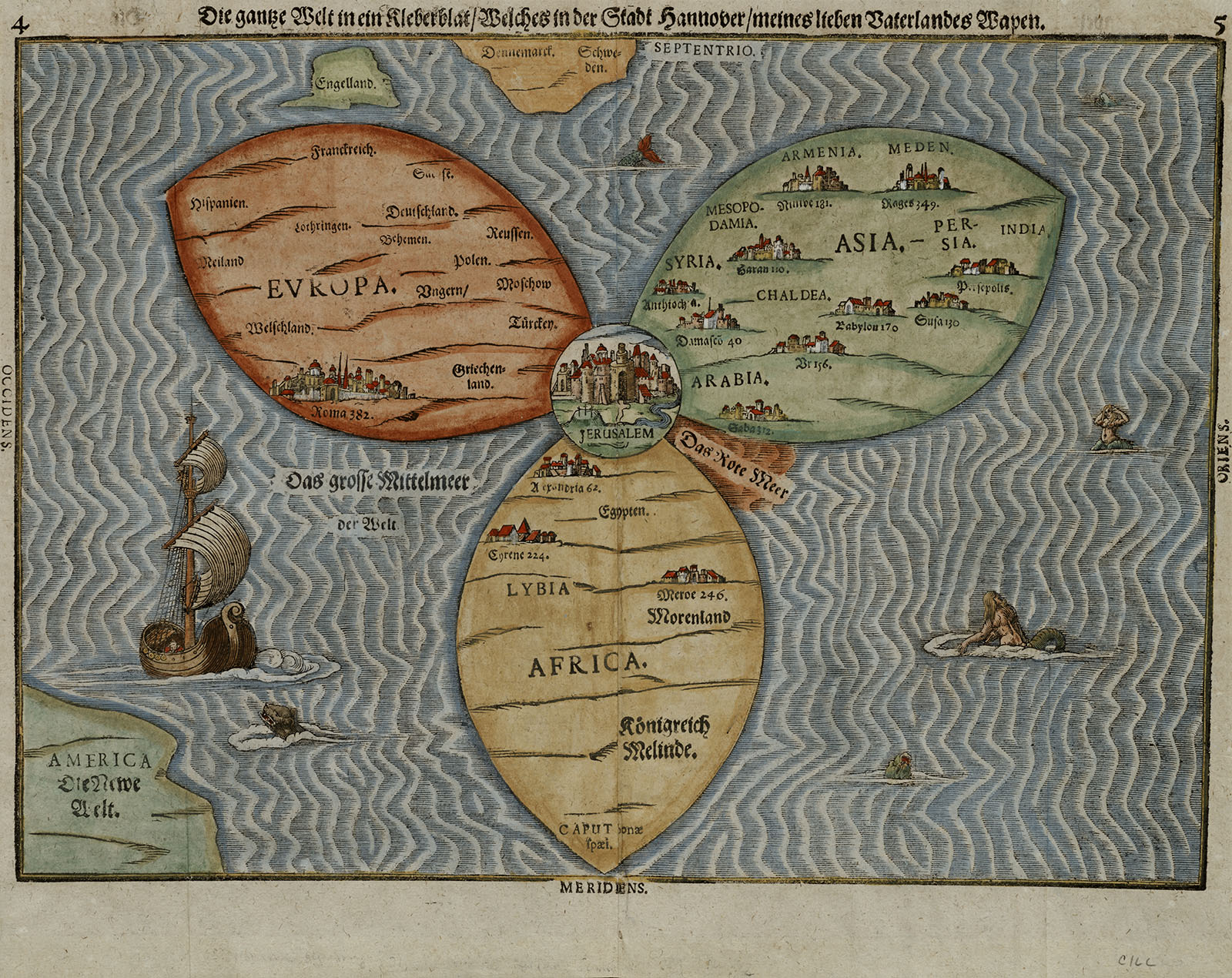
Bünting, Heinrich, Die gantze Welt in ein Kleberblat (1581)

Fries, Lorenz, ca. 1490-1531, Ptolemy, Grüninger, Johann, d. 1532?, Pirckheimer, Willibald, and Regiomontanus, Joannes. The World (1525)

Williams, Richard, A plan of Boston and its environs (1775)
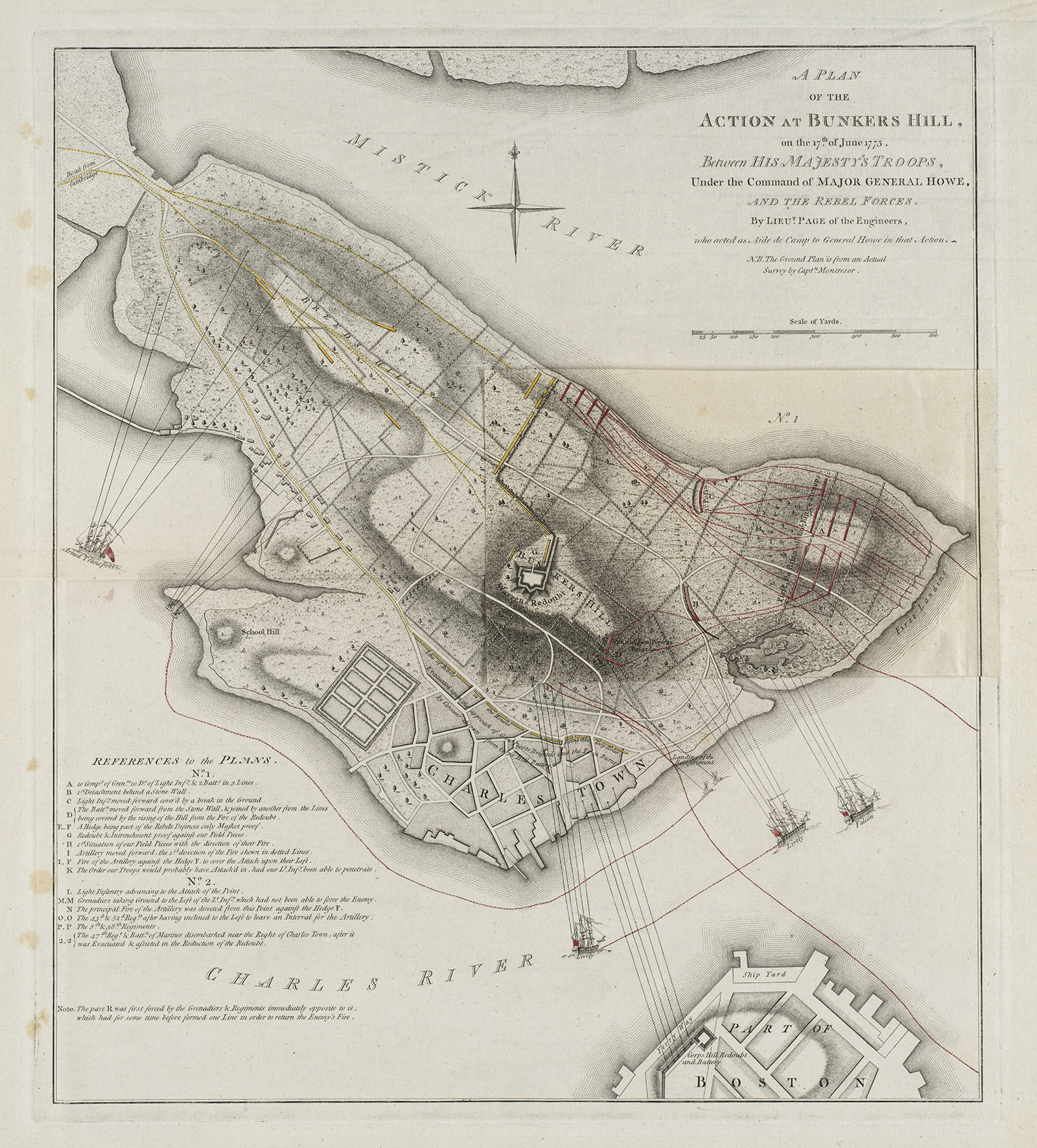
Page, Thomas Hyde, A plan of the Action at Bunkers Hill, on the 17th of June 1775... (1778)
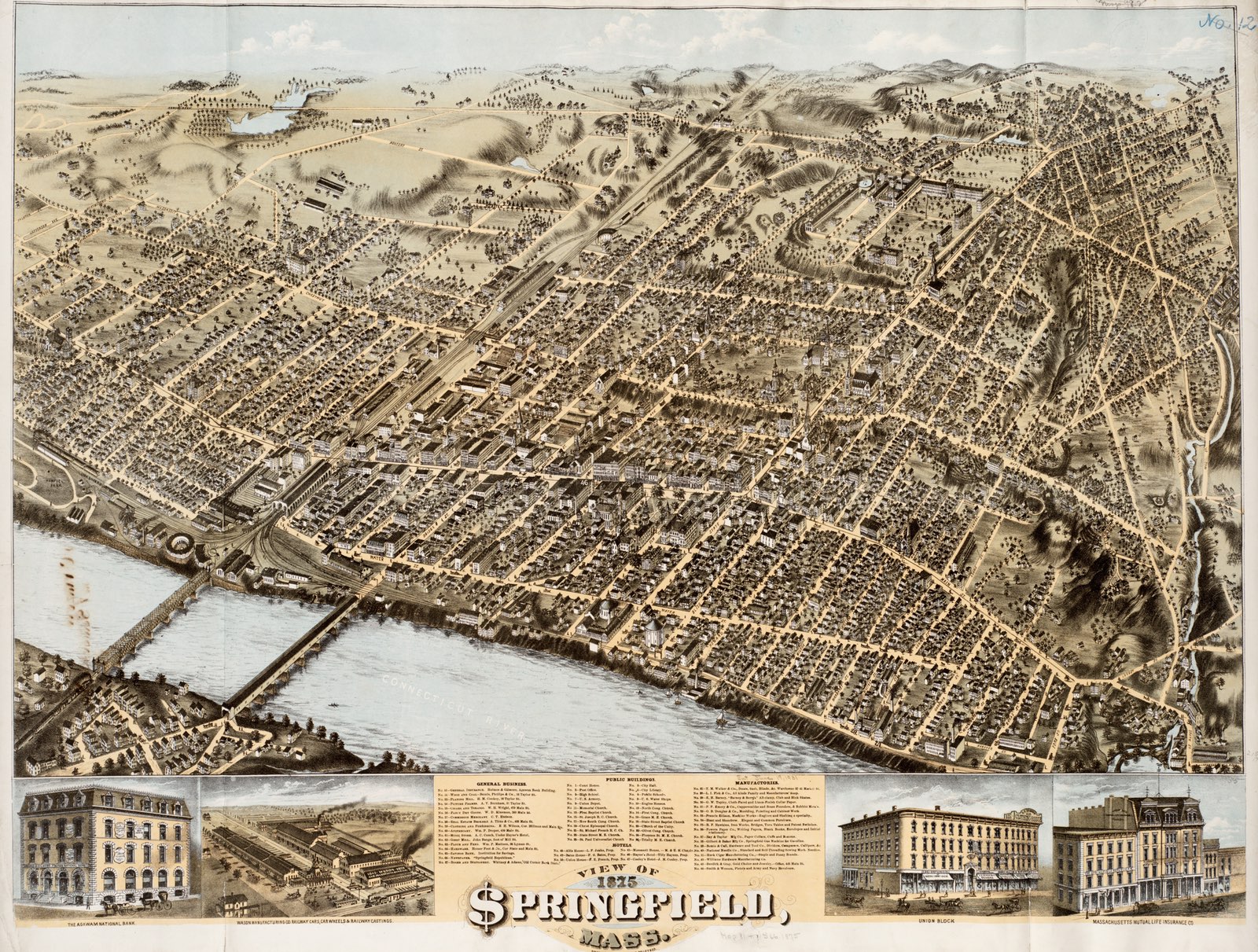
O.H. Bailey & Co. View of Springfield, Mass. (1875)
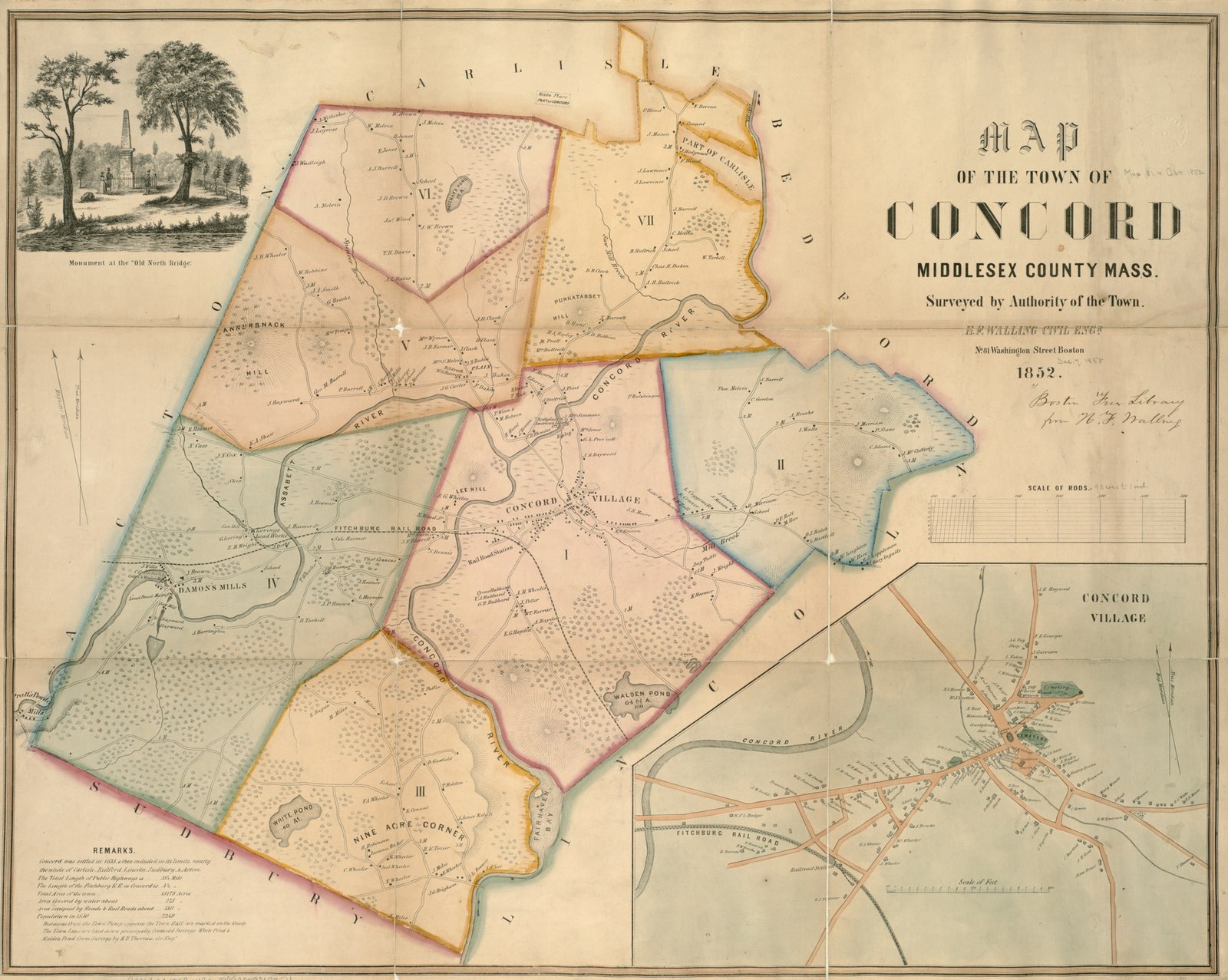
Walling, Henry Francis. Map of the town of Concord (1852)