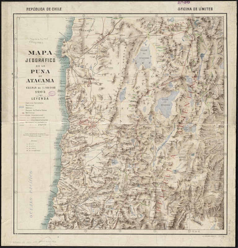
Mapa jeografico de la Puna de Atacama
Item Information
- Title:
- Mapa jeografico de la Puna de Atacama
- Creator:
- Chile. Oficina de Límites
- Date:
-
1905
- Format:
-
Maps/Atlases
- Location:
-
Boston Public Library
Norman B. Leventhal Map Center - Collection (local):
-
Norman B. Leventhal Map Center Collection
- Subjects:
-
Atacama Plateau (Argentina and Chile)--Maps
- Places:
-
Atacama, Puna de
- Extent:
- 1 map : color ; 62 x 59 cm
- Terms of Use:
-
No known copyright restrictions.
No known restrictions on use.
- Publisher:
-
Santo. ; Santo. :
Officina de Límites, ; Lit. Suiza.
- Scale:
-
Scale 1:1,000,000
- Language:
-
Spanish
- Notes:
-
Shows roads, railroads, mines, and mineral deposits in the provinces of Antofagasta, Atacama, and part of Argentina.
Relief shown by shading and spot heights.
Includes legend.
- Identifier:
-
06_01_011906
- Call #:
-
G5332.A8 1905 .O35
- Barcode:
-
39999065691964


