Toggle navigation
LMEC Home
Exhibitions
Georeferencing
Tools for Teachers
Collections
My Favorites
Sign Up / Log In
Search
Search the map portal
Map Collection
Map Collection
Map Sets
Search
Search
Search for
Search In
All Fields
Creator
Title
Subject
Place
Search All Digital Collections
Advanced Search
90 Results
My Search
Start Over
2018
Remove constraint 2018
Filter your Search
Place
North and Central America
74
United States
70
Massachusetts
55
Boston
43
Suffolk (county)
43
Europe
8
World
6
Middlesex (county)
5
more
Place
»
Topic
Boston (Mass.)--Maps
26
Parks--Massachusetts--Boston--Maps
8
Boston (Mass.)--Aerial views
4
World maps--Early works to 1800
4
Charles River (Mass.)--Maps
3
Internet access--Massachusetts--Boston--Maps
3
Jamaica Plain (Boston, Mass.)--Maps
3
Cambridge (Mass.)--Maps
2
more
Topic
»
Date
Date range begin
–
Date range end
Current results range from
1488
to
2020
View distribution
Creator
Boston Public Library. Norman B. Leventhal Map and Education Center
10
Huffman, Daniel P.
9
Boston (Mass.). Park Commissioners
5
Massachusetts. Metropolitan Park Commission
3
Olmsted, Frederick Law, 1822-1903
3
Geo. H. Walker & Co
2
Geo. H. Walker & Co.
2
O.H. Bailey & Co
2
more
Creator
»
Format
Maps/Atlases
90
Manuscripts
2
Georeferenced
Yes
19
No
71
Collection
Norman B. Leventhal Map & Education Center Collection
89
Boston and New England Maps
48
Urban Maps
30
American Revolutionary War-Era Maps
3
Maritime Charts and Atlases
3
Mapping Boston Collection
2
Town plans, 1830
1
Available to use
No known restrictions
78
Creative Commons license
12
Search Constraints
Sort by relevance
relevance
title
date (asc)
date (desc)
Number of results to display per page
20 per page
10
per page
20
per page
50
per page
100
per page
View results as:
grid view
map view
Search Results
1.
Change in median housing value, 2010 to 2018
2.
Change in white population (non-Hispanic), 2010 to 2018
3.
Most popular mode of commuting : 2014-2018 American Community Survey
4.
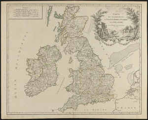
Carte des grandes routes d'Angleterre, d'Ecosse, et d'Irlande
5.
Mean travel time to work
6.
Proportion of units where rent costs over 30% of resident's income
7.
Percent foreign-born
8.
Total foreign-born
9.
Plenty of free wi-fi is keeping Boston connected!
10.
Disconnected : Boston's free wi-fi leaves many in the dark
11.
Boston kids count
12.
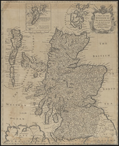
A map of the kingdom of Scotland from the latest and best observations, for Mr. Tindal's Continuation of Mr. Rapin's History
13.
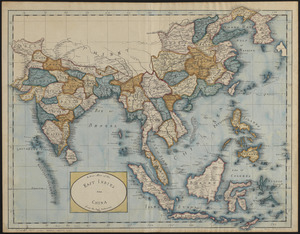
A new map of the East Indies and China from the best authorities
14.
Angling in troubled waters = der fischfang im truben = la peche en eau trouble = la pesca nelle acque turbes : a serio-comic...
15.
Ausicht von Boston : nach der natur aufgenommen
16.
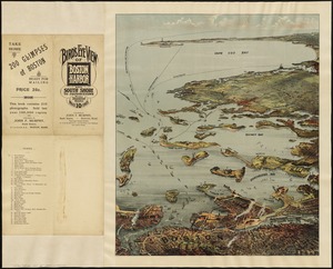
Bird's eye view of Boston Harbor and south shore to Provincetown showing steamboat routes
17.
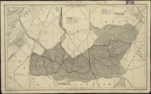
Blue Hills Reservation
18.
Brighton park : Brighton district
19.
Carte du Mexique et des pays limitrophes situés au nord et à l'est : dressée d'après la grande carte de la Nouvelle Espagne...
20.
Charles River : carries shown by red lines
‹ Prev
Next ›
1
2
3
4
5