Toggle navigation
LMEC Home
Exhibitions
Georeferencing
Tools for Teachers
Collections
My Favorites
Sign Up / Log In
Search
Search the map portal
Map Collection
Map Collection
Map Sets
Search
Search
Search for
Search In
All Fields
Creator
Title
Subject
Place
Search All Digital Collections
Advanced Search
182 Results
My Search
Start Over
1885
Remove constraint 1885
Filter your Search
Place
North and Central America
148
United States
106
Massachusetts
39
Costa Rica
17
Boston
16
Europe
16
Suffolk (county)
16
Virginia
9
more
Place
»
Topic
Boston (Mass.)--Maps
7
Grant, Ulysses S. (Ulysses Simpson), 1822-1885
5
Fire risk assessment--Massachusetts--Boston--Maps
4
Richmond (Va.)--History--Civil War, 1861-1865--Maps
4
Boston (Mass.)--Aerial views
3
Europe--Maps
3
North Carolina--Maps
3
Bahamas--Maps
2
more
Topic
»
Date
Date range begin
–
Date range end
Current results range from
1694
to
1925
View distribution
Creator
United States. Hydrographic Office
48
O.H. Bailey & Co
21
Franke, M. (Max)
11
Geological Survey (U.S.)
9
Ruebsam, E. A. (E. August)
9
Bachmann, John, fl. 1849-1885
8
Erni, A. (Adolphe)
7
Lesher, C. E. (Carl Eugene), 1885-
7
more
Creator
»
Format
Maps/Atlases
179
Manuscripts
3
Prints
2
Books
1
Georeferenced
Yes
10
No
172
Collection
Norman B. Leventhal Map & Education Center Collection
177
Urban Maps
60
Maritime Charts and Atlases
55
Boston and New England Maps
47
Lucius Beebe Memorial Library Historic Maps
1
Massachusetts Real Estate Atlases
1
Ralph Finos Map Collection at Phillips Academy
1
Sidney R. Knafel Map Collection at Phillips Academy
1
more
Collection
»
Available to use
No known restrictions
180
Search Constraints
Sort by title
relevance
title
date (asc)
date (desc)
Number of results to display per page
50 per page
10
per page
20
per page
50
per page
100
per page
View results as:
grid view
map view
Search Results
1.
Alma, Michigan : 1885
2.
Ancient Spain & Portugal : Hispania or Iberia
3.
Asia, east coast, China Sea in four sheets : compiled from the latest surveys 1885
4.
Atlas of Brookfield, West Brookfield and No. Brookfield towns, Massachusetts : compiled from recent and actual surveys and records
5.
Atlas of Brookfield, West Brookfield and North Brookfield towns, Massachusetts
6.
Atlas of Malden City, Massachusetts
7.
Atlas of the city of Boston : Charlestown and Brighton, volume six : from actual surveys and official records
8.
Ballardvale, Mass : 1885
9.
Bangor : Pennsylvania
10.
Bath, Penn
11.
Battle of Cerro Gordo, April 17th & 18th 1847
12.
Battles of Mexico : survey of the line of operations of the U.S. Army, under command of Major General Winfield Scott, on the...
13.
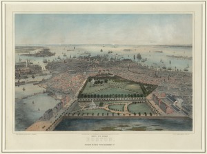
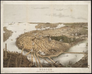
Bird's eye view of Boston
14.
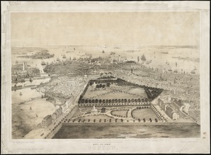
Bird's eye view of Boston
15.
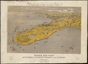
Birds eye view of Florida and part of Georgia and Alabama
16.
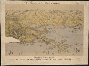
Birds eye view of Louisiana, Mississippi, Alabama and part of Florida
17.
Birds eye view of North and South Carolina and part of Georgia
18.
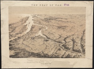
Bird's eye view of part of Maryland, Distr of Columbia and part of Virginia
19.
Birds eye view of the Soudan
20.
Birds eye view of Virginia, Maryland, Delaware and the District of Columbia
21.
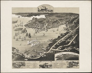
Boothbay Harbor, Lincoln County, Maine : 1885
22.
Boston : bird's-eye view from the north
23.
Camp at Framingham : First Brigade Mass. Vol. Militia June 9th to 13th 1885
24.
Camp at Framingham : Second Brigade Mass. Vol. Militia, July 21st to 25th 1885
25.
Camp Wetmore, R.I. brigade militia, July 7th to 11th, 1885, Oakland Beach
26.
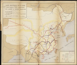
Carte industrielle de la Chine : contenant les lignes ferrées & lignes télégraphiques construites, concédées & probables,...
27.
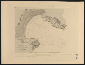
Central America, west coast of Costa Rica, Ballena Bay (Gulf of Nicoya) : from a survey in 1885 by the officers of the U.S.S....
28.
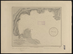
Central America, west coast of Costa Rica, El Rincon Harbor (Gulf of Dulce) : from a survey in 1885 by the officers of the...
29.
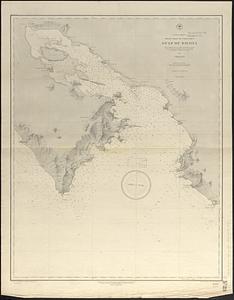
Central America, west coast of Costa Rica, Gulf of Dulce
30.
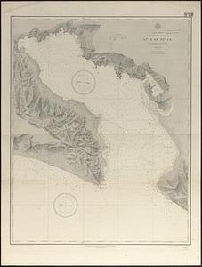
Central America, west coast of Costa Rica, Gulf of Nicoya
31.
Central America, west coast of Costa Rica, Juanilla Bay : from a survey in 1885 by the officers of the U.S.S. Ranger, Commander...
32.
Central America, west coast of Costa Rica, Murcielago Bay : from a survey in 1885 by the officers of the U.S.S. Ranger,...
33.
Central America, west coast of Costa Rica, Piedra Blanca Bay : from a survey in 1885 by the officers of the U.S.S. Ranger,...
34.
Central America, west coast of Costa Rica, Port Culebra
35.
Central America, west coast of Costa Rica, Port Elena (Elena Bay) : from a survey in 1885 by the officers of the U.S.S. Ranger,...
36.
Central America, west coast of Costa Rica, Potrero and Braxilito Bays : from a survey in 1885 by the officers of the U.S.S....
37.
Central America, west coast of Costa Rica, Potrero Grande Bay : from a survey in 1885 by the officers of the U.S.S. Ranger,...
38.
Central America, west coast of Costa Rica, Punta Arenas anchorage (Gulf of Nicoya) : from a survey in 1885 by the officers of...
39.
Central America, west coast of Costa Rica, Uvita Bay : from a survey in 1885 by the officers of the U.S.S. Ranger, Commander...
40.
Central America, west coast of Nicaragua, Salinas Bay : from a survey in 1885 by the officers of the U.S.S. Ranger, Commander...
41.
Chapmans' Quarries : Pennsylvania, 1885
42.
Chester, Mass : 1885
43.
Cities of East Saginaw and Saginaw, Michigan, 1885
44.
City of Hartford, Conn.
45.
The city of Vineland, New Jersey : 1885
46.
Clayton, Delaware : 1885
47.
The country around Herat : projected from Major Holditch's map
48.
Dominion of Canada, Gulf of Saint Lawrence, Shediac Bay and Harbor (New Brunswick) : from a British survey in 1885
49.
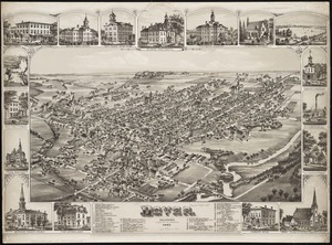
Dover, Delaware : 1885
50.
A draught of Boston Harbor by Capt. Cyprian Southake
‹ Prev
Next ›
1
2
3
4