Toggle navigation
LMEC Home
Exhibitions
Georeferencing
Tools for Teachers
Collections
My Favorites
Sign Up / Log In
Search
Search the map portal
Map Collection
Map Collection
Map Sets
Search
Search
Search for
Search In
All Fields
Creator
Title
Subject
Place
Search All Digital Collections
Advanced Search
160 Results
My Search
Start Over
1860
Remove constraint 1860
Filter your Search
Place
North and Central America
97
United States
77
Europe
21
Canada
14
Boston
12
Suffolk (county)
12
New York
7
Massachusetts
6
more
Place
»
Topic
Boston (Mass.)--Maps
11
New England--Maps
6
United States--Maps
6
Canada--Boundaries--United States--Maps
5
United States--Boundaries--Canada--Maps
5
Southern States--Maps
4
Switzerland--Maps
4
United States--History--Civil War, 1861-1865--Maps
4
more
Topic
»
Date
Date range begin
–
Date range end
Current results range from
1702
to
1932
View distribution
Creator
Bartholomew, J. G. (John George), 1860-1920
10
Moore, John Bassett, 1860-1947
8
United States. Congress (53rd, 2nd session : 1893-1894). House
8
E.P. Dutton (Firm)
6
United States. Hydrographic Office
6
Boston (Mass.). Engineering Dept
4
J.M. Dent & Sons
4
United States Coast Survey
4
more
Creator
»
Format
Maps/Atlases
157
Manuscripts
6
Prints
2
Drawings/Illustrations
1
Posters
1
Georeferenced
Yes
24
No
136
Collection
Norman B. Leventhal Map Center Collection
155
Boston and New England Maps
31
Urban Maps
25
Maritime Charts and Atlases
15
American Revolutionary War-Era Maps
2
Mapping Boston Collection
2
American Antiquarian Society Collection
1
Lucius Beebe Memorial Library Historic Maps
1
more
Collection
»
Available to use
No known restrictions
152
Creative Commons license
4
Search Constraints
Sort by relevance
relevance
title
date (asc)
date (desc)
Number of results to display per page
50 per page
10
per page
20
per page
50
per page
100
per page
View results as:
grid view
map view
Search Results
1.
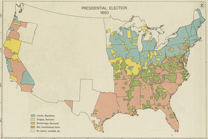
Presidential election 1860
2.
Density of population, 1860
3.
Property qualifications for suffrage, 1860
4.
The estate of the Brookline Land Company : June 20, 1860
5.
Plan of Washington Street showing proposed lines of widening from Warren to Kneeland : Oct. 1st 1860
6.
Plan of Washington Street showing proposed lines of widening from Asylum to Warren : Oct. 2nd 1860
7.
Plan of Washington Street showing proposed lines of widening from Dover to Asylum : Oct. 3rd 1860
8.
West Indies, ports and anchorages at the eastern end of Cuba : from Spanish government surveys in 1860-74
9.
Map of explorations and surveys in New Mexico and Utah made under the direction of the Secretary of War by Capt. J. N. Macomb...
10.
Arabia, n.e. coast, Gulf of 'Omman, Maskat & Matreh : from British surveys in 1828, 1849 & 1860 : republication of the British...
11.
Commercial map of New England
12.
North America, east coast, harbors on the south coast of Newfoundland : republication of Brit. Admty. charts nos. 2829, 301,...
13.
Harbors on the west coast of Newfoundland : republication of Brit. Admty. charts no. 2918 & 7121, corrected to 1874
14.
Solar and lunar eclipse diagrams
15.
Lloyd's new political chart, 1861 : with a map of the United States, showing the free states, border slave states, cotton...
16.
A map of Amherst with a view of the college and Mount Pleasant Institution
17.
South Weymouth, Norfolk County, Mass. 1885 : from the fair grounds
18.
New map of Boston, comprising the whole city, with the new boundaries of the wards
19.
Chicago
20.
Map of Boston Common and Public Garden
21.
A map of the world
22.
University and city of Oxford
23.
How the public domain has been squandered, map showing the 139,403,026 acres of the people's land - equal to 871,268 farms of...
24.
The facts of prohibition in the United States
25.
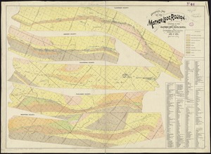
Geological map of the Mother Lode region
26.
The battle-field of the nations : a panoramic view of the seat of war in the Danubian provinces, Turkey, Asia Minor, Southern...
27.
Maps of the Far East, illustrating Russo-Japanese War
28.
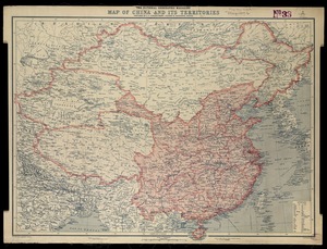
National Geographic Magazine map of China and its territories
29.
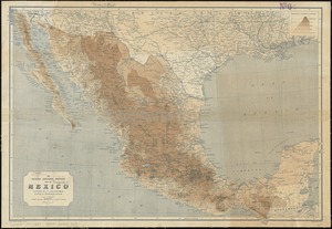
The National Geographic Magazine map of Mexico
30.
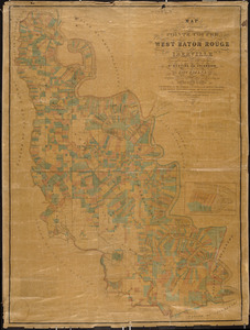
Map of the parishes of Pointe Coupee, West Baton Rouge and Iberville : including parts of the parishes of St. Martins and...
31.
Plan of the town of Quebec, the capital of Canada in North America, with the Bason and a part of the adjacent country shewing...
32.
Africa January rainfall -- Africa July rainfall
33.
Africa vegetation
34.
Egyptian Empire B.C. 1450
35.
Kingdom of the Caliphs
36.
Political map of the Balkan States
37.
Map of the city & county of New York ; Upper part of the city and county of New York on a reduced scale
38.
Map of Egypt
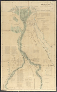
39.
New-England
40.
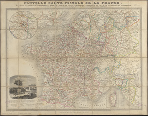
Nouvelle carte postale de la France, à l'usage des voyageurs, comprenant le nord de l'Italie, la Suisse, la Hollande, la...
41.
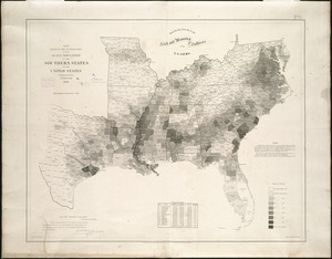
Map showing the distribution of the slave population of the southern states of the United States
42.
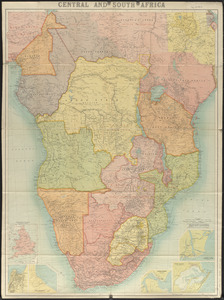
Central and South Africa
43.
Map of North America showing the two lines of frontier as settled in October and November 1782 respectively by Mr. Oswald, the...
44.
The s.e. coast of the United States and its relation to the British West India colonies
45.
Complete map of the rail roads and water courses in the United States & Canada
46.
New Brunswick, Nova Scotia, Newfoundland, and Prince Edward Id.
47.
A new map of the province of Quebec, : according to the Royal proclamation, of the 7th of October 1763
48.
Sketch map of the British coast showing the relative positions of Liverpool, Beaumaris, Moelfra Bay & Point Lynas (taken from...
49.
Section of a track chart of the world, covering the Behring Sea
50.
Washington Sound and approaches, Washington Territory, 1866
‹ Prev
Next ›
1
2
3
4