Toggle navigation
LMEC Home
Exhibitions
Georeferencing
Tools for Teachers
Collections
My Favorites
Sign Up / Log In
Search
Search the map portal
Map Collection
Map Collection
Map Sets
Search
Search
Search for
Search In
All Fields
Creator
Title
Subject
Place
Search All Digital Collections
Advanced Search
187 Results
My Search
Start Over
1900
Remove constraint 1900
Filter your Search
Place
North and Central America
146
United States
116
Massachusetts
48
Boston
26
Suffolk (county)
26
Asia
18
Cuba
13
Europe
13
more
Place
»
Topic
Boston (Mass.)--Maps
13
United States--Maps
10
Franco-Prussian War, 1870-1871--Aerial views
7
France--History--1789-1900--Aerial views
6
Germany--History--1789-1900--Aerial views
6
Havana (Cuba)--Maps
6
Luzon (Philippines)--Maps
6
New England--Maps--Early works to 1800--Facsimiles
5
more
Topic
»
Date
Date range begin
–
Date range end
Current results range from
1764
to
2005
View distribution
Creator
United States. War Department
16
United States. Congress (56th, 2nd session : 1900-1901). Senate
10
United States. Congress. Senate. Committee on Foreign Relations
10
United States. Army. Department of Cuba
9
United States. Congress (56th, 2nd session : 1900-1901). House
8
United States. Government Printing Office
8
United States. Army. Corps of Engineers
7
Geo. H. Walker & Co.
6
more
Creator
»
Format
Maps/Atlases
182
Manuscripts
7
Photographs
3
Prints
2
Books
1
Drawings/Illustrations
1
Posters
1
Georeferenced
Yes
21
No
166
Collection
Norman B. Leventhal Map & Education Center Collection
176
Boston and New England Maps
17
Urban Maps
16
Robert E. Diefenbach Map Collection at Phillips Academy
5
American Revolutionary War-Era Maps
3
Massachusetts Real Estate Atlases
3
Maritime Charts and Atlases
2
Colonial and Revolutionary Boston
1
more
Collection
»
Available to use
No known restrictions
176
Creative Commons license
2
Search Constraints
Sort by relevance
relevance
title
date (asc)
date (desc)
Number of results to display per page
20 per page
10
per page
20
per page
50
per page
100
per page
View results as:
grid view
map view
Search Results
161.
Map of the Back Bay Fens showing the public ways bordering and crossing them and the neighboring newly laid out parts of...
162.
Plan of corner of Centry & Beacon St's -- 1741
163.
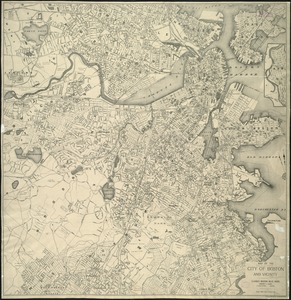
Atlas of Middlesex County : volume 2, cities of Melrose & Woburn, towns of Bedford, Burlington, Concord, North Reading,...
164.
Atlas of Middlesex County, Massachusetts, volume 3 : towns of Ashland, Framingham, Holliston, Hopkinton, Natick, Sherborn,...
165.
[Chiapas]
166.
Family of Mrs. Donovan, Roxbury
167.
Map of Arnold Arboretum showing location of the trees and shrubs
168.
A map of New England and New York
169.
Map of the city of Boston and vicinity
170.
A mapp of New England
171.
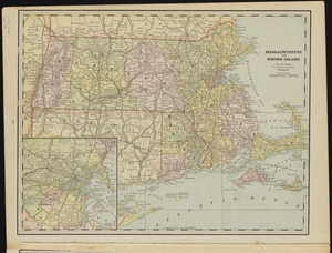
Massachusetts and Rhode Island
172.
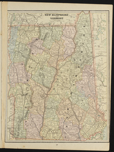
New Hampshire and Vermont
173.
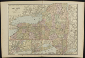
New York
174.
Nord-Amerika
175.
North America
176.
Plan and sections, Caribou gold district, Halifax Co., N.S
177.
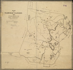
Plan of Framingham Plantation 1699
178.
Plan of the burnt district : showing proposed improvements in streets. Nov. 12th 1872
179.
Plano de Asuncion
180.
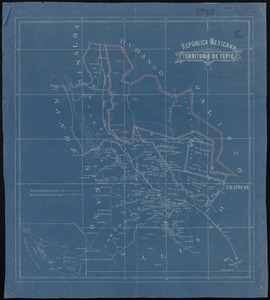
República Mexicana, Territorio de Tepic
‹ Prev
Next ›
1
2
…
5
6
7
8
9
10


![[Chiapas]](https://bpldcassets.blob.core.windows.net/derivatives/images/commonwealth:4m90fj278/image_thumbnail_300.jpg)