Toggle navigation
LMEC Home
Exhibitions
Georeferencing
Tools for Teachers
Collections
My Favorites
Sign Up / Log In
Search
Search the map portal
Map Collection
Map Collection
Map Sets
Search
Search
Search for
Search In
All Fields
Creator
Title
Subject
Place
Search All Digital Collections
Advanced Search
1475 Results
My Search
Start Over
Subject
"Boston (Mass.)--Maps"
Remove constraint Subject: "Boston (Mass.)--Maps"
Filter your Search
Place
North and Central America
1,474
United States
1,472
Suffolk (county)
1,391
Boston
1,387
Massachusetts
1,090
Boston Harbor
125
Roxbury
89
Charlestown
71
more
Place
»
Topic
Boston (Mass.)--Maps
741
City planning--Massachusetts--Boston--Maps
407
Urban renewal--Massachusetts--Boston--Maps
245
Real property--Massachusetts--Boston--Maps
243
Landowners--Massachusetts--Boston--Maps
160
Buildings--Massachusetts--Boston--Maps
121
Land use--Massachusetts--Boston--Maps
98
Roxbury (Boston, Mass.)--Maps
88
more
Topic
»
Date
Date range begin
–
Date range end
Current results range from
1689
to
2023
View distribution
Creator
Boston Redevelopment Authority
386
Bromley, George Washington
69
Bromley, Walter Scott
68
G.W. Bromley & Co.
46
Geo. H. Walker & Co
28
Boston (Mass.). Engineering Dept
21
Boynton, George W., d. 1884
21
Sampson, Davenport & Co
21
more
Creator
»
Format
Maps/Atlases
1,472
Manuscripts
50
Drawings/Illustrations
5
Posters
1
Prints
1
Georeferenced
Yes
140
No
1,335
Collection
Boston and New England Maps
1,200
Urban Maps
1,011
Norman B. Leventhal Map & Education Center Collection
994
Boston Redevelopment Authority Collection
449
American Revolutionary War-Era Maps
129
Mapping Boston Collection
52
Massachusetts Real Estate Atlases
38
Maritime Charts and Atlases
28
more
Collection
»
Available to use
No known restrictions
1,292
Creative Commons license
116
Search Constraints
Sort by relevance
relevance
title
date (asc)
date (desc)
Number of results to display per page
20 per page
10
per page
20
per page
50
per page
100
per page
View results as:
grid view
map view
Search Results
581.
Profile of Huntington Avenue/St. James Avenue from Harcourt Street to Berkeley Street
582.
Ruggles Center : existing condition plan
583.
Ruggles Center : site area diagram
584.
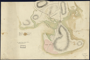
Sketch of the ground about Charles Town
585.
South Bay and Savin Hill parks : Dorchester district
586.
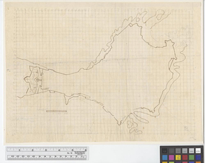
A draught of Boston Harbor by Capt. Cyprian Southake
587.
Hafen von Boston
588.
Map of Boston Common : with surrounding streets & adjacent parts of Beacon Hill
589.
A new and accurate plan of the town of Boston in New England : A new plan of Boston Harbor from an actual survey
590.
Plan de la ville de Boston et ses environs
591.
Plan of the harbour of Boston, from surveys made under the direction of commissioners appointed by a resolve of the...
592.
Plan of a portion of the properties of the Long Wharf or Boston Pier & Central Wharf & Wet Dock Corporatins, showing sixteen...
593.
[Plan of lots between Mount Vernon and Pinckney Streets in Boston]
594.
Plan of the estate of the late Warren White : to be sold at public auction on Wednesday March 27th 1872 at 12 o'clock m. on the...
595.
Atlas of the county of Suffolk, Massachusetts, vol. 3 : including South Boston and Dorchester
596.
Plan of lands on the Back Bay belonging to the Boston Water Power Co., the Commonwealth and other parthies [i.e. parties],...
597.
L'incendie de Boston : plan montrant les ravages causés par l'incendie (extrait de l'American Register)
598.
Plan of South Bay showing the Harbor Commissioners lines
599.
Appleton St. Woonerf
600.
Boston
‹ Prev
Next ›
1
2
…
26
27
28
29
30
31
32
33
34
…
73
74


![[Plan of lots between Mount Vernon and Pinckney Streets in Boston]](https://bpldcassets.blob.core.windows.net/derivatives/images/commonwealth:9s161h42m/image_thumbnail_300.jpg)


![Plan of lands on the Back Bay belonging to the Boston Water Power Co., the Commonwealth and other parthies [i.e. parties], showing the system of streets, grades and sewers as laid out and recommended by the Back Bay Commissioners](https://bpldcassets.blob.core.windows.net/derivatives/images/commonwealth:1257bb305/image_thumbnail_300.jpg)