Toggle navigation
LMEC Home
Exhibitions
Georeferencing
Tools for Teachers
Collections
My Favorites
Sign Up / Log In
Search
Search the map portal
Map Collection
Map Collection
Map Sets
Search
Search
Search for
Search In
All Fields
Creator
Title
Subject
Place
Search All Digital Collections
Advanced Search
76 Results
My Search
Start Over
1803
Remove constraint 1803
Filter your Search
Place
North and Central America
56
United States
54
Europe
9
New York
7
North America
6
Massachusetts
5
Ohio
4
Boston
3
more
Place
»
Topic
United States--Maps
7
Georgia--Maps
3
Manhattan (New York, N.Y.)--Maps
3
New York (N.Y.)--Administrative and political divisions--Maps
3
North America--Maps--Early works to 1800
3
Boston (Mass.)--Aerial views
2
Kentucky--Maps
2
Maryland--Maps
2
more
Topic
»
Date
Date range begin
–
Date range end
Current results range from
1753
to
1932
View distribution
Creator
Barker, W. (William), active 1795-1803
31
Carey, Mathew, 1760-1839
29
Burr, David H., 1803-1875
7
Lewis, Samuel, 1753 or 4-1822
5
Arrowsmith, Aaron, 1750-1823
3
Dorman, Moses, 1803-1877
3
Brion de la Tour, Louis, fl. 1756-1803
2
Carleton, Osgood, 1742-1816
2
more
Creator
»
Format
Maps/Atlases
76
Georeferenced
Yes
8
No
68
Collection
Norman B. Leventhal Map & Education Center Collection
57
American Revolutionary War-Era Maps
17
Boston and New England Maps
10
Urban Maps
8
New York Public Library Collection
5
American Antiquarian Society Collection
3
Richard H. Brown Revolutionary War Map Collection at Mount Vernon
3
Town plans, 1830
3
more
Collection
»
Available to use
No known restrictions
60
Creative Commons license
9
Search Constraints
Sort by relevance
relevance
title
date (asc)
date (desc)
Number of results to display per page
20 per page
10
per page
20
per page
50
per page
100
per page
View results as:
grid view
map view
Search Results
41.
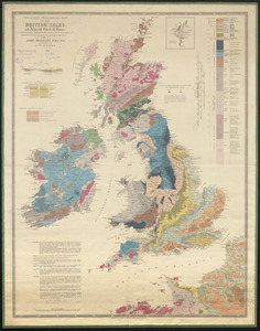
New index geological map of the British Isles, and adjacent coast of France constructed from published documents,...
42.
Connecticut
43.
Kentuckey
44.
Maryland
45.
Massachusetts
46.
Mississippi Territory and Georgia
47.
New York
48.
North Carolina
49.
Ohio and N.W. Territory
50.
Pennsylvania
51.
Rhode Island
52.
Tennassee : lately the S. Wn. Territory
53.
The United States of America
54.
Virginia
55.
Map of Oregon and upper California, from the surveys of John Charles Frémont and other authorities
56.
Amerique Septentrionale divisée en ses principales parties, ou sont distingués les vns des autres les estats suivant qu'il...
57.
Plat of the seven ranges of townships being part of the territory of the United States n.w. of the Ohio River which by a late...
58.
A map of part of the N:W: Territory of the United States : compiled from actual surveys, and the best information
59.
The province of Maine, from the best authorities
60.
The state of Maryland, from the best authorities
‹ Prev
Next ›
1
2
3
4