Toggle navigation
LMEC Home
Exhibitions
Georeferencing
Tools for Teachers
Collections
My Favorites
Sign Up / Log In
Search
Search the map portal
Map Collection
Map Collection
Map Sets
Search
Search
Search for
Search In
All Fields
Creator
Title
Subject
Place
Search All Digital Collections
Advanced Search
187 Results
My Search
Start Over
1900
Remove constraint 1900
Filter your Search
Place
North and Central America
146
United States
116
Massachusetts
48
Boston
26
Suffolk (county)
26
Asia
18
Cuba
13
Europe
13
more
Place
»
Topic
Boston (Mass.)--Maps
13
United States--Maps
10
Franco-Prussian War, 1870-1871--Aerial views
7
France--History--1789-1900--Aerial views
6
Germany--History--1789-1900--Aerial views
6
Havana (Cuba)--Maps
6
Luzon (Philippines)--Maps
6
New England--Maps--Early works to 1800--Facsimiles
5
more
Topic
»
Date
Date range begin
–
Date range end
Current results range from
1764
to
2005
View distribution
Creator
United States. War Department
16
United States. Congress (56th, 2nd session : 1900-1901). Senate
10
United States. Congress. Senate. Committee on Foreign Relations
10
United States. Army. Department of Cuba
9
United States. Congress (56th, 2nd session : 1900-1901). House
8
United States. Government Printing Office
8
United States. Army. Corps of Engineers
7
Geo. H. Walker & Co.
6
more
Creator
»
Format
Maps/Atlases
182
Manuscripts
7
Photographs
3
Prints
2
Books
1
Drawings/Illustrations
1
Posters
1
Georeferenced
Yes
21
No
166
Collection
Norman B. Leventhal Map & Education Center Collection
176
Boston and New England Maps
17
Urban Maps
16
Robert E. Diefenbach Map Collection at Phillips Academy
5
American Revolutionary War-Era Maps
3
Massachusetts Real Estate Atlases
3
Maritime Charts and Atlases
2
Colonial and Revolutionary Boston
1
more
Collection
»
Available to use
No known restrictions
176
Creative Commons license
2
Search Constraints
Sort by relevance
relevance
title
date (asc)
date (desc)
Number of results to display per page
20 per page
10
per page
20
per page
50
per page
100
per page
View results as:
grid view
map view
Search Results
21.
The population map
22.
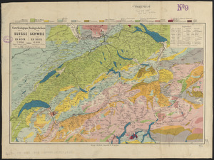
Carte geologique de la Suisse = Geologische karte der Schweiz
23.
Eldridge's map of Martha's Vineyard
24.
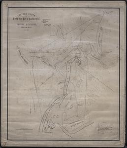
Chatham Lights to south west part of Handkerchief
25.
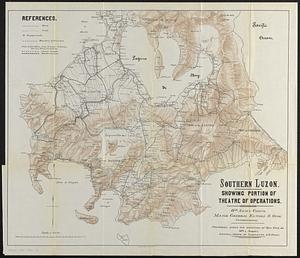
Southern Luzon : showing portion of theatre of operations ; 8th Army Corps, Major General Elwell S. Otis commanding
26.
The battle fields and military positions in the Virginian peninsula : from surveys supplied by officers of the army
27.
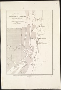
Map showing siege operations against Forts Sumter and Wagner between July 13th & Sept. 7th, 1863
28.
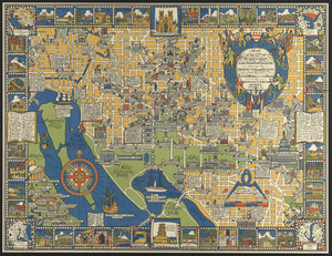
The colour of an old city : a map of Boston, decorative and historical
29.
A kite view of Philadelphia and the Sesqui Centennial International Exposition
30.
Map of the city of Washington in the District of Columbia shewing the architectvre and history from the most ancient times down...
31.
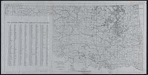
Oil and gas producing areas in Oklahoma
32.
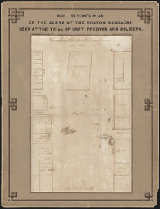
Paul Revere's plan of the scene of the Boston Massacre : used at the trial of Capt. Preston and soldiers
33.
Panay, military district no 4, Department of the Visayas
34.
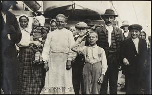
Immigrant boy salutes flag on ship in Boston harbor
35.
Peking
36.
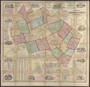
Map of Merrimack County, New Hampshire
37.
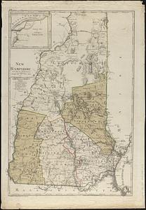
New Hampshire
38.
New-Hampshire : from late survey
39.
Map of China, Burma, Siam, Annam &c
40.
Map of Arnold Arboretum showing location of the trees and shrubs
‹ Prev
Next ›
1
2
3
4
5
6
…
9
10