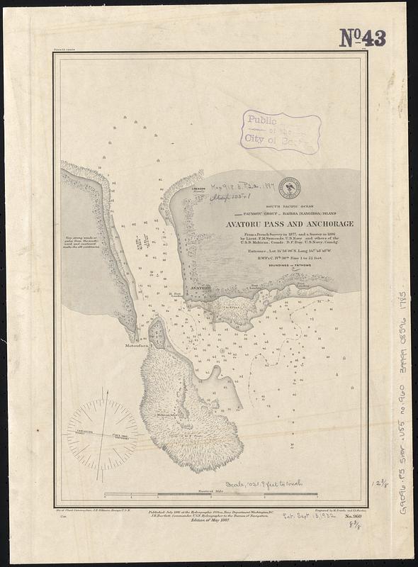
South Pacific Ocean, Paumotu Group - Rairoa (Rangiroa) Island, Avatoru Pass and anchorage
Item Information
- Title:
- South Pacific Ocean, Paumotu Group - Rairoa (Rangiroa) Island, Avatoru Pass and anchorage
- Title (alt.):
-
Avatoru Pass and anchorage
- Issuing body:
- United States. Hydrographic Office
- Engraver:
- Franke, M. (Max)
- Engraver:
- Ourdan, V. L. (Vincent L.)
- Surveyor:
- Symonds, Frederick M.
- Name on Item:
-
from a French survey in 1877, and a survey in 1886 by Lieut. F.M. Symonds, U.S. Navy and others of the U.S.S. Mohican, Comdr. B.F. Day, U.S. Navy, comdg. ; engraved by M. Franke and V.L. Ourdan
- Date:
-
1887
- Format:
-
Maps/Atlases
- Genre:
-
Nautical charts
- Location:
-
Boston Public Library
Norman B. Leventhal Map & Education Center - Collection (local):
-
Norman B. Leventhal Map & Education Center Collection
- Subjects:
-
Rangiroa (French Polynesia)--Maps
Avatoru Pass (French Polynesia)--Maps
Nautical charts--French Polynesia--Rangiroa
Nautical charts--French Polynesia--Avatoru Pass
- Places:
-
French Polynesia (territory)Îles Tuamotu-Gambier (area)
Rangiroa
Passe Avatoru
- Extent:
- 1 map ; 32 x 22 cm
- Terms of Use:
-
No known copyright restrictions.
No known restrictions on use.
- Publisher:
-
Washington, D.C. :
Hydrographic Office
- Edition:
- Edition of May 1887
- Scale:
-
Scale approximately 1:12,200
- Language:
-
English
- Notes:
-
Depths shown by soundings and pictorially.
Includes notes.
- Identifier:
-
06_01_017615
- Call #:
-
G9096.P5 svar .U55 no. 960
- Barcode:
-
39999085961785


