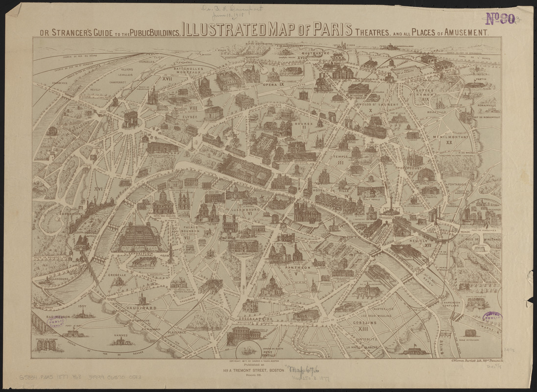
Illustrated map of Paris : or stranger's guide to the public buildings, theatres, and all places of amusement
Item Information
- Title:
- Illustrated map of Paris : or stranger's guide to the public buildings, theatres, and all places of amusement
- Publisher:
- Young, George Henry
- Lithographer:
- Bartlett, G. Warren
- Date:
-
1877
- Format:
-
Maps/Atlases
- Location:
-
Boston Public Library
Norman B. Leventhal Map & Education Center - Collection (local):
-
Norman B. Leventhal Map & Education Center Collection
- Subjects:
-
Paris (France)--Maps
- Places:
-
FranceÎle-de-France (region)Paris
- Extent:
- 1 map : color ; 36 x 53 cm
- Terms of Use:
-
No known copyright restrictions.
No known restrictions on use.
- Publisher:
-
Boston :
George H. Young
- Scale:
-
Not drawn to scale
- Language:
-
English
- Notes:
-
Pictorial map showing the main buildings of Paris, the Universal Exposition and boulevards.
- Identifier:
-
06_01_014194
- Call #:
-
G5834.P3A5 1877 .Y68
- Barcode:
-
39999065700583