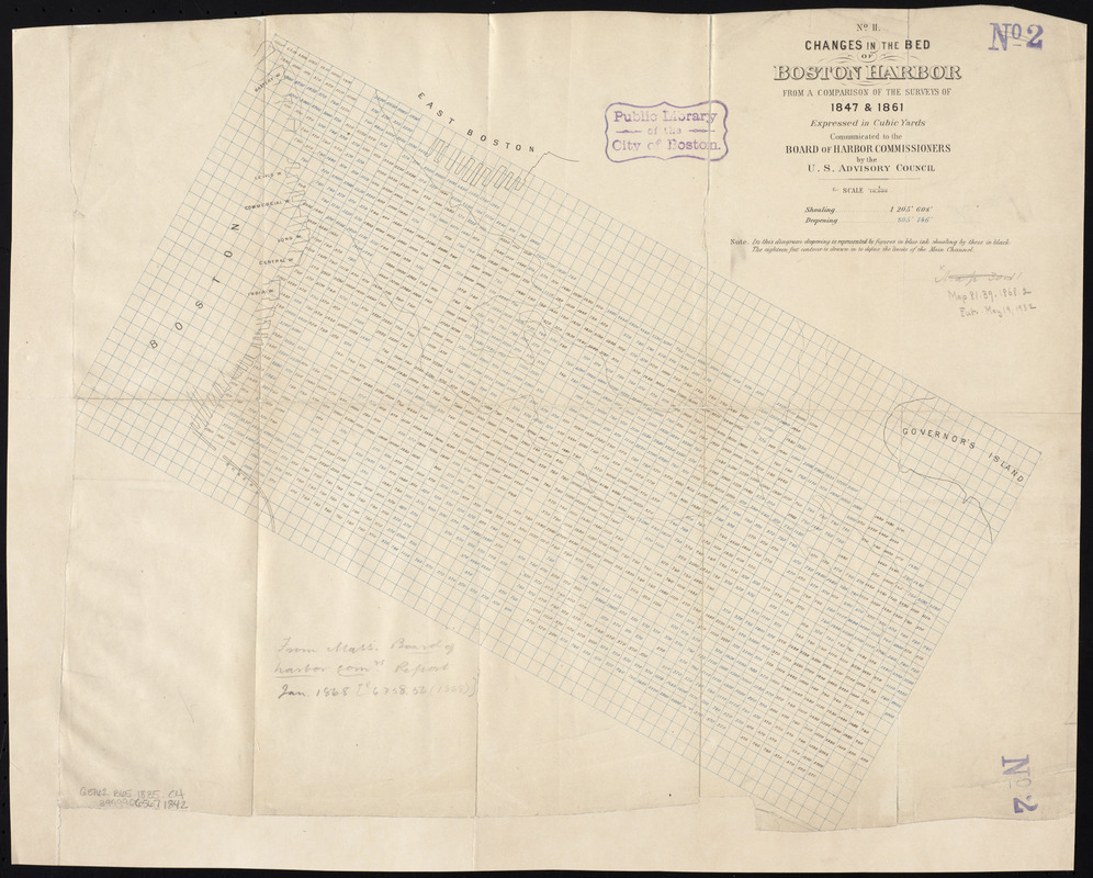
Changes in the bed of Boston Harbor from a comparison of the surveys of 1835-61

Item Information
- Title:
- Changes in the bed of Boston Harbor from a comparison of the surveys of 1835-61
- Cartographer:
- Massachusetts. Board of Harbor Commissioners
- Date:
-
[1868?]
- Format:
-
Maps/Atlases
- Location:
-
Boston Public Library
Norman B. Leventhal Map Center - Collection (local):
-
Norman B. Leventhal Map Center Collection
- Subjects:
-
Boston Harbor (Mass.)--Maps
- Places:
-
Boston Harbor
- Extent:
- 3 maps ; 49 x 57 cm. or smaller
- Terms of Use:
-
No known copyright restrictions.
No known restrictions on use.
- Publisher:
-
[Boston] :
[The Commissioners]
- Scale:
-
Scale 1:10,000
- Language:
-
English
- Table of Contents:
-
No. I. From a comparison of the surveys of 1835 & 1847
No. II. From a comparison of the surveys of 1847 & 1861
No. III. From a comparison of the surveys of 1835 & 1861.
- Notes:
-
Relief shown by soundings and contours.
From: House document No. 10 of 1868, 2nd Annual Report of the Board of Harbor Commissioners, Jan., 1868.
Shows deepening by figures in blue ink, shoaling by figures in black ink.
- Identifier:
-
06_01_005302
06_01_005303
06_01_005304
- Call #:
-
G3762.B65 1835 .C4
- Barcode:
-
39999065671842


