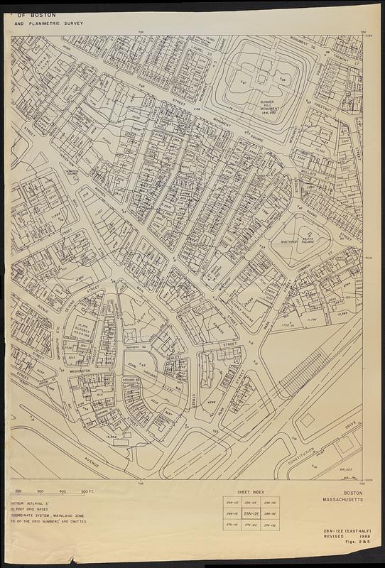
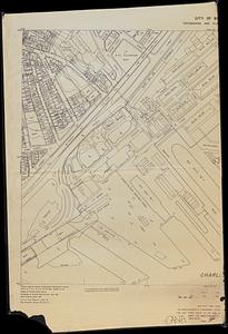
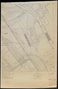
Charlestown Navy Yard area

Item Information
- Title:
- Charlestown Navy Yard area
- Cartographer:
- Boston Redevelopment Authority
- Date:
-
[1988]
- Format:
-
Maps/Atlases
- Location:
-
Boston Public Library
Norman B. Leventhal Map & Education Center - Collection (local):
-
Norman B. Leventhal Map & Education Center Collection
- Series:
- Boston Redevelopment Authority Maps & Manuscript Plans Collection
- Subjects:
-
Charlestown (Boston, Mass.)--Maps
Roads--Massachusetts--Boston--Maps
Buildings--Massachusetts--Boston--Maps
Charlestown Navy Yard (Mass.)
- Places:
-
MassachusettsSuffolk (county)BostonCharlestown
Boston Navy Yard
- Extent:
- 1 map on 3 sheets ; sheets 164 x 108 cm
- Terms of Use:
-
No known copyright restrictions.
No known restrictions on use.
- Publisher:
-
[Boston] :
[Boston Redevelopment Authority]
- Scale:
-
Scale approximately 1:480
- Language:
-
English
- Table of Contents:
-
27N-12E (east half)
28N-12E (east half)
28N-13E (west half).
- Notes:
-
Enlarged copies of sheets covering Charlestown Navy Yard from "City of Boston topographic and planimetric survey."
Relief shown by spot heights.
Shows buildings, roads, railroads, docks, and proposed rte. I-93.
"Revised 1988."
"Figs. 2 & 5."
Manuscript in ink at bottom of 28N-13E west half: CANA.
- Notes (date):
-
This date is inferred.
- Identifier:
-
06_01_018595
- Call #:
-
BRA MAP FOLDER 50 no.2-4
- Barcode:
-
30000008307626


