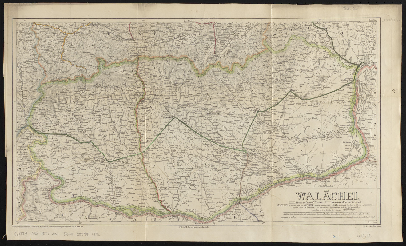
Die Walachei
Item Information
- Title:
- Die Walachei
- Title (alt.):
-
Wallachei
- Cartographer:
- Kiepert, Heinrich, 1818-1899
- Publisher:
- Geographisches Institut (Weimar, Thuringia, Germany)
- Name on Item:
-
nach Oesterreichischen u. Russischen aufnahmen u. ortsbestimmungen entworfen v. H. Kiepert
- Date:
-
1877
- Format:
-
Maps/Atlases
- Location:
-
Boston Public Library
Norman B. Leventhal Map & Education Center - Collection (local):
-
Norman B. Leventhal Map & Education Center Collection
- Subjects:
-
Wallachia--Maps
- Places:
-
RomaniaValahia (area)
- Extent:
- 1 map : hand color ; 33 x 58 cm, folded in cover 25 x 12 cm
- Terms of Use:
-
No known copyright restrictions.
No known restrictions on use.
- Publisher:
-
Weimar :
Geographisches Institut
- Edition:
- X. auflage
- Scale:
-
Scale 1:800,000
- Language:
-
German
- Notes:
-
Edition statement and date of publication from cover.
Relief shown by shading and spot heights.
Prime meridians: Paris and Ferro.
Inside cover includes advertisement for publisher's Hand- & eisenbahnkarten.
Bound with map of Bosnien und Dalmatien, map of Serbien, and cover of Die Walachei.
- Identifier:
-
06_01_016710
- Call #:
-
G6882.W3 1877 .K54
- Barcode:
-
39999085951596


