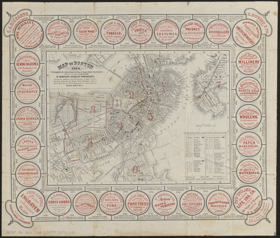
Map of Boston 1862 : photographically reduced from the plans of James Slade, City Engineer : with all the latest improvements : a complete guide to strangers, giving the distances from City Hall, in 1/4 mile circles : showing distinctly the hotels, public buildings, steam & horse rail-roads, ward boundaries, & fire A. districts : printed in oil colors
Item Information
- Title:
- Map of Boston 1862 : photographically reduced from the plans of James Slade, City Engineer : with all the latest improvements : a complete guide to strangers, giving the distances from City Hall, in 1/4 mile circles : showing distinctly the hotels, public buildings, steam & horse rail-roads, ward boundaries, & fire A. districts : printed in oil colors
- Publisher:
- L. Prang & Co.
- Date:
-
1862
- Format:
-
Maps/Atlases
- Location:
-
Boston Public Library
Norman B. Leventhal Map Center - Collection (local):
-
Norman B. Leventhal Map Center Collection
- Subjects:
-
Boston (Mass.)--Maps
- Places:
-
Suffolk (county)Boston
- Extent:
- 1 map : color ; 22 x 30 cm, on sheet 39 x 46 cm
- Terms of Use:
-
No known copyright restrictions.
No known restrictions on use.
- Publisher:
-
[Boston, Massachusetts] :
L. Prang & Co.
- Scale:
-
Scale approximately 1:19,500
- Language:
-
English
- Notes:
-
Oriented with north towards the upper right.
Relief shown by hachures.
Includes index to places of interest.
Map bordered by historical facts and advertisements for local businesses.
- Identifier:
-
06_01_014378
- Call #:
-
G3764.B6 1862 .L65
- Barcode:
-
39999065701110


